Put-in
AK
Put In
Save this feature with the run it belongs to.
Gauge Conditions
Runnable: ? – ? CFS
Approximate - nearest available gauge. Use as general reference only.
Data from American Whitewater & USGS
Photo
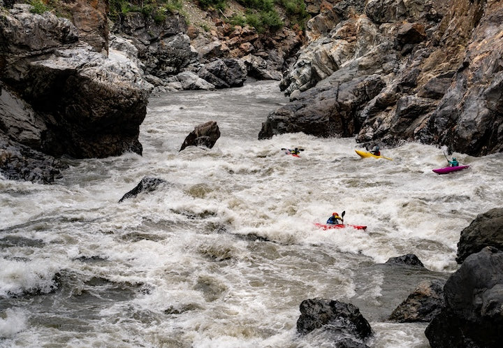
Photo courtesy of American Whitewater
Description
Put In marks the starting point for the Tonsina River descent, featuring an initial entry that requires careful navigation through potential glacial debris and shallow water conditions. While specific details are limited, paddlers should anticipate variable water levels and potential obstacles typical of Alaska glacial river systems, with close attention to boat positioning and route selection critical for a safe passage.
Location
Interactive river map
Loads as you approach this section.
Other Rapids on This Run (1)
View Full Run
1. Tonsina Glacier to Tonsina Lake
Tonsina
V+
41.0 mi
Current Conditions
5-Day Forecast
Whitewater data from
American Whitewater
American Whitewater