Gauge Conditions
Runnable: 1,000.0 – 20,000.0 CFS
Upper limit for best boatability uncertain. Please help your fellow boaters with a comment or report.
Data from American Whitewater & USGS
Photo
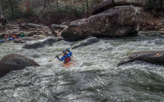
Photo courtesy of American Whitewater
Description
The Put In rapid marks the start of this Mill Creek run, featuring a narrow entry with potential rock dodging in the initial drop. Paddlers should be prepared for tight maneuvering and potential low-water obstacles, with careful route selection critical in the first 100 yards. Scout if water levels are uncertain, as the initial moves can set the tone for the downstream section.
Location
Other Rapids on This Run (1)

View Full Run
Route 42 to N. Fork Shenandoah
Mill Creek (Shenandoah trib)
I-III(V)
7.9 mi
Current Conditions
5-Day Forecast
Whitewater data from
American Whitewater
American Whitewater