01. Gothic Bridge to above Stupid Falls
Linked via: Proximity 98% confidence Synced 6mo ago
Gauge Conditions
Runnable: 600.0 – 3,000.0 CFS
Optimal flows: 900-2500 as defined by the 2013 Gunnison River Flow Survey
Data from American Whitewater & USGS
Run Map
Description
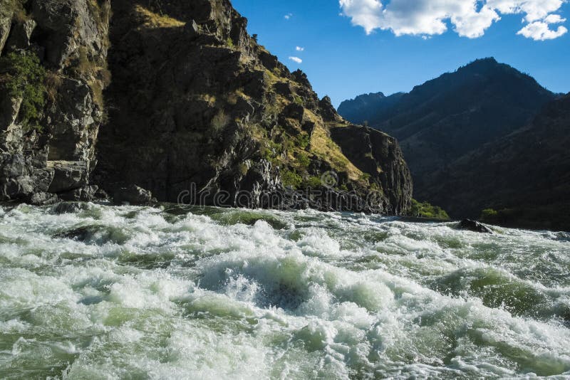
In the shadow of spectacular Gothic Mountain, the Upper East is the easiest of the Crested Butte creeks. There are 6 slides that deserve a quick scout. If your a Class V paddler take your play boat and surf every single wave the whole way down. Confident Class III boaters should be able to make it down this run as long as they have good babysitters.
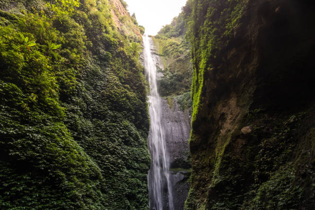
The end of this stretch includes “Stupid Falls”, a spectacular vert to slide waterfall that is 60 feet tall. At moderate flows, the upper stretch provides an unique opportunity for intermediate paddlers to test their skills on slides and moderately sized slides. At high water, this can be the most challenging run in Crested Butte. This segment is set in the Gothic Valley, the wildflower capital of Colorado and provides scenic views of the East River corridor.
To get there: Take Gothic Rd out of Crested Butte until you cross the river. This bridge is the put-in. To get to the takeout continue down the road another 50 yards past the bridge and take the first dirt road on the right. About a mile down that road keep an eye out for a large flat field to the right with the grass next to the road trampled down a bit from parking. Look for a small trail leading to the far corner of the field, this is where to scout Stupid Falls and the takeout.
The Quadruple Crown: Because of the short length and proximity of the Crested Butte creeks all 4 of them can be run in the same day. The East River is the best to start out with; it has the largest flow and the least gradient of the four. Next in line is Daisy Creek. Just continue downstream after Daisy to the confluence with the Slate River; there will be about 1/2 mile of slack water until the first rapid. The takeout for the Slate River is the same as Oh Be Joyful Creek so just walk or drive up to the OBJ put-in from there.
Rapids in this Run (3)
Waterfalls (2)
Difficulty
Class IV
Length
0.7 mi
Gradient
182 ft/mi
Rapids
3
Access Points
Difficulty Classes
I Easy
II Novice
III Intermediate
IV Advanced
V Expert/Extreme
VI Unrunnable
Current Conditions
5-Day Forecast
Whitewater data from
American Whitewater
American Whitewater