01. Gun Shy to Jasper Creek
Gauge Conditions
Runnable: ? – ? CFS
Approximate reading: This gauge is 19.0 miles away on Boulder Creek. Use as a general reference only.
Data from American Whitewater & USGS
Run Map
Description
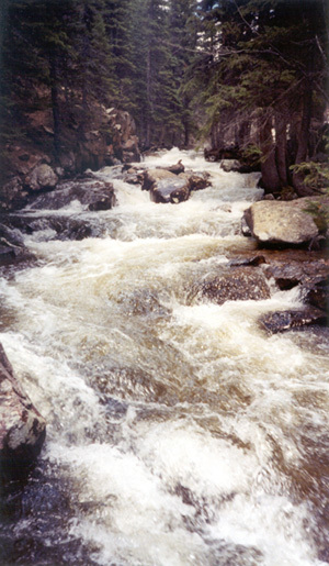
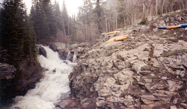
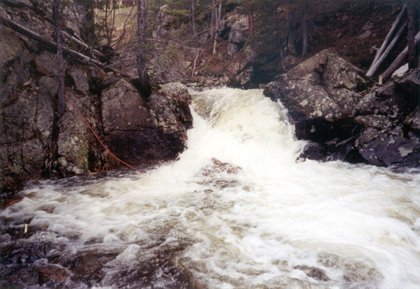
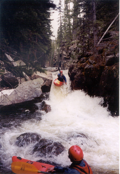
In 2003 the mile above Hellum's Waterfall was cleaned out and 1st descented. This has doubled the length of the run! The new top 1/2 has a different character, it is not gorged up and the inbetween stuff is easier while the named drops are bigger. The first of these is Gun Shy (Class V), 4 big ledge drops back-to-back with big holes and undercuts on both sides. Shortly downstream is Harvey Wallbanger (Class V), this is one ugly rapid and destined to be carnage central for the Source. It already has a reputation! There is a summer home sitting right next to this rapid, you must tresspass to scout so be very stealth. Just downstream is Hellum's Waterfall. The left channel will bounce down a technical sluice before dropping off a 10' fall and the right channel is a straight shot at a 15' vertical. Both options have rocky landings, and both have been done without pitoning. At this point you are at the old put-in. If this is your 1st time down it is impossible to remember every single cascade in the lower section. So concentrate your scout on the big cascade near the bottom - Dead Hiker Falls. DeForrestation Rapid, the first below Hellums, cleaned up in 2003 and no longer requires a scout. Every other rapid can be run on the fly. At medium to low flows you can expect a few minor pins in-between the major rapids, this run is really abusive to your boat. Think "manky-town". At high water (400cfs+) the rocks are nicely padded out but the creek starts to push into the trees and the holes get evil.
Do all hiking and scouting from river right because there is private property on the left.
Pics of the Upper Source can be found at Brian Adkins Webshots album, and pics of the Lower Source on Mike Albrecht's Webshots album.
To get there: Drive south out of Nederland towards Central City. At the edge of town turn right on the road to Eldora Ski Area, 1/4 mile down the road go straight instead of left to Eldora. After driving through a small town the pavement will end, another mile or so down the dirt road you will come to a fork in the road. To the right is the Fourth of July Road which takes you to the put-in, to the left is the Hessie Road and the take-out.
To get to the new put-in drive about a mile past Hellum's Waterfall, which is very obvious from the road, to a campground on the left. The campground is an undeveloped flat grassy field of about an acre in size with a couple of fire rings scattered about. The creek is only 50 feet from the road and mellow Class II at that point.
The takeout is 1/2 mile up the left fork, Hessie Road, or you can boat Class II(with wood hazards) down to the fork of the road. This latter option is a good idea for low clearance cars.
See _Colorado Rivers and Creeks II_, by Banks and Eckardt _(The Bible)_, for info on this and most of the other kewl runs of Colorado.
Lat/longitude coords are approximate, from TopoZone.
The various reaches of Boulder Creek,
Jasper Creek (Class V+/VI),
The Source (Class V),
Upper Boulder Canyon (Class V/V+),
Lower Boulder Canyon (Class IV),
Boulder Town \
Run (Class II/III),
North Fork Boulder (Class V+/VI),
Alto-Alto (Class IV),
Upper South Boulder (Class V+/VI),
Lower South Boulder (Class IV/V+/VI),
Eldorado Canyon (Class V+).
Rapids in this Run (4)
Waterfalls (6)
Hazards & Portages (4)
Caution: The following locations may require scouting or portaging. Always check current conditions.
Difficulty
Class V
Length
1.3 mi
Gradient
350 ft/mi
max 392
Rapids
4
4 Hazards
Access Points
Difficulty Classes
I Easy
II Novice
III Intermediate
IV Advanced
V Expert/Extreme
VI Unrunnable
Current Conditions
5-Day Forecast
Whitewater data from
American Whitewater
American Whitewater