01. MM 69 to Wills Gulch picnic area
No sufficiently local live gauge linked. 1 automated match was excluded because the closest is 39.2 miles away. Difficulty and route details are not current water conditions.
Run Map
Run Time Estimate
Select put-in and take-out to estimate time.
Plan This Trip
See wind-adjusted speed maps, forecast planning, and detailed time estimates.
Sign in to generate an AI timing estimate for this run.
Whitewater timing varies with scouting, portages, and group pace. Use as a planning baseline.
Description
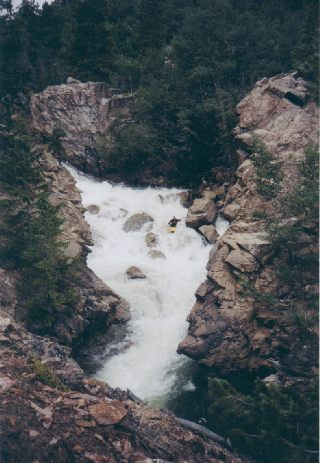
Lake Creek is a schizophrenic stream. 1/2 of it is meandering Class II, 1/3 is undefined continuous Class IV, and the rest is a handfull of sick V+ bedrock gorges. If you run the upper half be sure you scout the locations of Tombstone(V) and Toaster(V) before putting on. Floating into either could be fatal if you have not scouted them and don't realize what they are. If you run the Lower Gorge(V+,VI), make sure to scout the whole thing! Last but not least, do not forget to run Cauldron Rapid(V)! It's the second biggest drop, but lacks some of the scare factors of the rapids upstream.
The entire run parallels Hwy 82. The upper put-in is at milemarker 69, the take-out above the Lower Gorge is at mm 74.5, and Cauldron Rapid is at about mm 79.
In 2003 Lake Creek ran at huge levels (almost 2000cfs) for almost an entire month, as a result I have heard that almost all rapids had changed, some dramatic - some minor. Most significant was Tombstone which turned into an unrunnable sieve, no ifs and or butts this is now a mandatory portage!!!
Rapids in this Run (2)
Waterfalls (5)
Hazards & Portages (6)
Caution: The following locations may require scouting or portaging. Always check current conditions.
Difficulty
Class V+
Length
9.2 mi
Gradient
137 ft/mi
max 235
Rapids
2
6 Hazards
Access Points
Difficulty Classes
I Easy
II Novice
III Intermediate
IV Advanced
V Expert/Extreme
VI Unrunnable
Current Conditions
5-Day Forecast
Whitewater data from
American Whitewater
American Whitewater