01. to Millsite Reservoir
Gauge Conditions
Runnable: 250.0 – 1,000.0 CFS
Flow range for best boatability uncertain. Please help your fellow boaters with a comment or report.
Data from American Whitewater & USGS
Run Map
Run Time Estimate
Select put-in and take-out to estimate time.
Plan This Trip
See wind-adjusted speed maps, forecast planning, and detailed time estimates.
Sign in to generate an AI timing estimate for this run.
Whitewater timing varies with scouting, portages, and group pace. Use as a planning baseline.
Description
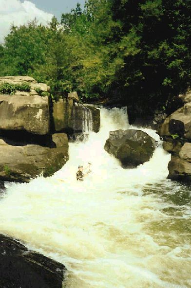
Another nice desert creek, worth doing if its over 300. Can be bank scouted a short walk from the road, like at the concrete dip in the road. Take a look for wood the first time down in the spring. A touch easier than Cottonwood Creek, but can still pack a punch at higher water, and, although its less forested than Huntington, wood will move after a high water event. IV- above 350.
Putting in as high as possible before the road turns away from the creek, at Stevens Creek on the map, is possible, but rarely done because there is usually riverwide wood, and comparatively flat water for the first 1.5 miles. Putting in at a paved bridge makes for a nice 2.4 mile run, and that is what is shown now on the map. Putting in at Stevens Creek would make the run 4.0 miles (measured on the road). You can run all the way down to the reservoir, but expect a more muddy, buggy takeout.
Rapids in this Run (2)
Difficulty
Class II-IV
Length
2.8 mi
Gradient
72 ft/mi
Rapids
2
Access Points
Difficulty Classes
I Easy
II Novice
III Intermediate
IV Advanced
V Expert/Extreme
VI Unrunnable
Current Conditions
5-Day Forecast
Whitewater data from
American Whitewater
American Whitewater