02. Soapstone to Pine Valley Campground
Linked via: Proximity 95% confidence Synced 6mo ago
Gauge Conditions
Runnable: 500.0 – 1,000.0 CFS
Flow range for best boatability uncertain. Please help your fellow boaters with a comment or report.
Data from American Whitewater & USGS
Run Map
Run Time Estimate
Select put-in and take-out to estimate time.
Unlock Advanced Trip Planning
See wind-adjusted speed maps, forecast planning, and detailed time estimates.
Sign in to generate an AI timing estimate for this run.
Whitewater timing varies with scouting, portages, and group pace. Use as a planning baseline.
Description
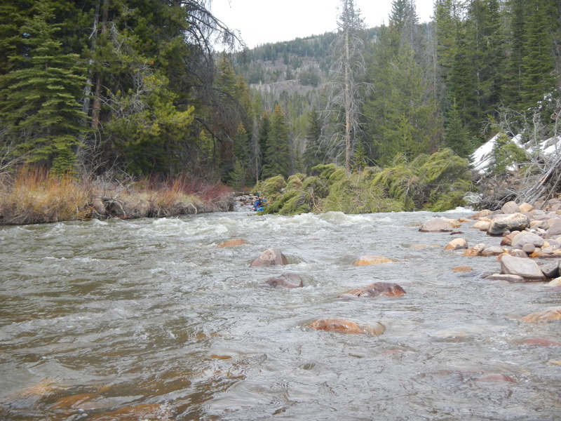
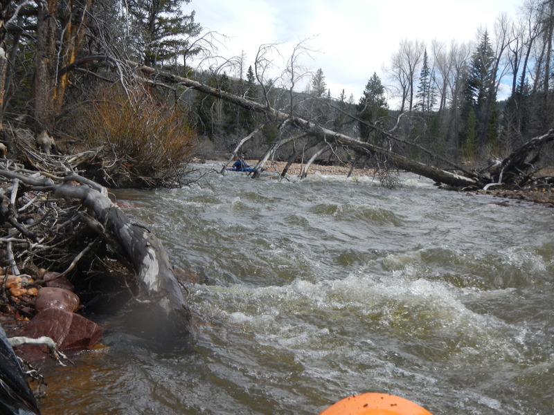
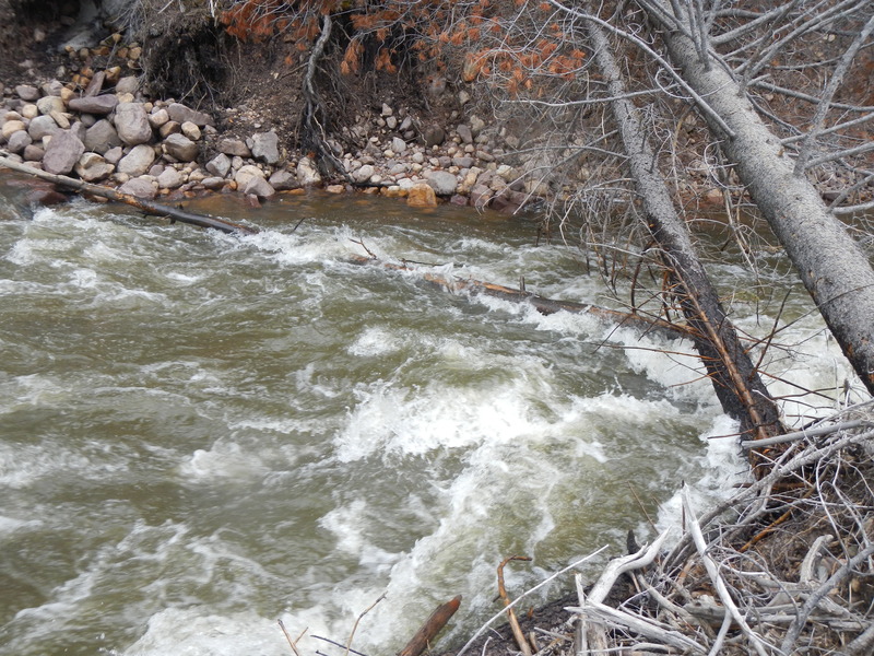
If you like adventure boating in the highland forest and want to start at Soapstone, going to Pine Valley campground is the easiest to set shuttle for (4.5 miles). 500 cfs on the Provo at Woodland gauge is a suggested minimum. In May 2021, evidently a high water year has cleared out some beaver dams and moved one riverwide log, and the first mile is somewhat better channelized. The wood avoidance is still class IV; or you could say there are a lot of must-make class 3 moves, and there are a handful of portages. Pine Valley to Woodland (5 miles) is rarely done, the wood is at least as bad, there is some private land, and the shuttle would be much longer.
The gradient is continuous so the rapids are steady class 2 and 3. Besides massive amounts of downed trees along the run, the river frequently splits into multiple channels. The river is especially braided near the beginning and below the FS Rd 922 take out. There are two-track trails north of the river, reserved for hiking, horseback riding or mountain biking; posted for no ATVs.
Scenery in the area is very nice.
Getting There: This section of the Provo runs along Highway 150. It is a bit over an hour away from either the Salt Lake City area or the Orem area.
Put In: There is a large turnout with convenient river access at the junction of Soapstone Basin Road and Highway 150. There appear to be other put in options upstream and downstream. Elevation at put in is about 7753 feet above sea level.
Take Out: There is river access at Lower Provo River Campground, which was open in May 2021. This is the location marked on our map. The elevation here is about 7380 feet.
FS Rd 922 is just upstream of the junction of the NF Provo River and leads to a large parking area close to the river. However there is a steep hillside with no trail that I saw, so it may not be the best takeout. The brick bathroom little building is visible from the river. Elevation here is about 7500 feet.
Wood Hazards: This section is noted for having lots of trees, logs and logjams in the river. Logs will often move from year to year and even from week to week during high flows. The satellite view on the map tab provides sufficient close up views to see how many logs can typically block this section. Be ready to pull over and portage at any time.
Hazards & Portages (3)
Caution: The following locations may require scouting or portaging. Always check current conditions.
Difficulty
Class III-IV
Length
4.5 mi
Gradient
85 ft/mi
Rapids
0
3 Hazards
Access Points
Difficulty Classes
I Easy
II Novice
III Intermediate
IV Advanced
V Expert/Extreme
VI Unrunnable
Current Conditions
5-Day Forecast
Whitewater data from
American Whitewater
American Whitewater