03. Bradfield Launch (McPhee Reservoir) to Dove Creek Pump Station
Gauge Conditions
Runnable: ? – ? CFS
Approximate reading: This gauge is 18.2 miles away on Dolores. Use as a general reference only.
Data from American Whitewater & USGS
Run Map
Description
FUN FACT: The start of one of the lesser-known multi-day trips in the country
SEASON: April to early June depending on snowpack and release from McPhee Dam.
ISSUES: Recreational users have traditionally been the last to be considered in the management plan for McPhee Dam. A proposal to construct additional diversions designed to capture even more of the spring melt will only make the situation worse. Check with the San Juan Citizen's Alliance for the latest information on this issue.
LOGISTICS: The Bradfield Launch site is reached via Highway 666 and County Road R16 near the town of Cahone. There is camping at the launch site. The take-out for this section is at the Mountain Sheep Point Recreation site, otherwise known as Pump Station, which can be accessed via County Road J.
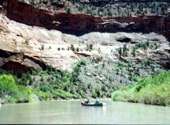
DESCRIPTION: The Dolores has been a source of irrigation water for over a century. Unfortunately the completion of McPhee dam, one of the last big water projects in the Colorado basin, has resulted in less than dependable flows for boaters and in some years none at all. While the Dolores does not have the intense rapids of some of it's more popular neighboring runs, the camping is superb and one can plan a multiday trip that starts out in the high elevation Ponderosa forests and ends in the desert canyons of the Colorado River. The Dolores is managed by the BLM and they maintain a web page with information on the river. Although permits are not currently required, you will still need your firepan, portable toilet, and dishwater strainer. You will also find a place to sign in at the launch site.
The typical trip starts at the Bradfield Launch and this is considered mile 0. There is an additional 10 miles of river upstream of the bridge before reaching McPhee Dam. This reach is parralleled by FR 504 and is popular with fishermen, but not often boated.
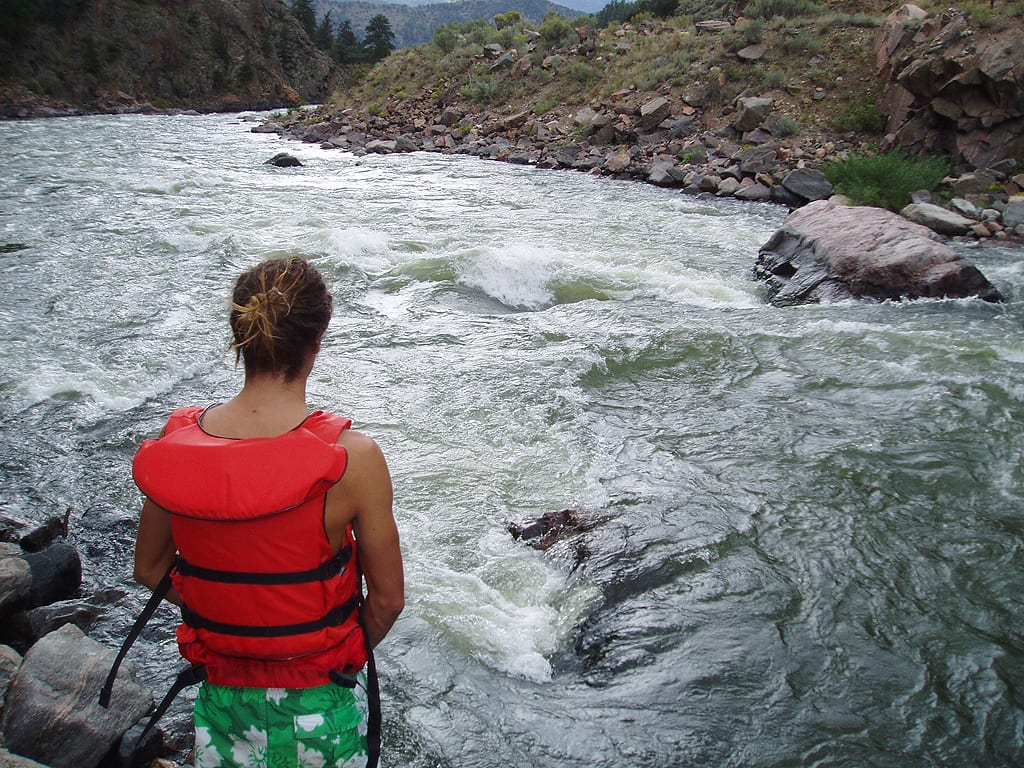
From the Bradfield Launch, the first several miles consists of swift water and semi-continuous class II+ rapids. For those looking to canoe this stretch, whitewater boat handling skills are required along with float bags. Once you leave the road at Bradfield Launch there is no access to the canyon until you reach the Dove Creek Pumping Station 19 miles downstream. There are several excellent camp sites in this forested upper canyon where you can bed down among the pines. The first real class III rapid is at Glade Canyon at river mile 15. The next point of interest is some Anasazi cliff dwellings just past river mile 18. A short distance downstream you will round the bend at Mountain Sheep Point and come to Big Canyon Rapid, another class III. Once you round the point you will be at Dove Creek Pump Station which is the end of this section.
Boaters can continue their trip downstream by taking advantage of boating opportunities on the following sections of the Dolores and Colorado:
- 1) Dolores River, Bradfield Launch to Dove Creek Pump Station, this page
- 2) Dolores River, Dove Creek Pump Station to Slickrock, 28 miles, II-III+(IV)
- 3) Dolores River, Slickrock to Bedrock, 50 miles, II+(III)
- 4) Dolores River, Bedrock to Gateway, 44 miles, II+
- 5) Dolores River, Gateway to Colorado River, 30 miles, II+(IV)
- 6) Colorado River, Cisco to Moab, 47 miles, I-III
- 7) Colorado River, Moab to Lake Powell (Cataract Canyon), 112 miles, I-IV
Rapids in this Run (2)
Difficulty
Class II-III(IV)
Length
18.5 mi
Rapids
2
Access Points
Difficulty Classes
I Easy
II Novice
III Intermediate
IV Advanced
V Expert/Extreme
VI Unrunnable
Current Conditions
5-Day Forecast
Whitewater data from
American Whitewater
American Whitewater