03. Gross Mountain Res to Eldorado State Park
Gauge Conditions
Runnable: ? – ? CFS
Approximate reading: This gauge is 2.0 miles away on Boulder Creek. Use as a general reference only.
Data from American Whitewater & USGS
Run Map
Description
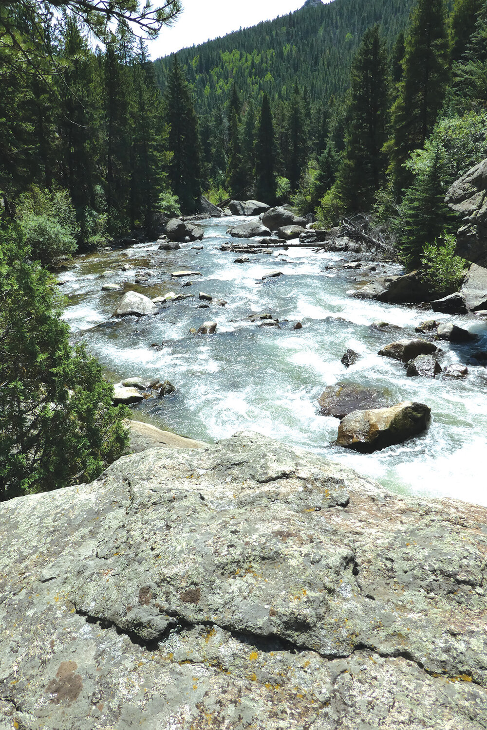
South Boulder Creek from _Gross Dam to Eldorado Canyon State Park_ is Boulder's backyard boating flave.
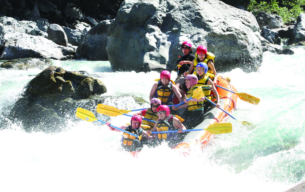
Lower South Boulder Creek holds three Class V+ exceptions and is a Front Range whitewater kayaking treat with remoteness and atypical Front Range creeking challenge. Mank.
The Put-in for Lower SBC is 1/4 mile below Gross Dam. From the vehicle bridge that crosses the creek, park river-left, uphill in the developed parking turnout of the turn.
Advisory: Denver Water Board property surrounds this unique putin.
Please stick to the foot trail than runs from the turnout down to the creek.
Launch from the cool mossy banks right away into the cold and remote feel of South Boulder Creek, Gross Reservoir to Eldorado Canyon State Park.
Wood from recent wildfires and high water will regularly load into any drop or corner. As of early fall of 2020, there were at least 2 river-wide strainers which required portaging at low flows.
Ramble under a footbridge, river hooks left, eddy out left for:
\\* Mile 0.9, Moist Slot, Drop One, Class V, the first of the three bigger drops on this run. Eddy/Scout/Portage river-left. This narrow slot on river right is setup by strong cross-current seams and folding water. Enter the Slot close to the right wall, paddle through the slot angled slightly left. The drop is about six feet on a sloping flake with a stopper hole to stuff you. \*This is a dangerous rapid. Either you feel it or shoulder your boat.
More rambling creekin' with occasional playwaves. Keep eyes peeled for mountain lions ( Felis concolour) and bears as this reach holds good habitat. Boogie-boating for about a mile until The Brain.
A channelized straight-away section of the river with picnic tables on river-left indicates that you are nearing The Brain, or Hole in the Wall rapid.
\\* Mile 1.7 - The Brain / Hole in the Wall, Drop Two, Class V+. Eddy/scout/portage river-left. The Brain has many ledges to stuff a boater in. When run correctly, after negotiating the setup, a good landing puts you hard against the rock in the bottom. For those who portage, seal launch from large river left boulder just after crux ... more boogie boating for about a mile, until a flat pool is reached after the river bends left.
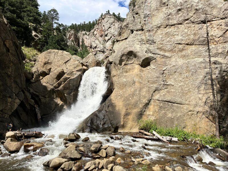
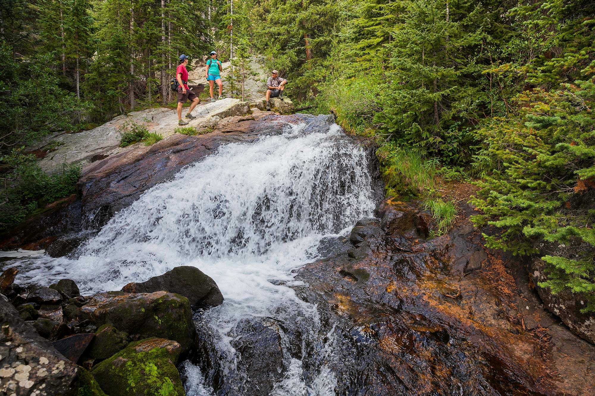
\\* Mile 3.0 Bridge Falls / Martin Gulch Falls, Drop Three, Class V+. Eddy/scout/portage river-right. Recent changes in this waterfalls geology warrant scouting. Bridge Falls is filled with wood, undercuts and fast, shallow landings followed by a stomper hole. After Bridge Falls pass under a footbridge and enter a beautiful Class IV cascade into more canyon that emerges into a forebay.
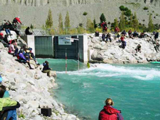
\*Mile 4.2, Forebay and the Dam Drop \- Eddy/scout/portage river left.
The route over the Dam is right. Be four to five feet away from the right hand wall in the right hand chute. Dam Drop is about 30 feet high and on a slight angle just off vertical. After the dam drop, over half the water in the river is stolen away to the thirsty pipes of Lakewood and Denver. Prepare for about 1.3 miles of boneyard shallows (90 to 120cfs).
Attempting the de-watered section with less than a 125cfs on the lower gauge (Eldorado Canyon, 1\*7\*) is not recommended. Rental boats preferred.
\*Mile 6.5, Take-out river-left in picnic grounds, free food for kayakers! or \*Mile 6.7, Take-out river-right upstream of the green vehicle bridge Below this bridge leads into Class V+ Eldorado Canyon and Harmon Falls.
Shuttle is about 50 minutes one way. Bumpy Boulder County backroads and dusty washboard gravel roads around Denver Water Board property.
For descriptions of Colorado runs, see _Whitewater of the Southern Rockies_ by Stafford and McCutchen, or _Colorado Rivers and Creeks_ by Banks and Eckert.
Lat/longitude coords are approximate, from TopoZone.
The various reaches of Boulder Creek, Jasper Creek (Class V+/VI), The Source (Class V), Upper Boulder Canyon (Class V/V+), Lower Boulder Canyon (Class IV), Boulder Town Run (Class II/III), North Fork Boulder (Class V+/VI), Alto-Alto (Class IV), Upper South Boulder (Class V+/VI), Lower South Boulder (Class IV/V+/VI), Eldorado Canyon (Class V+).
Spiders await you!
Rapids in this Run (1)
Waterfalls (3)
Playspots (1)
Hazards & Portages (4)
Caution: The following locations may require scouting or portaging. Always check current conditions.
Difficulty
Class IV(V+)
Length
5.8 mi
Gradient
65 ft/mi
max 175
Rapids
1
3 Hazards
1 Portage
Access Points
Difficulty Classes
I Easy
II Novice
III Intermediate
IV Advanced
V Expert/Extreme
VI Unrunnable
Current Conditions
5-Day Forecast
Whitewater data from
American Whitewater
American Whitewater