05. Abiquiu Dam to confluence with Rio Grande
Gauge Conditions
Runnable: 200.0 – 3,000.0 CFS
Flow range for best boatability uncertain. Please help your fellow boaters with a comment or report.
Data from American Whitewater & USGS
Run Map
Run Time Estimate
Select put-in and take-out to estimate time.
Plan This Trip
See wind-adjusted speed maps, forecast planning, and detailed time estimates.
Sign in to generate an AI timing estimate for this run.
Whitewater timing varies with scouting, portages, and group pace. Use as a planning baseline.
Description
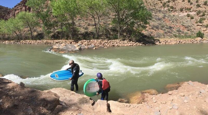
During the Fall/Winter of 2019/2020 the Army Corp. of Engineers and the New Mexico Fish and Wildlife office, completed a river enhancement of fish habitat/ fish ladder, by doing so they have created a play feature in that constriction. As we have tested flows the rapid is quickly becoming a great park and play feature. See the image gallery for pictures and flow rate. A big THANK YOU to NMFG and The Army Corp, along a huge THANK YOU to Ed Lucero who have the vision and the contacts to see this implemented.
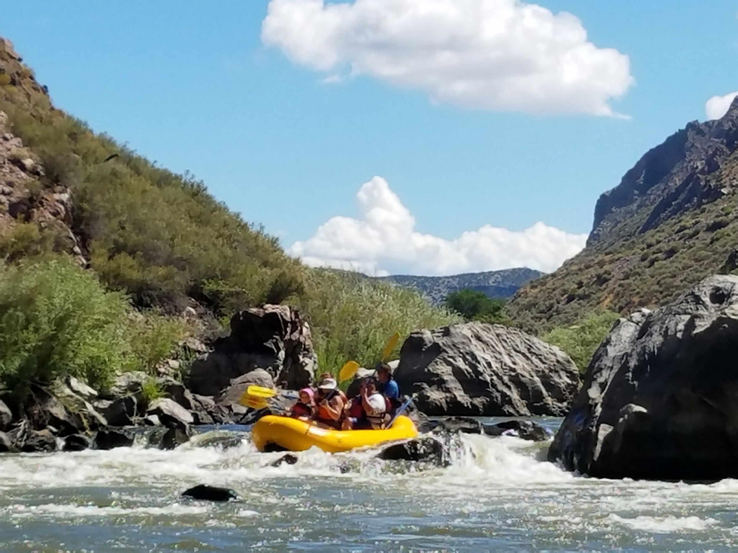
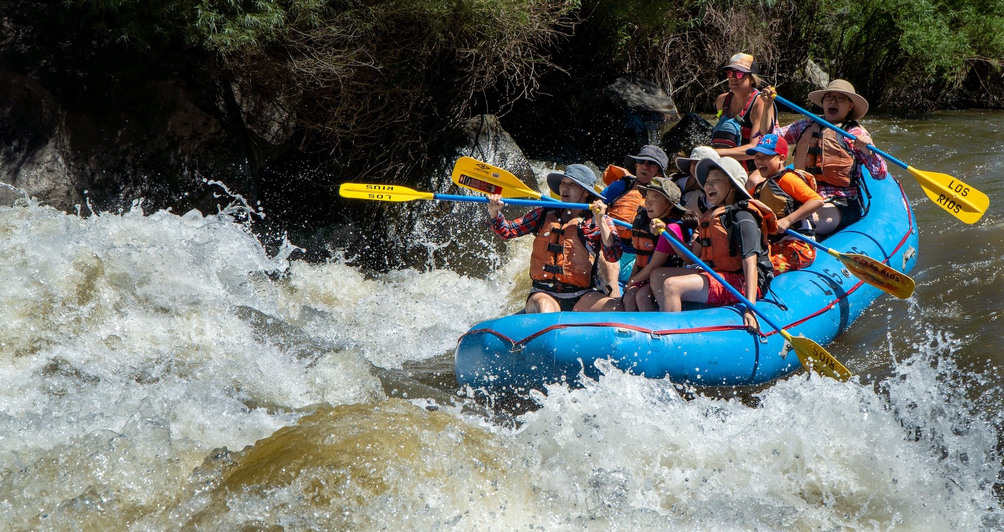
7.5 miles of class I/II meandering river is available below with several low-head dams. The take-out is just above or below the crossing with NM 84.
For information, see New Mexico Whitewater, by NM State Parks & Rivers of SW, by
Playspots (1)
Hazards & Portages (4)
Caution: The following locations may require scouting or portaging. Always check current conditions.
Difficulty
Class I-II
Length
7.5 mi
Rapids
0
4 Hazards
Access Points
Shuttle Info
Best access is along Hwy 84. The access road on river right is improved gravel for 1.5 miles and then becomes a worn 4x4 dirt road for over a mile before joining with paved road on the other side.
Difficulty Classes
I Easy
II Novice
III Intermediate
IV Advanced
V Expert/Extreme
VI Unrunnable
Current Conditions
5-Day Forecast
Whitewater data from
American Whitewater
American Whitewater