05. Green River Town to Colorado Confluence
Linked via: Proximity 45% confidence Synced 6mo ago
Gauge Conditions
Runnable: 1,000.0 – 20,000.0 CFS
Runnable: 1,000.0 – 20,000.0 CFS
Data from American Whitewater & USGS
Run Map
Run Time Estimate
Select put-in and take-out to estimate time.
Unlock Advanced Trip Planning
See wind-adjusted speed maps, forecast planning, and detailed time estimates.
Sign in to generate an AI timing estimate for this run.
Whitewater timing varies with scouting, portages, and group pace. Use as a planning baseline.
Description
River Description
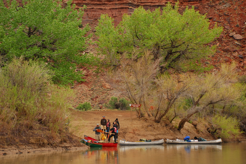
This run includes two sections, Labyrinth Canyon where the river predominately flows through BLM lands and Stillwater Canyon where the river flows through Canyonlands National Park. A rough road into Mineral Bottom provides intermediate access between these two segments. Groups can plan on covering 15 to 20 miles per day during high water or 10 to 15 miles per day during low water, depending on the amount of time spent hiking or how much you paddle. A trip through Labyrinth Canyon on the lower Green River can be enjoyed almost any time of the year, except in winter when there is ice on the river. The standard season is between Easter and Labor Day.
This is an easy flatwater run suitable for canoes, kayaks, and rafts of all types but the river runners must be prepared with backcountry skills as this is a wilderness trip. There are no designated campsites and during periods of high water, camps can be difficult to find, especially for large groups. During late summer and fall, sandbars are usually plentiful and make ideal camps.
Labyrinth Canyon (68 miles, with 45 mile option)
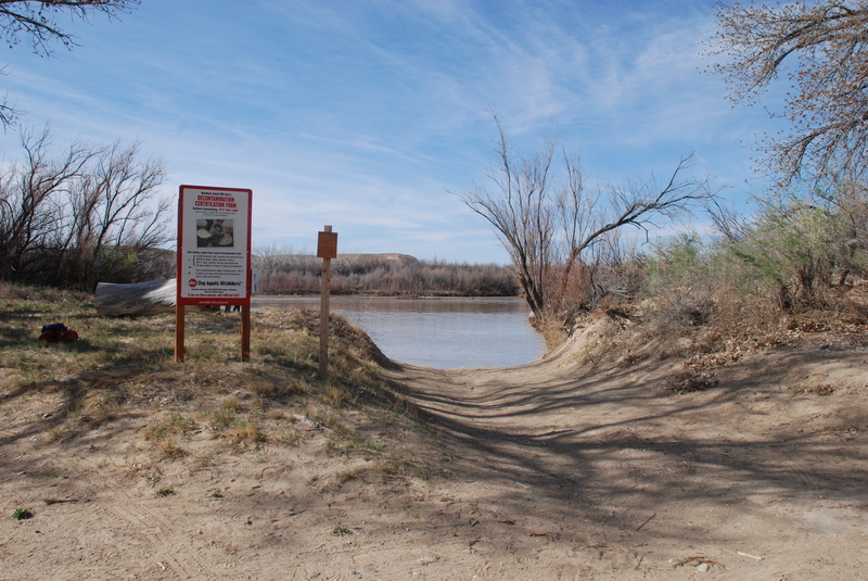
Labyrinth Canyon was named by John Wesley Powell during his 1869 expedition for its meandering course. The canyon is a geologic wonderland with canyon walls composed of layered sandstone. The first 23 miles are mostly private lands followed by lands managed by U.S. Bureau of Land Management and the Utah State Division of Lands and Forestry. These two agencies have adopted one set of regulations for river recreation and have joint enforcement responsibility. The Price BLM Office is the official public contact point for Labyrinth Canyon information and the distributor for required permits. An unimproved road provides access at Mineral Bottom that can be used as a take-out for this run or you can continue on downstream through Stillwater Canyon.
Stillwater Canyon (52 miles)
The trip through Stillwater Canyon takes you through Canyonlands National Park and a permit from the National Park Service is required. Amazing rock formations and scenery on a grand scale along with ruins and rock art sites provide plenty of opportunities for exploration. The river provides access into the Doll House and the Maze.
Since there is no road access at the end of this run you have three options once you reach the confluence with the Colorado River: 1) arrange for a jet boat shuttle back upstream the Colorado River to Moab, 2) bring your own motor to make the upstream journey, or 3) obtain a permit in advance and continue the journey downstream through the challenging whitewater of Cataract Canyon.
Notes on Boat Passage at Green River Diversion (Tusher Dam) if you put in upstream of Green River Town.
As of March 17, 2017, the boat passage is officially open, allowing safe passage for boaters through the Green River Diversion (Tusher Dam). The diversion is located ~ 6 miles upstream from the Town of Green River, in between Swasey’s Boat Ramp and Green River State Park Campground. The rehabilitation project removed the keeper hydraulic that was present below the dam at high flows, and incorporated a boat passage in the center of the dam to improve passage at low flows.
Details:
Boater Warning Signs: Warning signs are located at Swasey’s Boat Ramp and directly upstream (300 feet) of the portage trail. The signs indicate the location of the boat passage (CENTER OF DIVERSION) and portage trail (RIVER LEFT). If the boat passage is closed then the signs will read, “CAUTION Boat Chute Closed Use Portage Trail”.
Portage Trail: The portage trail and emergency boat landing are both located ~ 300 feet upstream of the diversion structure on RIVER LEFT. The trail will be maintained to be 15 feet wide, and will be on an existing two track road that skirts around the diversion dam site.
Boat Passage: The boat passage is located in the CENTER of the diversion structure, between two indicator boulders. The passage is designed to be fully functioning at flows greater than 1,300 cfs; if flows drop significantly lower than 1,300 cfs then it is possible the boat passage will not be navigable. At high water, the indicator boulders may be submerged. Given the varying conditions, it is recommended to scout the boat passage before continuing downstream.
If you have concerns about the safety or maintenance of the boater warning signs, portage trail, and/or boat passage (including debris build up), please call Eli Tome with UT Division of State Lands at (435) 210-0362.
Rapids in this Run (3)
![Spanish Bottom, Take-Out [jet boat pick up]](https://howsyourriver.s3.amazonaws.com/images/rapids/spanish-bottom-take-out-jet-boat-pick-up-green-ut.jpg)
Difficulty
Class I
Length
121.2 mi
Gradient
2 ft/mi
Rapids
3
Access Points
Difficulty Classes
I Easy
II Novice
III Intermediate
IV Advanced
V Expert/Extreme
VI Unrunnable
Permit Required
Permits are required year-round for all overnight river trips. A permit allows for the launch of one group, maximum of 40 people, for the date issued, up to 14 consecutive nights. Reservations for river permits become available 4 months in advance of the start of each season at 8:00AM Mountain Time. Advanced permit reservations close two days prior to a launch date.
Get Permit
Current Conditions
5-Day Forecast
Whitewater data from
American Whitewater
American Whitewater