09. Glen Lyn, VA to Bull Falls Camping Area, WV
Gauge Conditions
Runnable: 2.5 – 7.1 FT
Data from American Whitewater & USGS
Run Map
Run Time Estimate
Select put-in and take-out to estimate time.
Plan This Trip
See wind-adjusted speed maps, forecast planning, and detailed time estimates.
Sign in to generate an AI timing estimate for this run.
Whitewater timing varies with scouting, portages, and group pace. Use as a planning baseline.
Description
For a shorter run from the Glen Lyn park (about 7 miles) you can cross over the 460 bridge to river left and turn right on Rt. 648, then bear right on the gravel Rt. 649, which has several good access points. This section includes Shumate Falls and Wylie Falls with a takeout near the state line. You can also do a bike shuttle if you put in at the first access on Rt. 649, shortening the run to 5.5 miles. This is a particularly pleasant and peaceful section of the New in Virginia, since there are no houses, no highways, and no railroad tracks alongside (due to the Bluestone Project downstream).
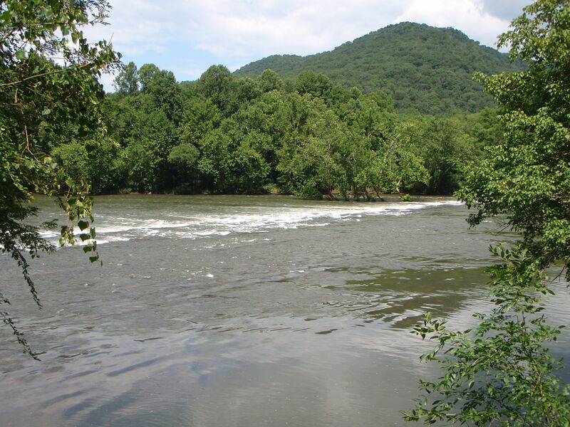
According to the New River Atlas, this section of river is marked by batteau sluices blasted out in the 1880s, of which Wylie Falls (on the far right) is one of the best examples on the New. At Shumate Falls, blasting was begun but never completed, resulting in the U-shaped ledge on river right.
Andrea Jones reports:
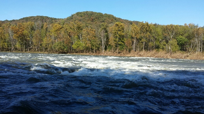
Putin is at Glen Lyn park on river right, just upstream of the Rte. 460 bridge at Glen Lyn. About two miles downstream of the putin is a rapid that has a 3 - 4 ft drop on the right into a horseshoe-shaped hole / foam pile, Shumate Falls. The left side is a class II cobble bar. Most of the other rapids are class I-II with an area on the right side of the river that appears to have been blasted out at some time in the past. NOTE: This is the backwater of Bluestone Lake and, if the lake is high, the last few rapids could be swallowed by the lake. Bluestone Dam is currently used for flood control, but could be converted to power generation in the future.
Another reader reported:
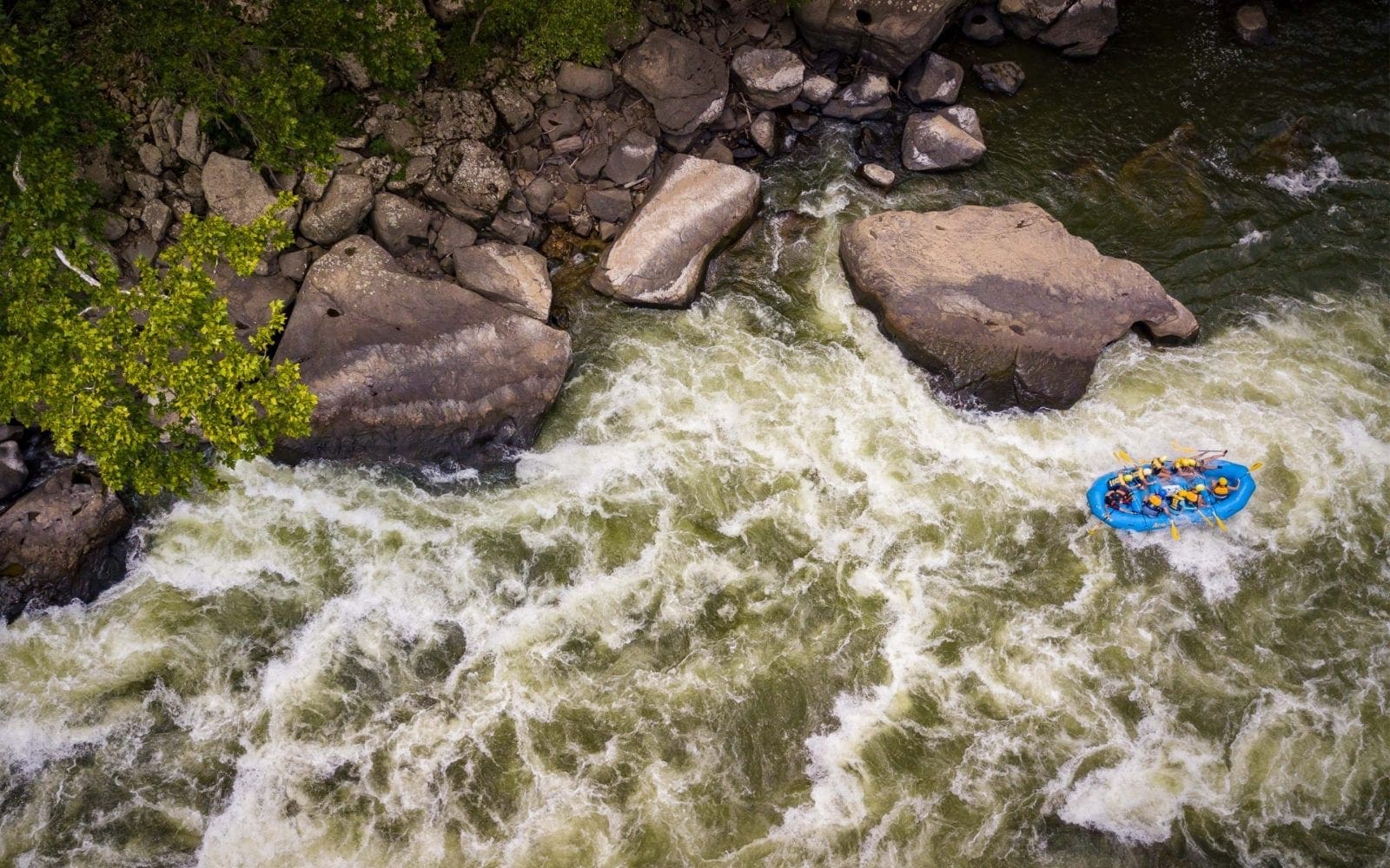
There are three basic lines on the second major rapid from the putin, Shumate Falls. At 4.18 feet there are two class-II slots to the left. There is a center line which is a low class III with a sticky hole which is easy to punch through. The far right side, Shumate Falls proper, is class III+ /IV- with a major keeper hole in the horseshoe. To scout this rapid you must get out on the island and cross a barbed wire fence on the other side of the island. As 8/7/09 the land was not posted. I do not recommend to eddy out above the rapid. If you decide not to run the rapid, there is heavy fast current and it is truly a scary ferry to get to river left.
See Also:
New River Water Trail for maps and info.
_Exploring Virginia's Waterways_, Ed Gertler (2022 ed.), p. 344.
Rapids in this Run (4)
Difficulty
Class I-III
Length
21.0 mi
Gradient
5 ft/mi
Rapids
4
Access Points
Difficulty Classes
I Easy
II Novice
III Intermediate
IV Advanced
V Expert/Extreme
VI Unrunnable
Current Conditions
5-Day Forecast
Whitewater data from
American Whitewater
American Whitewater