1. Altmar to Route 2A
Gauge Conditions
Runnable: 1,000.0 – 10,000.0 CFS
Data from American Whitewater & USGS
Run Map
Run Time Estimate
Select put-in and take-out to estimate time.
Plan This Trip
See wind-adjusted speed maps, forecast planning, and detailed time estimates.
Sign in to generate an AI timing estimate for this run.
Whitewater timing varies with scouting, portages, and group pace. Use as a planning baseline.
Description
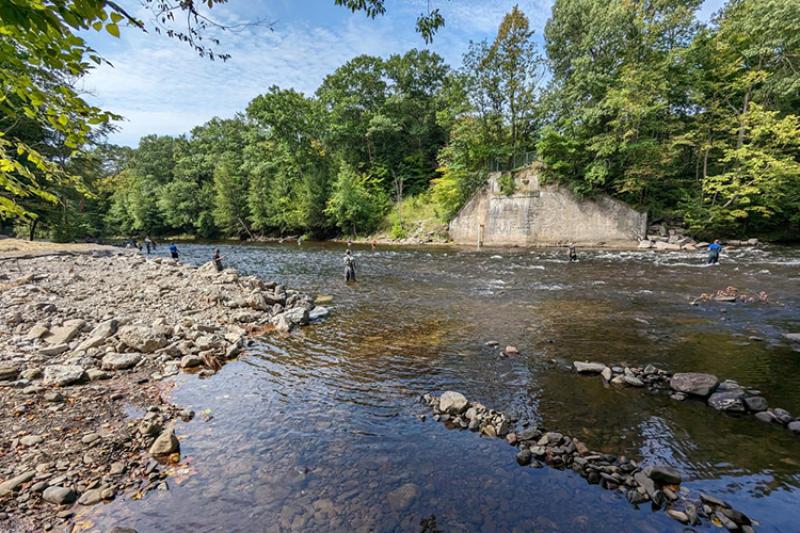
An easier section than the stretch that goes through Pulaski. A good option for beginners or trained beginners who struggle with the main Salmon WW run. The river is usually quite wide with a cobble bottom, giving it an occasional Class II feel. The rapid near Double Eagle is the most continuous whitewater on this section (may be considered an easy III by some). You'll see less fisherman and houses up here which is nice for beginners and dealing with swimmers.
The rapids increase in difficulty as you go down. The first two thirds are mostly just little ripples. A bit boring with a whitewater boat, but great fun in an open canoe. The most difficult rapid here is the descent into Trestle Pool. Whitewater boaters will get splashed a few times, experienced canoeists will have an excellent time, and less experienced canoeists may want to spot this one before running it.
The final third contains the real rapids. For those wanting a whitewater run, put in at the public access on Riverside Pointe Rd. and take out at the usual spot on Route 2A. A good canoeist could navigate this section, though with much greater difficulty.
Expect the water to be chilly, the dam upstream releases from the bottom.
Dam release information: https://www.safewaters.com/facility/lighthouse-hill
Watertown Area Reaches:
Black River (Rt. 3 Wave) Black River (Watertown to Brownville)
Black Creek Deer River (Section 1)
Deer River (Section 2) Roaring Brook (Brokeback Gorge)
Salmon River (Section 1) Salmon River (Section 2)
Sandy Creek South Sandy Creek (Section 1)
South Sandy Creek (Section 2) Mad River
Mill Creek Negro Brook
Syracuse Area Runs:
Butternut Creek Chittenango Creek (Cazenovia)
Chittenango Creek (Chittenango) Fish Creek E. Branch (Taberg)
Limestone Creek (Edwards Falls) Oriskany Creek (Oriskany Falls)
Oriskany Creek (Clinton) Owasco River (Outlet)
Salmon River (Section 1) Salmon River (Section 2)
Google Map of New York Whitewater
New York Whitewater Paddlers Facebook Group
Difficulty
Class I-II(III)
Length
7.1 mi
Rapids
6
Access Points
Difficulty Classes
I Easy
II Novice
III Intermediate
IV Advanced
V Expert/Extreme
VI Unrunnable
Current Conditions
5-Day Forecast
Whitewater data from
American Whitewater
American Whitewater