1. Boiling Springs CG to upstream of Trail Creek
Gauge Conditions
Runnable: 600.0 – 3,000.0 CFS
Data from American Whitewater & USGS
Run Map
Run Time Estimate
Select put-in and take-out to estimate time.
Plan This Trip
See wind-adjusted speed maps, forecast planning, and detailed time estimates.
Sign in to generate an AI timing estimate for this run.
Whitewater timing varies with scouting, portages, and group pace. Use as a planning baseline.
Description
Lat/Longitude data are *very* approximate.
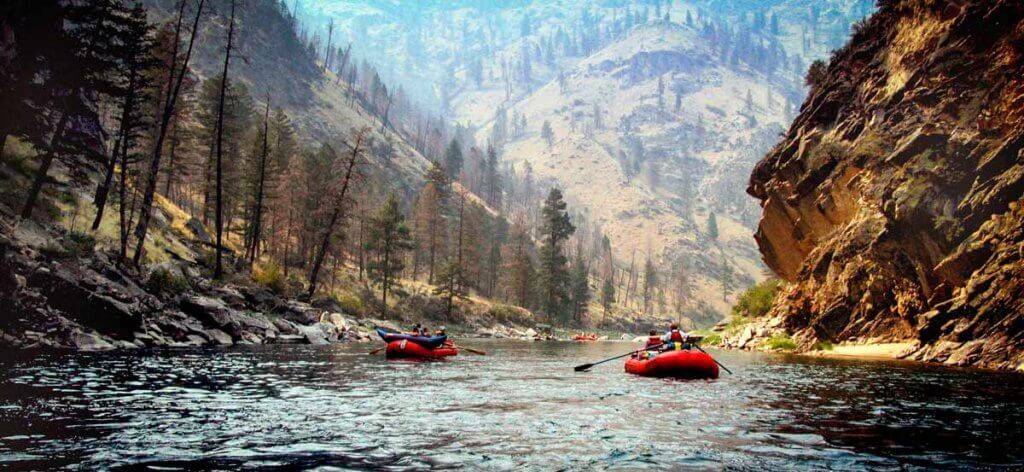
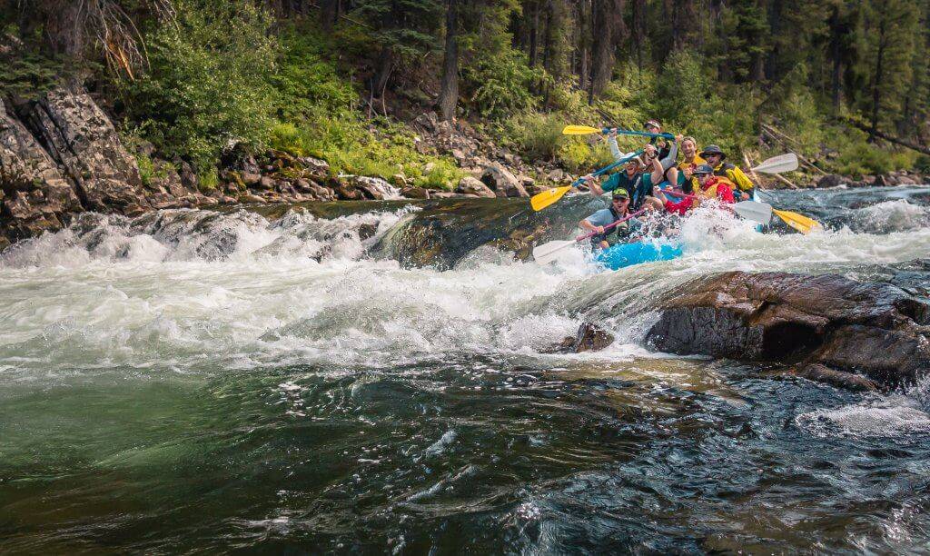
This section is notably different than most of the big water runs of the Payette and Salmon runs in Idaho. Pool drops and creek-style paddling are the most iconic characteristics. Most rocks are like sandpaper and you will lose momentum when trying to boof and can be a pin hazard with inattentive paddling. Paddle with confidence & commit to all the moves and you should avoid many of the hazards. The last rapid, Molly's Nipple, could be called class V and the whole run might be class V above 1500 cfs or so.
There are three sections of this gorge run: the Gorge (Silver Creek to Trail Creek), the Distillery (bridge to bridge) and Boiling Springs (CG to bridge). This beta ends at Trail Creek campground, upstream of two class V+ roadside sections, knowl locally as 'the Steeps', which have lots of wood and strainers (and no run description currently).
Boiling Springs:
A nice warm up to the rest of the run, a good skill builder for technical paddling, and an ideal spring run for beautiful scenery, clear water, and the occasional bit of action. Your biggest limitation is the road-- it sometimes takes until mid May to clear and be accessible by 2WD or standard passenger vehicles. The majority of the run is roadside, as are most of the iconic rapids. Use your drive up to scout for new logs that may have fallen into the river.
There are four major rapids. First up is the Kinks (III), approximately 1.5 miles downstream of the campground. As you round a bend, the river narrows, boulders become prevalent, and your first technical movements become required. After a half mile of calmer waters, you approach the most dangerous rapid: Hawking (IV+). Named for the undercut rock into a black hole (river left), you will need to weave around several small holes and power to the right to avoid the hazard. Immediately downstream is Plinko (IV), a fast and fun vertical slot with a great scouting point from the road. Pick your line on the drive up and send it! The last significant rapid is The Gates of Argonath (III). As you approach, the river depth rapidly increases and the granite walls tower high as you approach the horizon line. At lower waters there are challenging hydraulics, but normally you can enter river left and ride the snaking current to crash the small hole at the end. Finish the run through read-and-run class 1-2 waters, avoid any new wood, and take out at the bridge. *\*\*4WD highly recommended to park by the river at this takeout. There is plentifiul parking just upstream of the bridge if you are in a smaller vehicle\*\
*Video-- Boiling Springs @850cfs*
The Distillery:
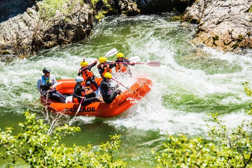
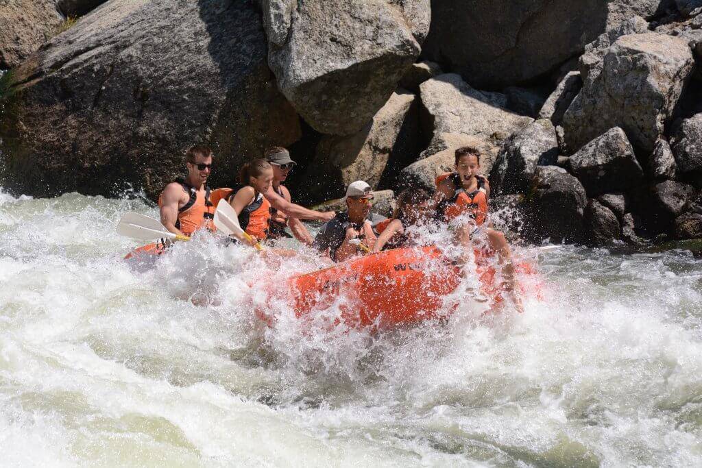
Main rapids: Gin (IV), Tequila (V), Scotch on the Rocks (IV). Lots of technical paddling with great steep canyon scenery. The last half mile of this section is absent of enough wood and well worth your time if you are running the Gorge. The entrance to Gin is right of center. Tequila requires careful scouting and skillful execution. Avoid the undercut rock on left, the turbulent pool on right, and be ready to maneuver through the technical section below the rapid. The last lenghty sequence of drops is called Scotch on the Rocks and requires precise technical maneuvering to stay out of holes and off logs. Scout from the road to choose your lines; many of them are on river right.
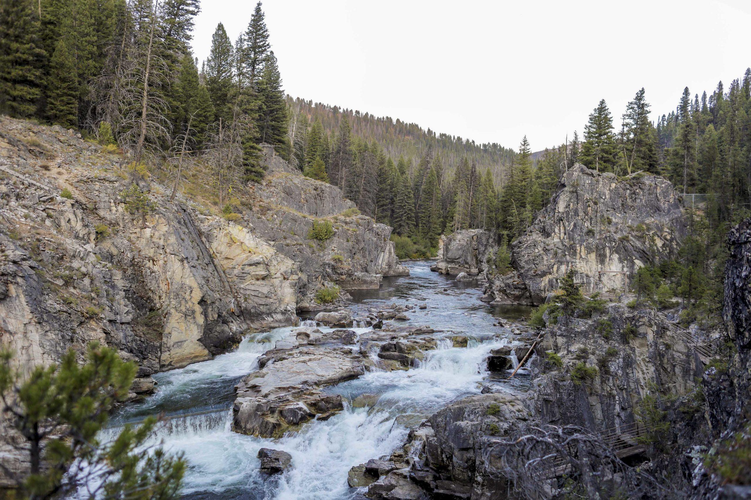
The Gorge:
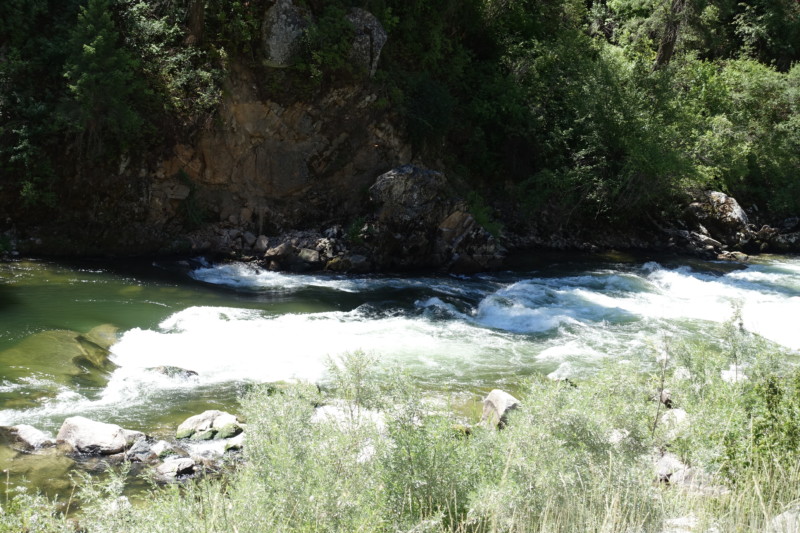
From the Silver Creek bridge, paddle through some mellow flatwater and enjoy the beautiful scenery until you reach the horizon line that marks the beginning of Crud (III+). In 2021 there was a log in the main line and forcing you river right (but there's a guardian rock just above that slot!). You need to eddy left at the big boulder, ferry to the narrow window behind it, then build up some speed in the slackwater for the 4-6 ft drop.
Enjoy a bit of fun read-and-run class 2 immediately below. Work back to the left to avoid John's Hole around the next bend. Flipping in this turbulent pool will suck you back into the pourover, pin your paddle in an awkward position, and leave you clinging to a nearby rock until you exit or or get rescued.
The next IV rapid is IDPB (Insert Drugs, Press Button). This is a relatively simple rapid, but has dire consequences if you don't execute correctly. You can see the rapid from ~50yds upstream as a horizon line and logjam on river left below. The line is similar to Crud-- eddy out left, ferry across, drop down. Contrary to Crud, this drop is 6-8ft, does not have a setup pool above. Point your bow to the right as you boof and prepare for the pool below to push you left toward the logjam. Try to stay close to the boulder on river right as you boof into the pool. Below 500cfs, a rock just downstream of the first drop emerges and may challenge your balance and bracing ability.
The final rapid is Molly's Nipple (IV+). It can be the coolest rapid of the day or a traumatic end to your run if you take the wrong line. There is a pull out on the dirt road to scout from above. A narrow waterfall across the canyon that marks this rapid and you can scout most of it from the road or even hike down to get a closer look and see the safe lines from below. The leadup to it is constant, so try to watch for the cliff on river right 100-200yds before this rapid. The technical skills for this rapid are Class IV, but the hazards and consequences for a bad line can be severe.
The first drop on the right is a massive hole and the flow tries to take you directly into it during the high-gradient Class III boulder garden above. DO NOT GO RIGHT. The normal line is to go left or center on the first drop. Eddy out as often as you need, but make sure you can work to the left through the pushy waters. At lower water, the far left channel is barely wide enough for a creek boat; make sure to hold your paddle parallel to the boat or it might get yanked from your hands. The middle channel is a fun boof/pourover onto the 'Pancake Rock', which water is constantly pounding and will launch you toward the right for a fun boost after the drop (not viable below 800cfs). You can finish the rapid via left, center, or right windows with left being the easiest. Scout for wood when driving up.
WHEN TO RUN: The run is best done in the spring, while run-off provides higher flows (~500 - 1,500 cfs). Best in Late April - Early July. The Middle Fork relies totally on snow-pack and run-off. Expect snow on the narrow road until late spring.
HOW TO GET THERE: From Boise take state hwy 55 north about 32 miles to Banks. Turn right on the Banks-Lowman Hwy. Follow this for about 8 miles and turn left at the sign for Crouch. Follow this (Middle Fork Road) for about 18 miles to the West Fork Bridge. Leave a shuttle near Trail Creek Campground.
WHAT ELSE IS IN THE AREA:** LOTS! The Payette South Fork (Canyon, Swirly Canyon and Staircase runs), Payette North Fork (Cabarton and Smiths Ferry-Banks class V sections), as well as the Payette Main. During the spring these are generally running high and fast. There is a great class IV/V section just above that usually has multiple tree portages and has fallen into disuse.
Rapids in this Run (15)
 Rapid
Rapid
The Hills Have Eyes (II)
 Rapid
Rapid
Kinks (III)
Rapid
IV
Hawking (IV)
Rapid
Plinko (IV)
 Rapid
Rapid
Gates of Argonath (III)
 Rapid
Rapid
Boiling Springs Take Out, Distillery Put In
 Rapid
Rapid
Gin (III+)
Rapid
V
Tequila (V)
Rapid
Scotch on the Rocks (IV)
 Rapid
Rapid
Gorge Put In
 Rapid
Rapid
Crud
 Rapid
Rapid
John's Hole (II)
 Rapid
Rapid
IDPB (IV)
Rapid
II
Scout Molly's Nipple
 Rapid
Rapid
Molly's Nipple (IV)
Difficulty
Class IV
Length
7.5 mi
Rapids
15
Access Points
Difficulty Classes
I Easy
II Novice
III Intermediate
IV Advanced
V Expert/Extreme
VI Unrunnable
Current Conditions
5-Day Forecast
Whitewater data from
American Whitewater
American Whitewater