1) Bridge on Forest Service Route 7 to Trimmer Springs Road
Gauge Conditions
Runnable: ? – ? CFS
Approximate reading: This gauge is 11.8 miles away on Big Creek (Kings River Trib). Use as a general reference only.
Data from American Whitewater & USGS
Run Map
Run Time Estimate
Select put-in and take-out to estimate time.
Plan This Trip
See wind-adjusted speed maps, forecast planning, and detailed time estimates.
Sign in to generate an AI timing estimate for this run.
Whitewater timing varies with scouting, portages, and group pace. Use as a planning baseline.
Description
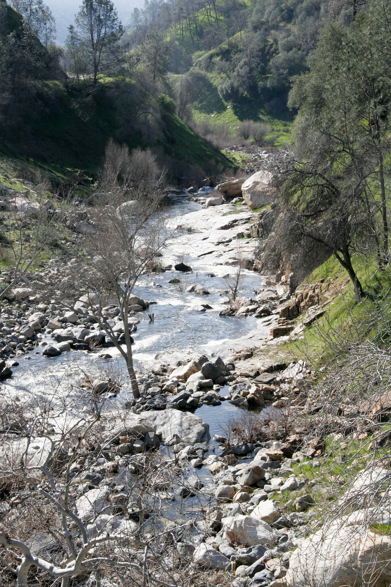
Big Creek is a small tributary of the Kings River. As one travels around Pine Flat Reservoir on the way to the Kings River, the road crosses bridges over two major inlets after passing Trimmer Springs. The first inlet and bridge is Sycamore Creek. The second bridge and inlet is Big Creek.
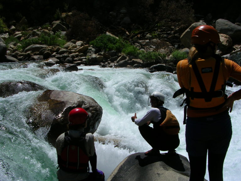
Big Creek is small and brushy, runnable during and after decent winter rain storms. It is fairly technical but not super steep. The streambed alternates between nice bedrock drops and rocky rapids. At low and moderate flows this creek is suitable for kayakers learning technical paddling and how to boat through bushes. At high flows this creek is dangerous because of the many bushes and trees in the streambed, acting as strainers. (When this creek is too high, nearby Sycamore Creek will often be at a good level.)
Put in: A dirt road parrallels the creek, so paddlers can put in or take out at almost any point. The most common put-in is at the remains of an old gauge and dam. But sometimes people drive all the way to where a bridge crosses the creek (elevation 1480 feet) and the road leaves the creek. The biggest drops are below the bridge but seems like the brush was worse up there as well. Worth a look since it is roadside.
Take out: The common take-outs are just upstream of the Trimmer Springs Rd. bridge, or just a short ways below the bridge on river right after a big rapid (elevation 930 feet). You can also continue boating down into the lake bottom, with the penalty of hiking farther uphill to the road afterwards. There is a trail leading down from the road on river right near the confluence with the Kings river, just where the road turns to the west.
In the summer time, Big Creek has a variety of nice swimming holes suitable for kids and families.
While at Big Creek, there are some strange old structures to explore. Just before you get to the Big Creek bridge (approaching from Trimmer) look to your left into the last two ravines before the bridge. Continue onto Big Creek road and look at the next 3 or 4 ravines as well. In each of these small gulleys, stairs lead up to large concrete basins with odd flumes and gates. They are fascinating to climb around on, but I have no definite idea what they were constructed for or when. One suggestion is that they were contstructed to collect water for use in a mining operation, or perhaps they were used in the mineral seperation process. A recent (Feb 2010) conversation with a retired Forest Service lands officer suggested that these structures were built in the 1920's for a rain runoff study. She was not positive, however.
Rapids in this Run (2)
Difficulty
Class III-V
Length
6.4 mi
Gradient
110 ft/mi
Rapids
2
Access Points
Difficulty Classes
I Easy
II Novice
III Intermediate
IV Advanced
V Expert/Extreme
VI Unrunnable
Current Conditions
5-Day Forecast
Whitewater data from
American Whitewater
American Whitewater