1. Buckhorn Dam to Lillington
Gauge Conditions
Runnable: ? – ? CFS
Approximate reading: This gauge is 13.6 miles away on Cape Fear. Use as a general reference only.
Data from American Whitewater & USGS
Run Map
Run Time Estimate
Select put-in and take-out to estimate time.
Plan This Trip
See wind-adjusted speed maps, forecast planning, and detailed time estimates.
Sign in to generate an AI timing estimate for this run.
Whitewater timing varies with scouting, portages, and group pace. Use as a planning baseline.
Description
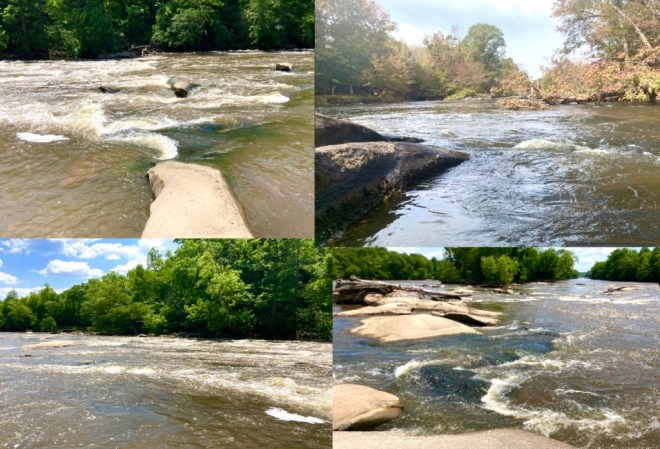
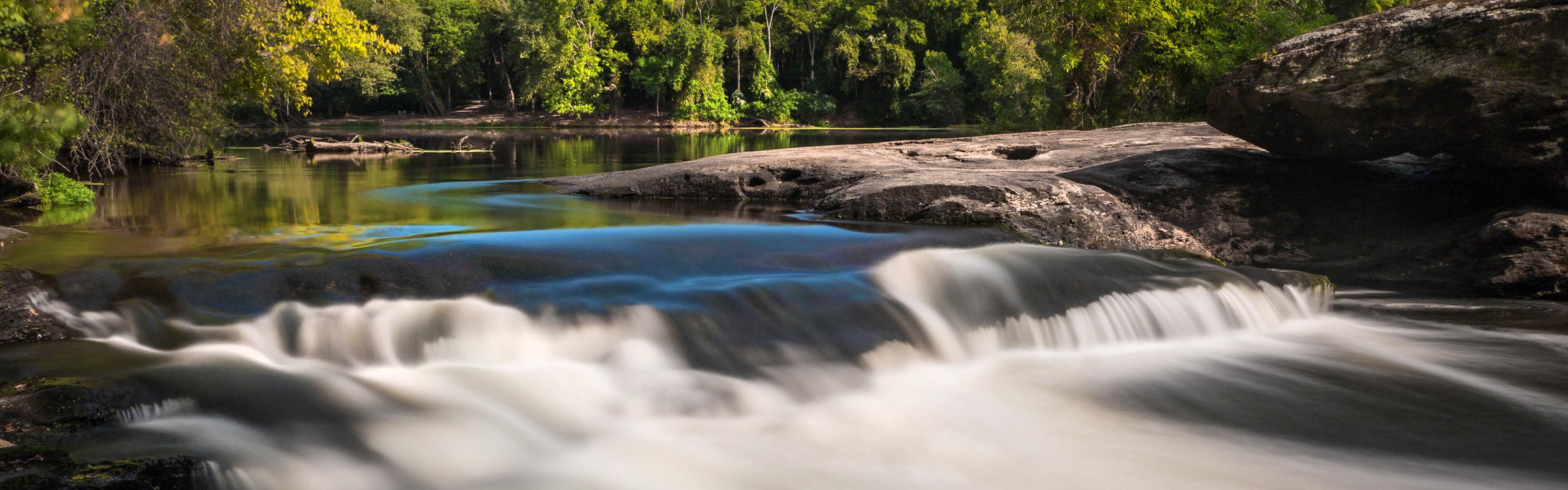
Buckhorn Falls Rapids:
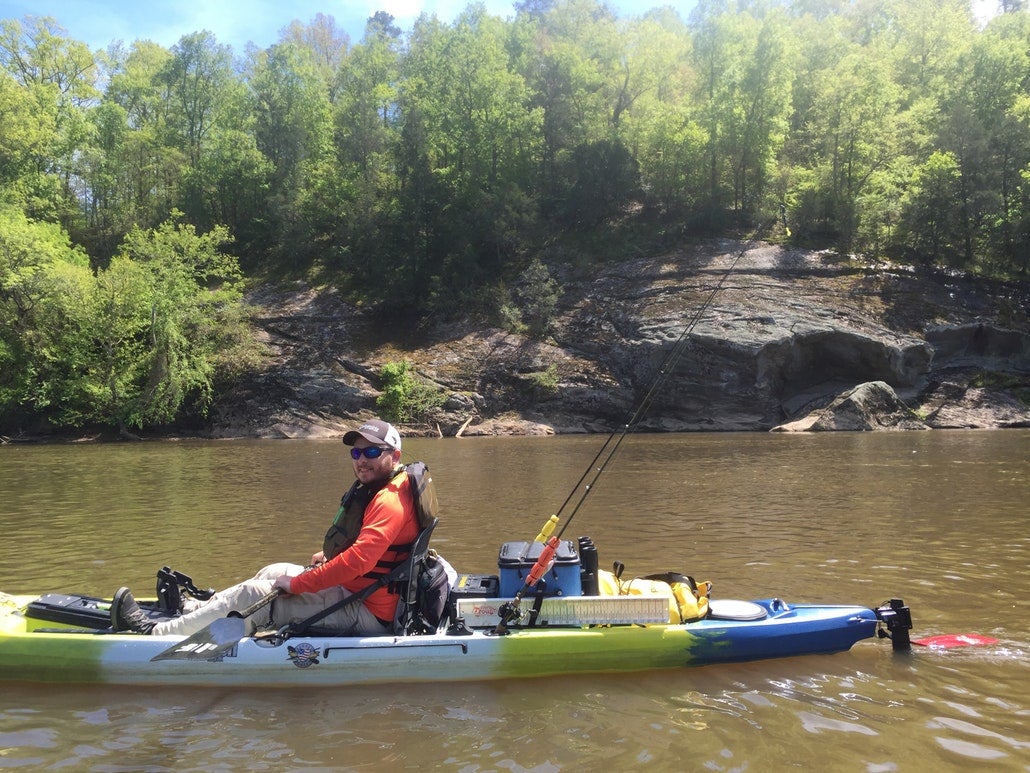
This part of the Cape Fear isn't particularly popular for whitewater paddling and is more a section used for longer camping trips to Raven Rock State Park or flat paddling/fishing before the rapids start. It does, however, offer some interesting whitewater features and good attainment practice for those who enjoy a workout and for less experienced or kayak/canoe camp paddlers, has some risk to be aware of. It also is a chance to paddle rapids if you missed the water levels for the Haw and Deep Rivers days after they have spiked. Park near the Buckhorn Dam at the end of Buckhorn Rd in Corinth, NC, which is a bumpy dirt road with many potholes throughout and put in below the dam. Do not put in anywhere near the hydraulic immediately below the dam. About half a mile downstream are the Buckhorn Falls rapids, which is a boulder garden that goes for about a quarter of a mile.
*Easier Camper's Route:*
For longer trips and less challenge, stay river left on the main channel till the rapids end. Do not enter the narrow channel that appears on the far left after passing the trail on the left bank since this is often clogged with down trees. There will be several small ledges and rocks to dodge, but rapids are less challenging on this side. Avoid rocks and keep your momentum moving downstream with the flow, but otherwise it should be fairly straightforward with rapids ending just beyond an island in the middle of the river. For those less experienced with whitewater or campers loaded with gear, I'd recommend not running this above 3000 cfs (combined flow from Haw and Deep River at Moncure) or over 4.5 ft on the Cape Fear Gage at Lillington. At very high levels, these class I-II rapids start approaching marginal class III difficulty with holes, strong current and swirly eddies. While the rapids are not difficult for an experienced whitewater paddler, risk of problems is high due to the remoteness of the location should a flip and swim occur, and recovery will be complicated since the river is wide. There have been several fatalities in recent years for those not aware of the rapids, so it is important to look at water levels coming in from the rivers upstream before putting on. A long, muddy trail does run the length of Buckhorn Creek and the river (river left) as a way of bypassing the rapids if this is preferred. The walk is about a mile long.
*Whitewater Route:*
For more exciting whitewater, stay river right when rocks start to appear. You can either stay in the main channel, which has a couple of small ledges on the far right or some fast boogie just a bit left of the ledges. More ledges with some small holes are just downstream and boogie water continues till you pass a house on the river right bank with a footbridge crossing a far right, sluice channel. Another option is once you start to see rocks, move into the far-right channel between two islands. A few small rapids appear and once you pass an island with some benches and other signs of someone's land river right, there is a channel to the left of a small rock island to practice some ferrying and peel outs. After this channel, work your way downstream back to the main channel, river left. If water is below 1800 cfs (combined flow from Haw and Deep River at Moncure) and passage is clear, you can take a narrow sluice channel on the far right before the channel rejoins the main one. This will pass under two low footbridges, so it is important to not take this route if water is too high or if you see any blockages. After running the rapids, you may either attain your way back to the put in or attain just up past the island, work your way far left downstream and paddle up Buckhorn Creek (river left) for a bit to reach the trail that parallels the creek and river back to the parking area. I find that attaining the whole way up is easiest if you have a combined flow of around 2500 cfs on the Haw and Deep Rivers but attaining to just above the island is not too difficult at lower levels. If walking on the trail back to your car, you may also choose to run the short stretch of rapids on Buckhorn Creek. This can be fun if the creek is running at 100 cfs or more and since you are walking up the trail, you can put in to run just the section of rapids that the creek offers, which is about a quarter mile in roughly the same parallel spot as the river rapids. If hiking back up, follow the trail back to the dam for about a mile or combine a hike/paddle back.
Continuing to Raven Rock/Lillington:
After Buckhorn Falls, flat water continues for several miles. At 5.7 miles into the trip, you reach Lanier Falls, a class II drop. Stay river left for a more gradual drop or river right for more of a challenging, abrupt drop. One mile later, you reach the Fish Traps rapids. At 8.3 miles into the trip, you will reach the paddle in camping sites for Raven Rock State Park. If camping, you will need to reserve a site ahead of time for $15/camper at Campground Details - Raven Rock State Park, NC - North Carolina State Parks. Parking for Raven Rock is not close to the river, so you will likely want to paddle further into Lillington for takeout. At approximately 14 miles into the trip (or 5.7 miles from the camp site), you will reach a railroad bridge. Start working your way river right to take out at Cape Fear River adventures about a quarter mile downstream just before the Main Street Bridge.
Difficulty
Class I-II(III)
Length
14.0 mi
Rapids
5
Access Points
Difficulty Classes
I Easy
II Novice
III Intermediate
IV Advanced
V Expert/Extreme
VI Unrunnable
Current Conditions
5-Day Forecast
Whitewater data from
American Whitewater
American Whitewater