1. Cascades: FS Road 327 to 1310 Bridge
Gauge Conditions
Runnable: 875.0 – 1,400.0 CFS
Data from American Whitewater & USGS
Run Map
Interactive run map
Loads as you approach this section.
Run Time Estimate
Select put-in and take-out to estimate time.
Plan This Trip
See wind-adjusted speed maps, forecast planning, and detailed time estimates.
Sign in to generate an AI timing estimate for this run.
Whitewater timing varies with scouting, portages, and group pace. Use as a planning baseline.
Description
The Nantahala Cascades are a classic Southern creek run, when they have water. Were it not for the Nantahala Dam diverting water around this reach to the powerhouse the section would be runnable something like 270 days per year. As it is though, paddlers have to take advantage of rain-driven flows that deliver flows through tributaries, or jump on one of eight annual releases that were negotiated by American Whitewater, Western Carolina Paddlers, and the Carolina Canoe Club. Releases are scheduled for a higher flow weekend each April and September, as well as 4 summer afternoons. Duke Energy, the US Forest Service, NOC, and NC Wildlife Resources Commission are supportive partners that help the releases happen.
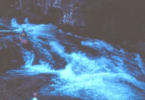
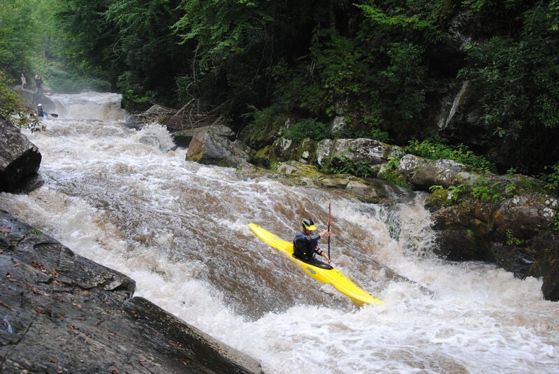
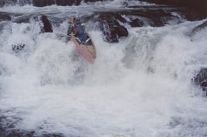
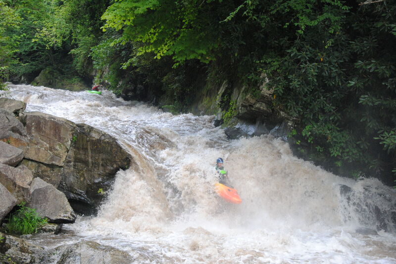
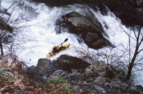
The Cascades are exceedingly well named, as the river roars over a handful of large roadside drops seperated by continuous technical boogie. At lower flows there is some breathing room between the drops, but at high flows the run takes on a freight train persona. Cocktail Rock and the drop below offer great warm up slides and boofs. V Slot challenges paddlers to avoid or embrace the meltdown. Horns of God requires paddlers negotiate a tricky entrance past a sticky hole to reach the glorious boof between the Horns. Big Kahuna is the crux of the run with its long hole-pocked slide ending in a big gushy boof. Junkyard requires a textbook skip out of a slide hole, and as a finale Chinese Feet offers paddlers a couple tight creeky slot moves. You can scout everything from the road.
If You Walk Laps: Paddlers walking laps on the Cascades need to walk single file, as far off the road as possible, and be very careful to keep you and your boat out of traffic. Paddlers walking in the road sometimes cause frustration with local residents needing to drive on the road. Please go out of your way to not impede traffic, and be respectful even if people are frustrated. If a lap shuttle is available at PB&J, use it!
During Scheduled Releases: While most paddlers have historically put in right above the Horns of God, there are three good roadside rapids in the mile upstream of the Horns. Because of the limited parking on release weekends paddlers are now strongly encouraged to either take the NOC shuttle from the lower Nantahala commercial put in if one is available, or park up along the dirt Old River Road to ease the mahem and enjoy some extra rapids. Ample parking exists up the Old River Road a mile or so. Note that many pull-off on the main paved road are closed to parking during release days, and if you use these spots for dropping off or picking up boats and people please move quickly to free up the spaces for the next group. Please no matter where you park keep your wheels off the roads, do not impede traffic, and obey signs. Walking laps is the norm, but walk single-file as far off the road as possible and keep those sterns out of traffic.
During Natural Flows: Use during natural flow days is generally low, and there is ample parking. Paddlers typically park right above the Horns to put in, and take out just downstream of the bridge. Similarly though, park vehicles and walk laps off the road surface.
To get to the Cascades, follow the road past the put-in for the Lower Nantahala. At the fifth bridge, the river will cross under the road and you will see the Cascades to your right. Just below this bridge is the standard takeout. Drive up the road a little ways and you will see an observation area and the standard put-in at Horns of God, the closest drop of them all to the road. Remember though, that during releases many pull-offs are closed so that shuttle buses and cars can drop folks off and turn around.
Rapids in this Run (5)
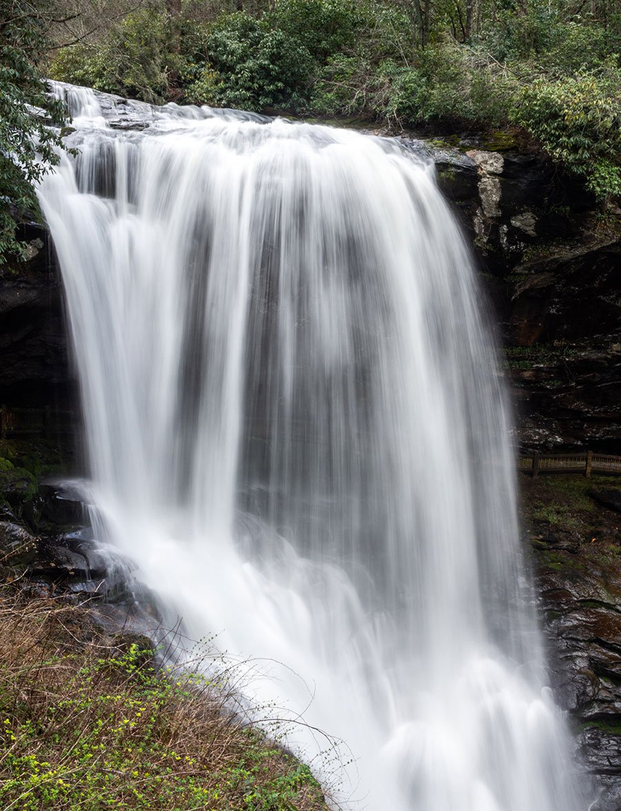
Waterfalls (4)
Hazards & Portages (2)
Caution: The following locations may require scouting or portaging. Always check current conditions.
Difficulty
Class IV-V
Length
1.7 mi
Gradient
210 ft/mi
Rapids
5
2 Hazards
Access Points
Difficulty Classes
I Easy
II Novice
III Intermediate
IV Advanced
V Expert/Extreme
VI Unrunnable
Current Conditions
5-Day Forecast
Whitewater data from
American Whitewater
American Whitewater