1. Duck Valley Indian Res. to Crutcher's Crossing Wild
Gauge Conditions
Runnable: 500.0 – 6,000.0 CFS
At lower flows the continuous section near the beginning may be impassable for rafts, but still runnable for smaller craft.
Data from American Whitewater & USGS
Run Map
Put-in
Take-out
Rapids/Hazards
Wild
Run Time Estimate
Select put-in and take-out to estimate time.
Plan This Trip
See wind-adjusted speed maps, forecast planning, and detailed time estimates.
Sign in to generate an AI timing estimate for this run.
Whitewater timing varies with scouting, portages, and group pace. Use as a planning baseline.
Description
Beginning in Duck Valley, the river is braided and meanders through a willowy marsh rich with bird life and exotic flowers. As the crow flies the distance from launch to Canyon Mouth is about a mile, but the actual river distance is longer due to the meanders. At the canyon mouth there is a solar panel on river right and maps show a road over there. We did not visualize any access.
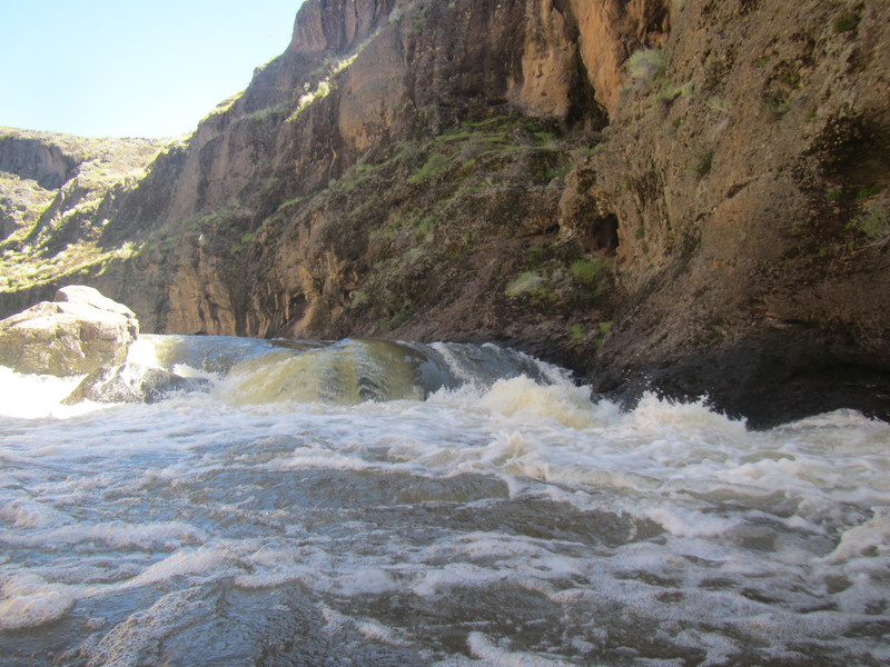
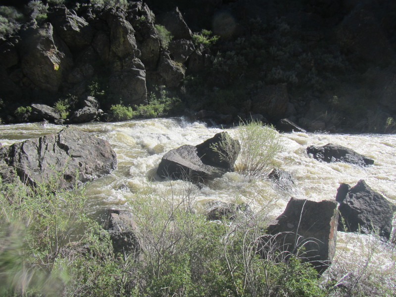
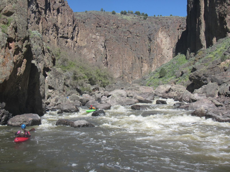
The whitewater begins immediately when you enter the canyon with a couple of class II rapids, and then class III's. The BLM map calls the section "continuous class II-III+" and names only one rapid, Tombstone. Do not be fooled. The character quickly becomes class III in character and the continuousness lasts for five miles and could cause some people to rate it a IV. This whitewater is considerably harder than the class III's below Garat. Tombstone rapid is obvious for the rock at the top, but it is not the largest nor the hardest rapid in the series.
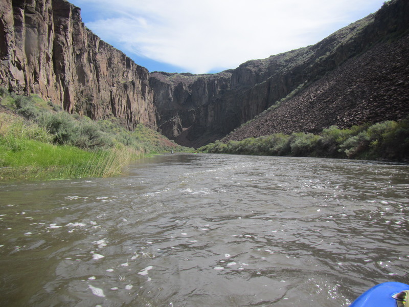
The rapids taper down after about 5 miles but there are still class III rapids periodically until about mile 8, after which it mellows considerably. If you plan to camp, do it soon, because the river drops into a low gorge with limited camping possibilities.
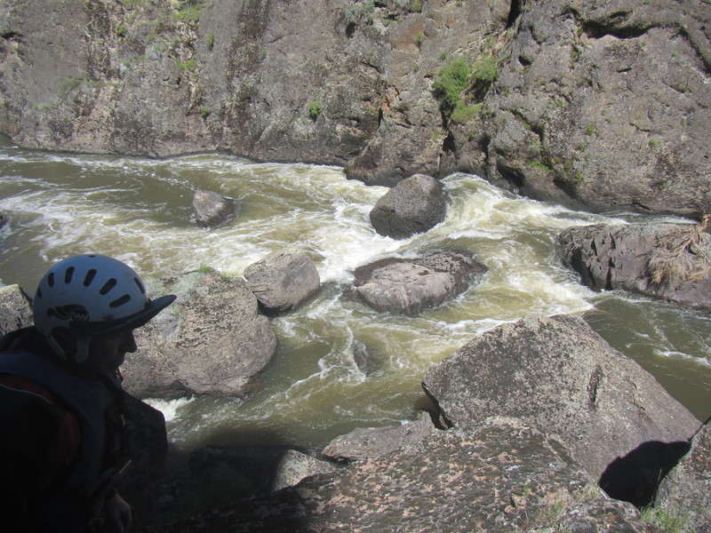
The low gorge continues with alternating calm and class II whitewater for 10 or so miles. This is Garat Gorge, pronounced "Grat" by the locals, as would rhyme with "grok". When the walls begin to get higher, and you reach a pool from which you can see an overhead pipe downstream from a horizon line, you have reached the infamous rapids of Garat Gorge.
Pipeline is first, class IV(+). Scout or portage right. At high flows the rock pile from which we scouted will go under water leaving sheer walls on both sides. Pipeline rapid looked like an easy run on the far river left, avoiding a hole and the rocky jumble in the middle. It is deceiving, because the left wall curves outward just below the drop. We ran two boats into this wall before deciding to portage the rest.
Raft Bridge Rapid is next, also class IV(+). Runnable either entering right (narrow) or center, making a move to the center drop. There's a sieve on the left and a narrow slot on the far right which is clean. The center drop has a rock in deepest part of the hole--skid over the rock on the left side of the channel to save your bow.
The other rapids in the Garat Gorge series are relatively easy at 1100cfs on the Crutcher gauge, except for Heartbreak Hotel.
Heartbreak Hotel IV+(V) begins with a double drop that appears runnable on river left, then percolates through a class III-IV runout. Portage or line boats through small channels on river right.
There's a decent medium/low-water camp on river right just around the bend from Heartbreak. Garat crossing is less than 1/2 mile downstream and has a BLM self-registration kiosk on river left, a short distance uphill from the river.
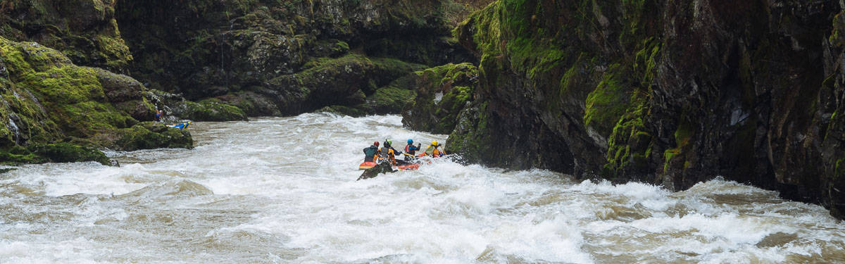
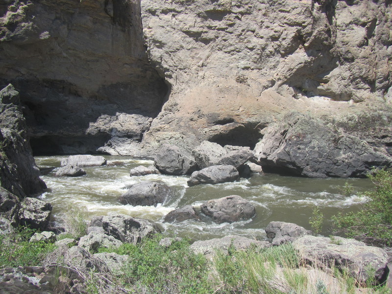
Downstream from Garat the river is much mellower, meandering for a day eastward to the Tules then northward to the Battle Creek confluence on the right, the Wiley Ranch road on the left, and the Deep Creek confluence on the right. Paddle up Deep Creek a short distance to find a camp on creek left. Almost 5 miles after Deep Creek is Rickert Crossing, and Boulder Jam (class III) is less than two miles from there. You may try to scout Boulder Jam on the left, however you cannot see the far right channel which is the line. Beware of the cave eddy on river right below the drop.
Owyhee Falls is just under 4 miles downstream from Boulder Jam, after a left bend in a dramatic deep canyon. The difficulty of portaging this rapid is probably the biggest reason this section is rarely done. Owyhee Falls is a class VI sieve at low flows, and probably develops a class V route at higher water. At low flows the portage a is strenous hump through the river right boulder pile at river level. When the water is too high to portage on the right, you must drag your boat and gear up the steep slope on river left, and traverse the slope until you can find a place to launch. People who do this portage on the left may never return.
There's a nice medium/low water camp on river right between Owyhee Falls and the next probable portage, Thread the Needle. Thread the Needle can be run by kayaks in the left center channel, which is narrow but a relatively straight shot and the reason for the name. The other channels are all sieves. Portage left and don't fall in. The second part of the rapid is quite runnable.
After Thread the Needle there is a series of class III rapids that are much easier than the class III above Garat. One rapid requires a strong move across the flow in front of a flip/pin spot.
Red Canyon on river right drains from high in the mountains and has clear water later in the season than most side canyons. Two miles after Red Canyon the canyon opens up and you will see the Crutcher gauge on river right. You can take out beside the gauge or scout on foot for the road to the water at the low water crossing not far downstream.
Rapids in this Run (9)
Hazards & Portages (1)
Caution: The following locations may require scouting or portaging. Always check current conditions.
Difficulty
Class III-IV(V+)
Length
65.6 mi
Rapids
9
1 Hazard
Access Points
Shuttle Info
The launch point is on river left about 1 mile from the Canyon Mouth, in the Duck Valley Shoshone-Piute Indian Reservation on unmarked dirt roads. Before the Canyon Mouth the river braids and meanders through a large marsh rich with birds and unusual plants. Few people go here, and getting directions is difficult. I will tell you what I remember, but go prepared for an adventure.
We were told to get permission from the Tribe to use their land, and we were also told by a tribal member not to. We stopped at the Tribal HQ but it was a Sunday and nobody was there.
From the ACE Hardware just south of the Idaho/Nevada border, take the road headed west that is in sight from the parking lot. It is paved "until it turns to dirt" but it is a good dirt road that wanders west and north back into Idaho. Take the first left that has a cattle guard across it, also a good dirt road. Follow this road until it bumps into the ridge that marks the west edge of the valley, and then turn right onto a small dirt track.
From this point on the roads may be impassable when wet. 4wd, high clearance, and sturdy tires are important as you may have to drive through the sagebrush to get around puddles that last into dry periods. Follow the small dirt track to a T intersection, where you turn left. Soon after that you pass through a gate in a barbed wire fence. Close the gate behind you because there may be some nice horses in there.
Follow that road approximately 1 mile, crossing one small wash, until you arrive at a deep meander of the stream that you can drive right up to. Launch here.
Taking out at Garat Crossing may or may not be possible depending on the behavior of the oil company that claims the land. Taking out at Crutcher on river left is still possible in 2017, and the access at Three Forks is well known and signed.
Difficulty Classes
I Easy
II Novice
III Intermediate
IV Advanced
V Expert/Extreme
VI Unrunnable
Permit Required
Self-registration permits available from the BLM website. Also seek permission from the Duck Valley Shoshone-Piute tribe.
Get Permit
Current Conditions
5-Day Forecast
Whitewater data from
American Whitewater
American Whitewater