1. Fish Barrier Dam to Thermalito Outlet
Gauge Conditions
Runnable: ? – ? CFS
Approximate reading: This gauge is 0.2 miles away on Feather. Use as a general reference only.
Data from American Whitewater & USGS
CDEC Flow Data California
Data from California Data Exchange Center (CDEC)
Run Map
Description
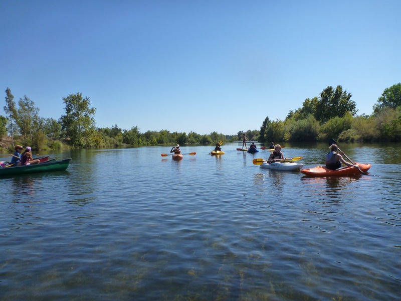
This is a nice class I-II float that is a great alternative to the Sacramento River. Most of this run feels remote and is very pretty. As an added bonus in the late summer and fall, there are often large numbers of salmon in the river. The class II riffles give those looking for an introduction to moving water some interesting rapids to navigate with minimal hazards. It is much lower volume than the Sacramento, typically flows are 600 cfs from the fish hatchery to the outlet of the Thermalito Afterbay. Flows below Thermolito return are usually much higher. Flow levels do not seem to change the difficulty of the run, but higher flows will decrease your travel time.
The rivers is fairly wide with a number of class II riffles from the hatchery until after you pass the River Reflections Campground and boat launch. Past this point, the river braids into several channels. All rapids are class II and make this section the highlight of the run.
Other Information Sources:
Oroville-Thermolito Complex: Wikipedia
Feather River Fish Hatchery
Rapids in this Run (4)


Hazards & Portages (1)
Caution: The following locations may require scouting or portaging. Always check current conditions.
Difficulty
Class I-II
Length
7.6 mi
Gradient
5 ft/mi
Rapids
4
1 Hazard
Access Points
Shuttle Info
**Directions**
There are several put-in and take-out options for this run. To put-in at the fish hatchery, take the Montgomery Street exit off of Highway 70 and turn West towards town. After passing through the downtown area, take a left at the roundabout and head across the river on Table Mountain Blvd. After crossing the bridge, take the first right and follow the road down to the hatchery viewing area. Follow this road back under the bridge. Upstream of the bridge, you will see a trail to the river.
If you are looking for a shorter trip, you can put-in at River Bend Park and shave about a mile and a half off of the trip. You get to River Bend Park by taking the Montgomery Street exit off of Highway 70 and turning West, towards the river. In the park you will find a nice boat launch and ample parking.
The third option is to put in at the river reflections resort. This is trims another two miles off the trip. The resort will charge you to park, for an additional fee they will also run your shuttle. To reach River Reflections Resort, take the exit at Georgia Pacific Way, this is stoplight South of Montgomery Street on Highway 70. Turn left on the frontage road, the resort will be on your right. http://riverreflectionsrvpark.com/
To reach the take out, take Oro Dam Blvd and head West. In 1.8 miles, take a left on Larkin Road. IN 3.4 miles, turn left into the Oroville Wildlife Area.
Difficulty Classes
I Easy
II Novice
III Intermediate
IV Advanced
V Expert/Extreme
VI Unrunnable
Current Conditions
5-Day Forecast
Whitewater data from
American Whitewater
American Whitewater