1 - Grandjean to Deadwood
Gauge Conditions
Runnable: 600.0 – 5,000.0 CFS
Runnable: 800.0 – 4,000.0 CFS
Approximate reading: This gauge is 20.0 miles away on South Fork Payette River. Use as a general reference only.
Data from American Whitewater & USGS
Run Map
Run Time Estimate
Select put-in and take-out to estimate time.
Plan This Trip
See wind-adjusted speed maps, forecast planning, and detailed time estimates.
Sign in to generate an AI timing estimate for this run.
Whitewater timing varies with scouting, portages, and group pace. Use as a planning baseline.
Description
The run from Grandjean to Deadwood is 35 miles and is typically divided into segments based on skill level of the group and the wood situation.
_Grandjean (rm 140.6) to Bonneville (rm 131.7); class II(IV); 8.9 miles_
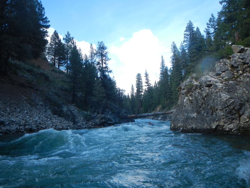
The section from Grandjean to Bonneville is mostly class II with the notable exception of Canyon Creek Rapid which is class III+ (IV above 2000cfs) and the short gorge just upstream of Bonneville which is class III+. Wood can be an issue in this upper segment of the run and higher flows greatly increase the risk and difficulty. Use caution in this remote stretch.
Canyon Creek (III+/IV) is a read-and-run with a couple of the biggest hits on this section. Follow the big tongues and crash the holes for a thrilling start to your run. Scout from the bridge at the CC/SF confluence if desired and make use of the forgiving eddies as needed.
The gorge before Bonneville hosts two significant rapids. First up is Emesis (III), which can be road scouted on the drive up. Enter river left and ride the rowdy wave train. Next is Kicks John's Ass (III), which is a stronger and slightly longer version of Emesis (plus a few powerful laterals to test your combat roll). This can also be road scouted.
_Bonneville (rm 131.7)_ _to Helende (rm 119.0); class II-III+; 12.7 miles_
A popular run begins at Bonneville (III). If you begin about a mile and half upstream of the campground you can start out with the fun class III rapids in the short gorge (described in segment above) that finishes off as you pass under the ID-21 bridge. Swing left around the riverbend and stair-step down three small drops. As the river widens and accelerates, a fun wave train finishes the rapid as Warm Springs joins with the SF.
Blue Jay (II) is just before the bridge. There are a couple fun waves to surf, otherwise run the left lines as you round the corner.
Downstream of the bridge, the river enters another short canyon at Chapman Creek Rapid, which is a class III+ rapid that can be boat scouted down the middle or from a large eddy on river left. You can turn from ID-21 at the Warm Springs trail signs and road scout the rapid from above for logs. (Remember to check below the crux for river-wide trees). There are multiple lines available for you to play it safe or go ham.
Just downstream, Alcatraz (Little Surprise) awaits. Following a semi-blind left turn, the river cascades through a big class III+ drop with a midstream boulder that is to be avoided. A good line is down the left side and finishing off towards the center but watch the smaller holes at the top that can quickly send you off your line. You can also punch through the hole on right at moderate flows.
__
Below this drop the river continues with more fun class II/III. As you pass under the next ID-21 bridge the river enters another great section with continuous class II punctuated with some fun class III moves. This action tapers off as you approach the Tenmile Trailhead.
Below Tenmile you pass by a small community of riverside cabins and a more open river channel with class II whitewater that continues on down to Helende Campground. This campground is a good take-out for a beginner run or a put-in for the great intermediate run that awaits downstream.
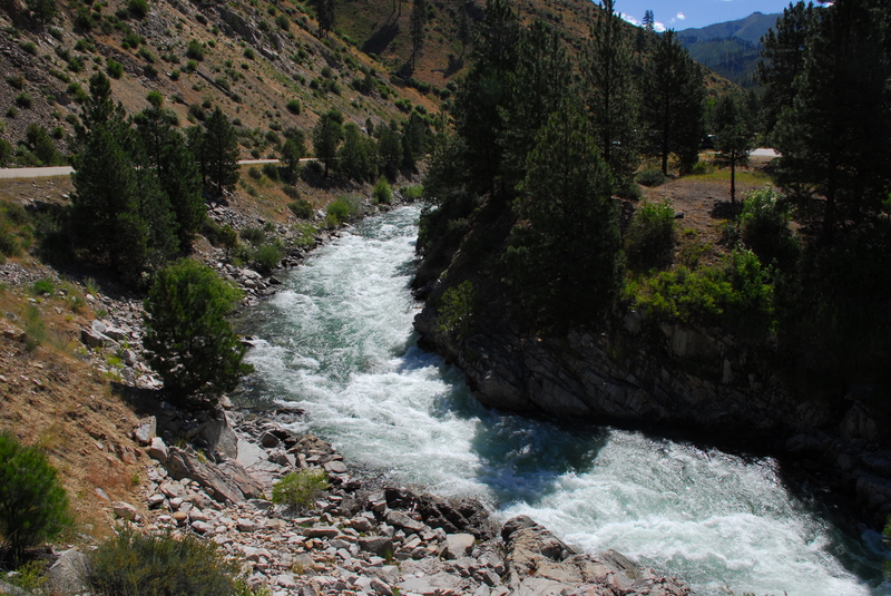
_Helende Campground (rm 119) to Mountainview Campground (rm 109.5); class III; 9.5 miles_
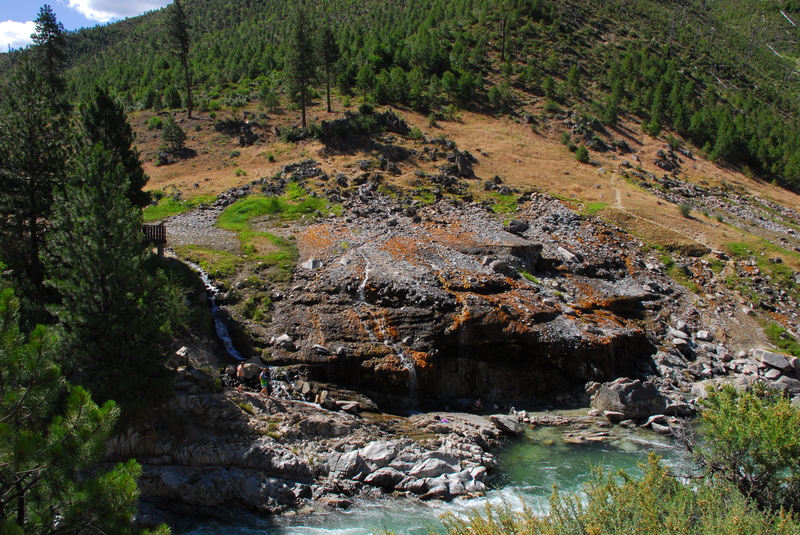
Helende to Mountainview Campground is characterized by fun class III rapids. The first gorge is just after you pass under the Forest Road 542 bridge. Use caution as you approach the horizon line (you can road scout the gorge from mile 78.2 on Highway 21). The highlight of this run is just another mile downstream as you enter the gorge at Kirkham Hot Spring. This is one of the best hot springs in the valley. The spring is extensively developed as a day use area and small campground that is visible from the road so it is not remote but it is a nice spot and a great stop for a lunch time soak.
_Mountainview Campground (rm 109.5) to Deadwood River Access (rm 105.1); class II+; 4.4 miles_
Below Mountainview the whitewater backs off a notch and is fun class II+ that is fairly continuous and a good beginner run to the Deadwood River Access which is the traditional put-in for the the Canyon run. You can take out here or continue on down another 4.6 miles to Pine Flat Campground which gives you a couple of nice class III rapids and an ending at the hot springs at Pine Flat.
Logistics:
There are a few alternative access points along ID-21 all the way up to the campground above Grandjean (river mile 140.6).
If you are starting your run at Bonneville, a good put-in is at the dispersed campsite at ID-21 mile 93.0. Bonneville Campground at ID-21 mile 91.5 is also listed as an access in some guides but this puts you in downstream of some good class III/IV.
Good access for rafts can be found across from the Warm Springs Guard Station. To reach it turn onto 025-RB at ID-21 mile 91.3. Follow this road 0.9 miles downstream and turn left into the dispersed campsite just before you reach the guard station. This access puts you in just downstream of Chapman Creek but just above Alcatraz.
A couple more roadside pullouts and dispersed campsites provide access as you continue downstream.
Tenmile Trailhead is at ID-21 mile 85.5 is sometimes used an access that comes at the end of some class II/III and the start of a short class II reach.
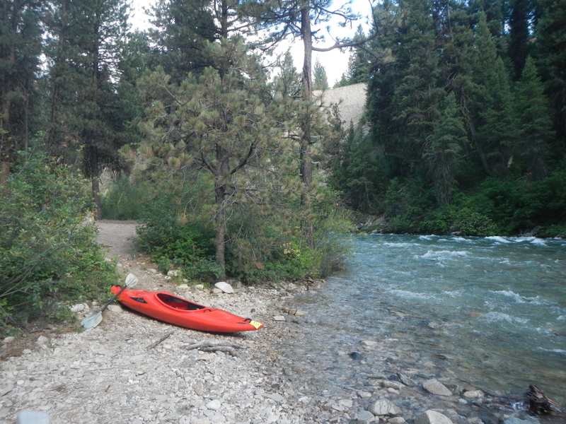
Helende Campround at ID-21 mile 81.5 is a good river access that serves as a take-out or put-in. Enter the campground but instead of following the loop around the sites, head straight on the dirt road towards the river. Rafts can easily use this access.
Kirkham Hot Springs is at ID-21 mile 76.9 and is sometimes used as a kayaker take-out for those making the short intermediate run down from Helende.
Mountainview Campground is at ID-21 mile 73.3 and serves as a take-out or put-in.
If continuing downstream past Mountainview you will turn off ID-21 at mile 72.6 onto the Banks-Lowman Road. You will be at mile 33.2 when you turn onto this road.
Deadwood Flats River Access is at mile 29.9 on the Banks-Lowman Road at river mile 105.1.
The Pine Flats Campground is at mile 27.9 on the Banks-Lowman Road at river mile 100.5.
Rapids in this Run (13)
Rapid
Hot Spring
Rapid
Wapiti Creek Bridge
Rapid
IV
Canyon Creek Rapid
Rapid
Bonneville - Dispersed Campsite Access
 Rapid
III
Rapid
III
Chapman Creek Rapid
 Rapid
Rapid
Warm Springs Guard Station Access
Rapid
III+
Alcatraz (Little Surprise)
Rapid
Tenmile Creek Road Bridge
Rapid
Helende Campground Access
Rapid
III
"Wake up" gorge
 Rapid
Rapid
Kirkham Hot Spring Access
 Rapid
III
Rapid
III
Kirkham
Rapid
Mountain View Campground Access
Difficulty
Class II-III+
Length
35.6 mi
Gradient
40 ft/mi
Rapids
13
Access Points
Difficulty Classes
I Easy
II Novice
III Intermediate
IV Advanced
V Expert/Extreme
VI Unrunnable
Current Conditions
5-Day Forecast
Whitewater data from
American Whitewater
American Whitewater