1) Hartwick Mill Run: Highway 124 to Pinnacle Springs (11 miles)
Gauge Conditions
Runnable: 2.0 – 6.0 FT
The creek has been frequently run at levels down to 1.0 feet but hang-ups, scoots and bumps are frequent and require low-draft boats.
Data from American Whitewater & USGS
Run Map
Run Time Estimate
Select put-in and take-out to estimate time.
Plan This Trip
See wind-adjusted speed maps, forecast planning, and detailed time estimates.
Sign in to generate an AI timing estimate for this run.
Whitewater timing varies with scouting, portages, and group pace. Use as a planning baseline.
Description
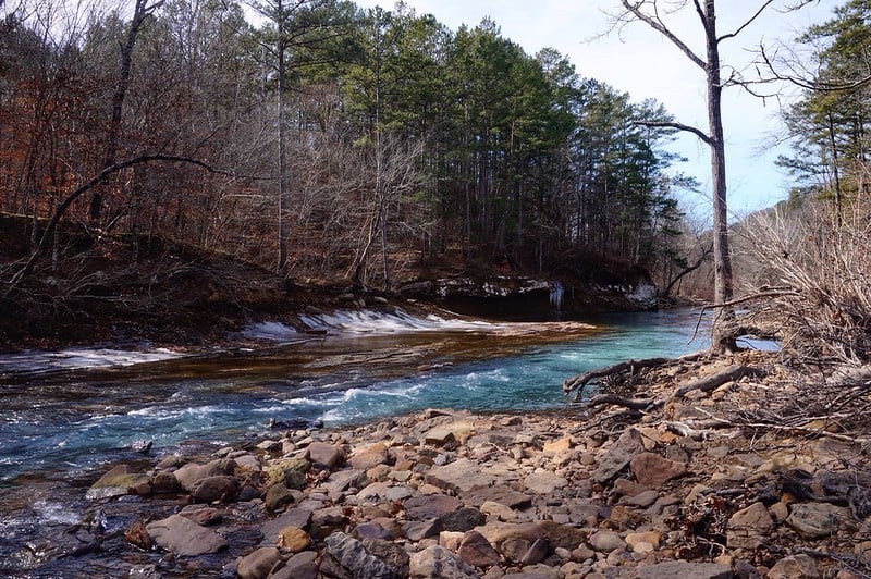
Above Batesville Mountain the Cadron is a quiet Ozark stream meandering through rolling countryside. Bordered by dense stands of hardwoods and bluffs, there are few signs of civilization. There are frequent ripples and shoals but the rapids are gentle. There are also many nice places to swim and explore waterfalls and rock grottos. This is a very scenic run for those learning to canoe or families with small children albeit a couple of the shoals near the end might make a mother nervous at levels above 4 feet.
The put-in is found on north-west corner of bridge -- do not block gate! This run passes the remnants of Hartwick Mill--a large corn grist mill that was washed away in the flood of 1927. Part of the old dam can still be seen protruding from the water just below the put-in river right. About 3.5 miles further downstream is "Sparky's Trail" -- the rock trail can be seen ascending the bluff on river right. The trail was built by a rock mason named Sparky who quarried, cut and stacked the rock all by himself. Explore the trails and vistas but please respect the private landowners -- Cadron Creek Outfitters -- by leaving no trace of your visit. As you approach the take-out BBB Falls can be seen cascading from atop a bluff river left. Soon thereafter you will enter Pinnacle Springs Campground -- most people run Sarah's Wave and take out at the "lower acess" where a gravel road can be seen on river left. There is a five dollar fee to take-out or put-in at Pinnacle Springs Campground for whch you get secured parking, streamside access, picnic tables, water. and porta-potties. Or you can go another mile and take out at Highway 310 bridge also on river left. There are no amenities here but you save some money and the current private landowner is receptive to no trace access. Do not block his gate.
UPDATE: May 2017 - Recent floods have resulted in several downed trees and bank erosion. One scrappy mandatory portage at this time approx. 2 miles downstream from Hartwick Mill Bridge.
Rapids in this Run (1)
Difficulty
Class I(II)
Length
13.2 mi
Gradient
3 ft/mi
max 5
Rapids
1
Access Points
Shuttle Info
Quickest shuttle makes use of Wolf Branch Road. From take-out drive up rough hill (high clearance SUVs and trucks advised) to Cargile Road. Turn left. Go 1/4 mile and turn left on Highway 310 (Pinnacle Springs Road). Go a mile or so and turn left on Wolf Branch. Go to end and turn left on Mill Bridge Road. Put-in at bridge at bottom of hill.
Difficulty Classes
I Easy
II Novice
III Intermediate
IV Advanced
V Expert/Extreme
VI Unrunnable
Current Conditions
5-Day Forecast
Whitewater data from
American Whitewater
American Whitewater