1 - Headworks to Kanaskat-Palmer State Park
Gauge Conditions
Runnable: 1,000.0 – 3,000.0 CFS
Data from American Whitewater & USGS
Run Map
Run Time Estimate
Select put-in and take-out to estimate time.
Plan This Trip
See wind-adjusted speed maps, forecast planning, and detailed time estimates.
Sign in to generate an AI timing estimate for this run.
Whitewater timing varies with scouting, portages, and group pace. Use as a planning baseline.
Description
EVENTS: The annual Green River Cleanup takes place in spring every year and is coordinated by Washington Recreational River Runners and Friends of the Green River.
SEASON: October to May after heavy winter rains. The best flows often come in fall or spring.
LOGISTICS: If it's your first time, a map is helpful to make sense of the roads here. In Summit, at the junction of Maple Valley - Black Diamond Road (Highway 169) and Kent-Kangley Road (Highway 516), head east towards Georgetown on Kent-Kangley Road. In approximately 3 miles, turn off to the south on Lake Retreat-Kanaskat Road. In another 3 miles turn on to Cumberland-Kanaskat Road to the right up over the railroad tracks, and then cross the bridge over the Green River. Follow the road as it turns to the west (headed downstream) a short distance to the turn-off into Kanaskat-Palmer State Park. Once you've entered the park head toward the right and a parking area with a short path that leads to the river. A large sign board warning of dangerous rapids downstream (the class IV gorge run) marks the takeout on the river. Those who want to run a couple more good class III rapids can use an alternate take-out in the park (head left instead of right as you approach the river). To reach the put-in, head back out the park and drive upstream along river left. Just before you reach the bridge you crossed on your way in, you will see a turn-off for Headwords Road which parrallels the river. Follow this road upstream approximately 2 miles to a put-in. The preferred access is just upstream of the security gate but through an agreement that was negotiated by Friends of the Green, American Whitewater, and local boating clubs with Tacoma Utilities, boaters can obtain a pass from the security guard to access the put-in (if you need to reach the security office by phone they can be reached at 360-886-1601).
DESCRIPTION:
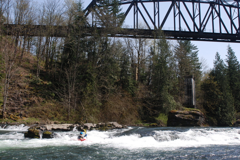
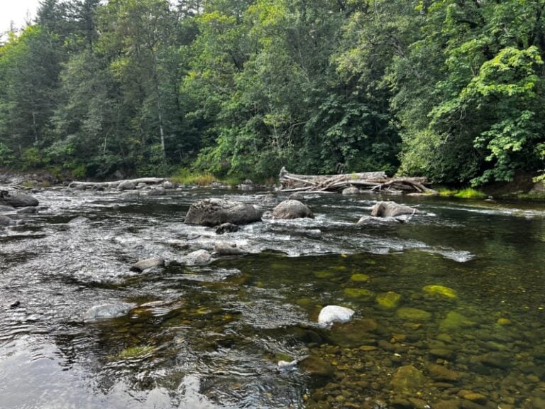
This is a good run for beginners led by a more experienced paddler. As with other dam release runs in the region, extensive brush along the banks becomes an annoyance during rescue situations. Most of the rapids are class II with the exception of Railroad Bridge, a class III ledge marked by a distinct horizon line after you float beneath the railroad bridge. The preferred line is down the tongue on river left but the details of the line change with flow. Be sure to scout from river left if you are unsure of the line, but stay below the high water mark and off of private property. Over the course of the run there are several good eddy lines to practice boat handling skills and some nice surf waves downstream of the highway bridge.
Paddlers in the region should note that the increasing demands of urban growth and endangered salmon have been the focus of management priorities on the river, but after a day or two of intense winter rains you are nearly always guaranteed to find this run with water.
An important consideration on this run is finding out when the water will be flowing. Although discharge from the dam often remains constant through the weekend, the engineers do sometimes adjust flows over the weekend at high flows of most interest to boaters.
Rapids in this Run (2)
Difficulty
Class II+(III)
Length
4.0 mi
Gradient
26 ft/mi
Rapids
2
Access Points
Difficulty Classes
I Easy
II Novice
III Intermediate
IV Advanced
V Expert/Extreme
VI Unrunnable
Current Conditions
5-Day Forecast
Whitewater data from
American Whitewater
American Whitewater