1. Lloyd Shoals Dam to Wise Creek
Gauge Conditions
Runnable: 800.0 – 5,000.0 CFS
Data from American Whitewater & USGS
Run Map
Run Time Estimate
Select put-in and take-out to estimate time.
Plan This Trip
See wind-adjusted speed maps, forecast planning, and detailed time estimates.
Sign in to generate an AI timing estimate for this run.
Whitewater timing varies with scouting, portages, and group pace. Use as a planning baseline.
Description
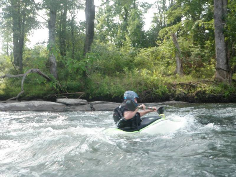
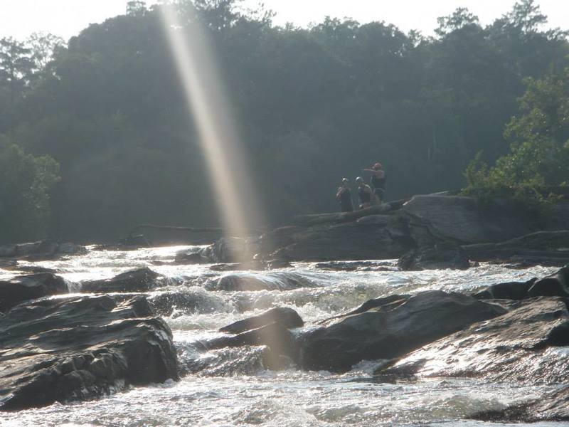
River corridor is historically called the Seven Islands area. Dam controlled run. Large river. The river corridor is very pleasing...completely forested with no streamside development. River left is a patchwork of National Forest and private land. The first half of the run is flat; consider it price of admission. The gradient picks up at mile 3 as islands become more prevalent. Smiths Shoals, arranged sporadically throughout the mile between Giles Ferry and the river left forest service road access, provide good surfing and play at flows above 2000cfs. Following another half mile of flats, you have a choice to make at mile 4.5, where 40 Acre Island divides the river for an entire mile. On the right side, the main channel takes 90% of the stream over the only III, a single large long stairstep ledge at Lamar's Mill. Usual portage is on river right.
The channel left of 40 Acre Island hides an exquisitely pretty creek run in which 15 or 20' of gradient is allocated throughout one mile of several interesting II/II+ drops. It is not an easier or safer alternative to the main channel due to deadfalls and lack of portage options.
## Guidebook
A Canoeing and Kayaking Guide to Georgia, Menasha Ridge Press, 2005
Playspots (2)
Difficulty
Class I-II(III)
Length
6.0 mi
Gradient
7 ft/mi
max 28
Rapids
0
Access Points
Shuttle Info
## Shuttle
25 minutes each way.
1. From put-in, take Jackson Lake Road south to Ga 16. Turn left on 16.
2. East on Ga 16 to Clay Rd. Turn right on Clay Rd.
3. South on Clay Rd to McElheney Crossroad/New Hope Church Rd. Turn right at McElheney.
4. New Hope Church Rd to New Hope Church. Turn right at the church onto FS 144 then immediately left on FS 1019.
5. Continue fwd through the next stop sign intersection. Road becomes FS 1098 for the rest of the way to the Wise Ck take out.
Alternate route: the FS roads that lead from Hwy 16 or from Wise Ck to the intermediate access point are graded and fine for passenger cars at this time. Please chime in if you find they've gone to pot again.
## Waypoints for access points and shuttle turns
putin,33.3161,-83.8403
takeout,33.2433,-83.8142
shtl1,33.3177,-83.8391
shtl2,33.3066,-83.8352
shtl3,33.3156,-83.7561
shtl4,33.2436,-83.7608
shtl5,33.2337,-83.7744
shtl6,33.2353,-83.7750
shtl7,33.2433,-83.8139
Difficulty Classes
I Easy
II Novice
III Intermediate
IV Advanced
V Expert/Extreme
VI Unrunnable
Current Conditions
5-Day Forecast
Whitewater data from
American Whitewater
American Whitewater