1. Lodgepole Campground to Hell's Crossing
Gauge Conditions
Runnable: 300.0 – 600.0 CFS
Data from American Whitewater & USGS
Run Map
Description
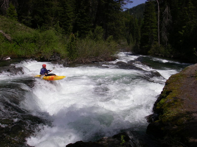
While there are a couple rapids on this run, much of it is low gradient that includes some sections of braided channel with massive log jams. One rapid is worth checking out if you happen to be in the area and want a quick whitewater fix. From Lodgepole Campground it's only a short distance down to a fun class IV drop behind the DOT site. The rapid is a two pitch drop with a couple of fun holes to punch. Be sure to scout as there could be log hazards in play.
Logistics: The Forest Service Lodgepole Campground, the put-in, is located at Highway 410 mile 76.7. Access is available on the upstream river left side of the bridge. The Forest Service Hell's Crossing Campground, the take-out, is located at Highway 410 mile 83.5. Alternativley you can just hike back up to the road from anywhere on this run.
Rapids in this Run (1)
Difficulty
Class II-III+
Length
8.9 mi
Rapids
1
Access Points
Difficulty Classes
I Easy
II Novice
III Intermediate
IV Advanced
V Expert/Extreme
VI Unrunnable
Current Conditions
5-Day Forecast
Whitewater data from
American Whitewater
American Whitewater