1 - Paradise to Selway Falls Wild
Gauge Conditions
Runnable: 700.0 – 35,000.0 CFS
Very rough estimate of high water division
Data from American Whitewater & USGS
Run Map
Put-in
Take-out
Rapids/Hazards
Wild
Recreational
Run Time Estimate
Select put-in and take-out to estimate time.
Plan This Trip
See wind-adjusted speed maps, forecast planning, and detailed time estimates.
Sign in to generate an AI timing estimate for this run.
Whitewater timing varies with scouting, portages, and group pace. Use as a planning baseline.
Description
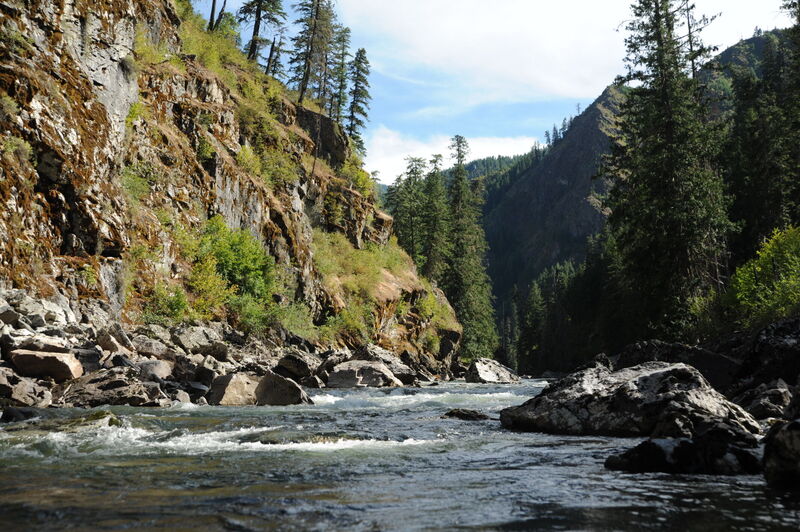
The Selway River is a Nationally designated Wild and Scenic River flowing through the Selway-Bitterroot Wilderness Area. As a major tributary of the Clearwater, it was one of the original eight Wild and Scenic Rivers desiganted in 1968. The Selway is one of North America's premiere wilderness whitewater trips where boaters typically spend three to five days on this 47 mile run.
History
American Whitewater co-founder Oz Hawksley pioneered whitewater boating on this run when he set out with Jack Reynolds, John Hawksley (who was 13 at the time) and Art Midouhas. They took an army surplus raft with home-made oar frame and a decked 15' Grumman canoe along with a 16mm moving camera which was used to document the run and make the case for conservation of this river. Oz had announced the trip in the American Whitewater Journal earlier in the year as 'one of the most beautiful wilderness areas, with a navigable river, left in the U.S.,' a statement that holds true today thanks to the foresight of Oz and others to include this river as one of our nation's original Wild and Scenic Rivers.
Season
Most dependable flows typically occur during late June. Snow often prevents access through May, peak snow melt in early June may make the river dangerously high, and flows are often too low by mid-July. Those looking to access the river before the control season may be able to do so by hiring transport by snowmobile. Flying in to Shearer airstrip, 15 miles downstream from the put-in, is also a possibility.
Description
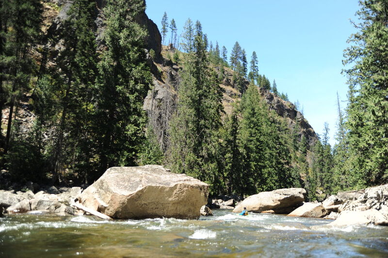
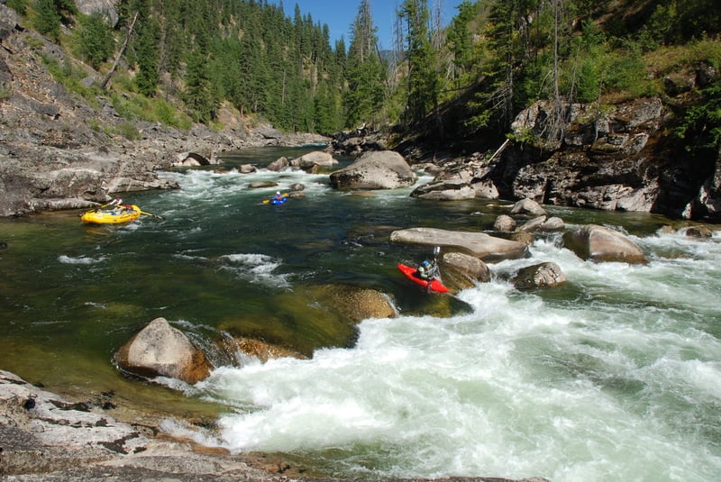
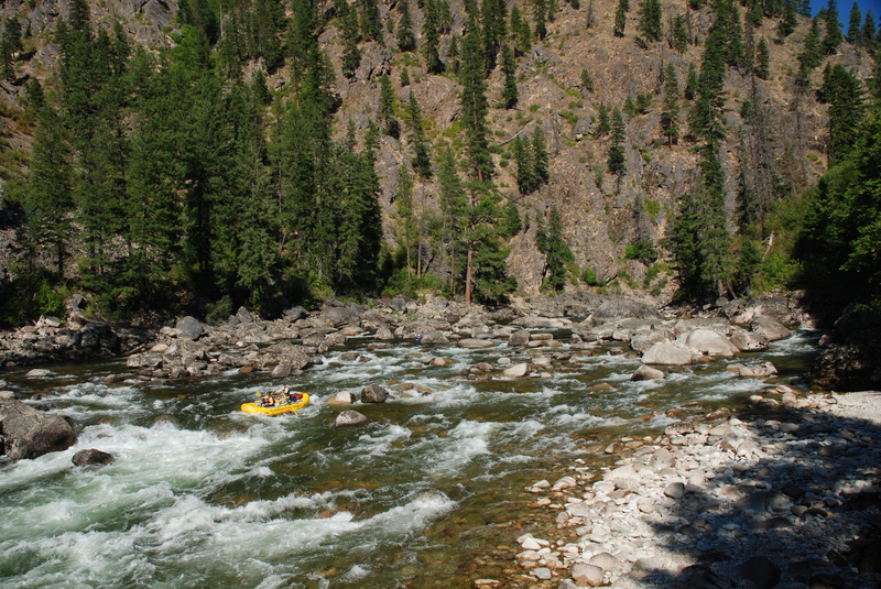
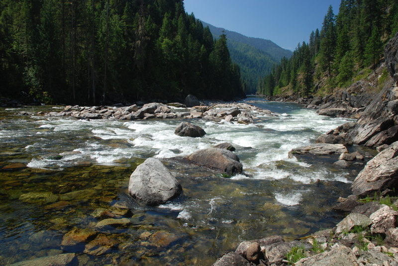
Boaters typically begin their trip by making the long drive over Nez Perce Pass in to the small campground at Paradise where the road ends and the adventure begins. Groups typically spend the night at the campground the day before their launch. In the first 27 miles there are a number of great class II and III rapids as the river flows through lush stands of old-growth forest with great campsites along the way. Goat Creek Rapid and Ham Rapid are the most notable drops in this section.
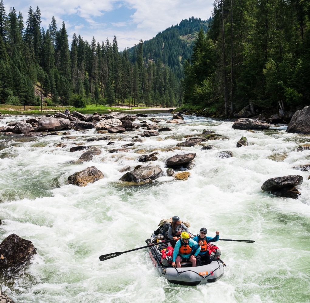
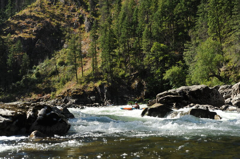
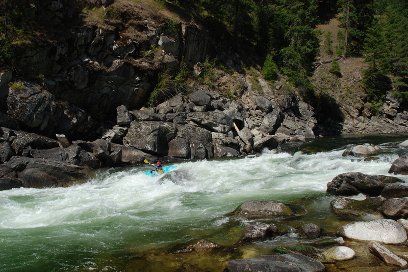
Moose Creek is a major tributary joining the Selway 27 miles into the trip and the flow of this creek, known as the Moose Juice, results in a higher volume river. If you are on a late-season trip and have been bumping down the upper section of the run, things clean up considerably. And if you are on a mid-season high water trip, get ready for the action to pick up considerably. Many groups camp near Moose Creek so they have a full day to tackle the next four miles of whitewater representing the highlight of the trip. The big drops include Double Drop, Wa-Roots (aka Grizzly Saddle), Ladle, and Litte Niagara with several Class III rapids in between. At high water this whole section can become one long section of continuous Class IV/V whitewater.
After you make it past the section with the biggest drops the rapids are once again spaced out a bit more as you continue to enjoy the higher flows of the lower half of the run. Although there are a number of good Class II and III rapids that remain, there are also a couple of bigger drops that deserve respect at Wolf Creek Rapid and Jim's Creek Rapid. Great opportunities for camping continue down to the take-out.
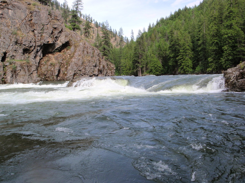
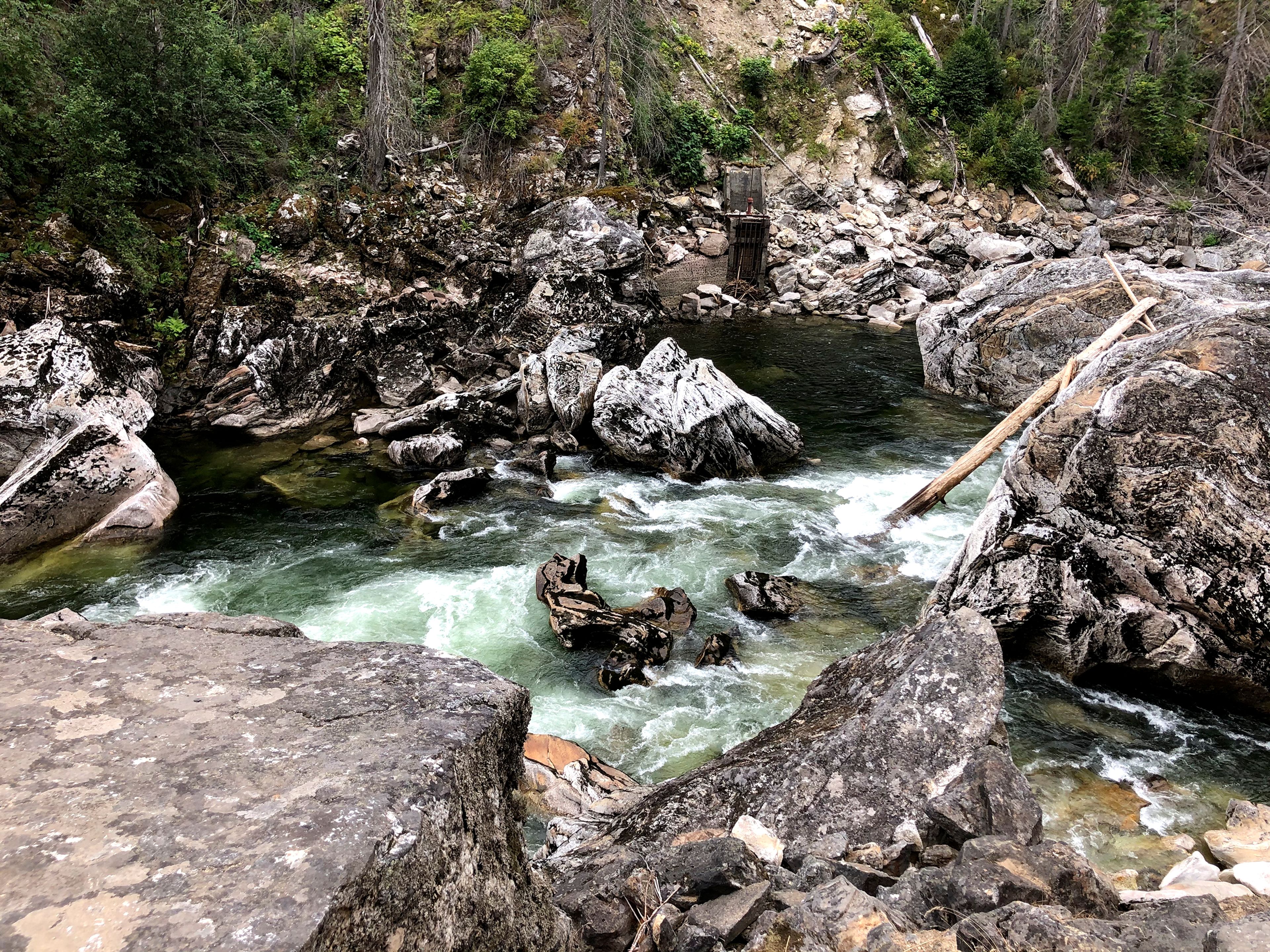
The Race Creek take-out is just upstream of the Meadow Creek confluence where Forest Road 223 comes up river from Highway 12 at Lowell. In another mile the Selway cascades through Selway Falls, a boiling cauldron of holes and sieves that is best enjoyed from the overlook along the road as you start your drive home.
Logistics
To reach the put-in from Darby, MT on US 93, drive south about 10 miles and turn right up West Fork Road. Follow this over Nez Perce Pass to Magruder Guard Station. At Margruder turn right and follow the Selway downstream to the Campground and put-in at Paradise.
To reach the take-out, turn off Highway 12 at mile 96.9 and cross the bridge to head up Selway River Road. The road ends at mile 19 just above Selway Falls
It's a long drive around to shuttle so a shuttle service is recommended.
An alternative option that is sometimes used for late season trips is to fly in to Shearer Airstrip which is a riverside airstrip 13 miles downstream from Paradise.
Other Information Sources:
http://www.fs.usda.gov/detail/bitterroot/home/?cid=STELPRDB5262645
- Four Rivers Lottery Brochure
- Selway River Rules & Regulations
- Selway River Fishing Information
- Selway River Trip Planning
- Safety - It's Your Life
- Leave No Weeds
- How to Avoid Giardia
- Current Idaho River Flows
- Selway River Information & Weather - Lowell, ID
Rapids in this Run (11)
Waterfalls (1)
Hazards & Portages (1)
Caution: The following locations may require scouting or portaging. Always check current conditions.
Difficulty
Class IV
Length
47.8 mi
Gradient
28 ft/mi
Rapids
11
1 Hazard
Access Points
Difficulty Classes
I Easy
II Novice
III Intermediate
IV Advanced
V Expert/Extreme
VI Unrunnable
Permit Required
The limited permit season runs annually from May 15 to July 31. Lottery applications due January 31. Only one party of up to 16 people is allowed to launch each day during that time. Permits are not required outside the control season on the Selway River. Group size is limited to 20 people outside the permit season.
Get Permit
Current Conditions
5-Day Forecast
Whitewater data from
American Whitewater
American Whitewater