1 - Powell to White Pine (Indian Grave Creek) Recreational
Gauge Conditions
Runnable: 2.0 – 10.0 FT
Flow range for best boatability uncertain. Please help your fellow boaters with a comment or report.
Data from American Whitewater & USGS
Run Map
Put-in
Take-out
Rapids/Hazards
Recreational
Run Time Estimate
Select put-in and take-out to estimate time.
Plan This Trip
See wind-adjusted speed maps, forecast planning, and detailed time estimates.
Sign in to generate an AI timing estimate for this run.
Whitewater timing varies with scouting, portages, and group pace. Use as a planning baseline.
Description
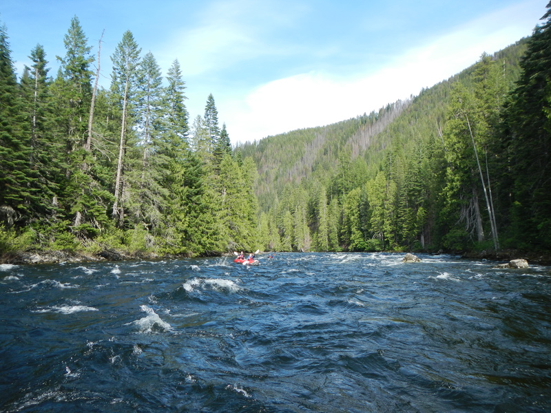
For those who wish to enjoy the beauty of the Lochsa without the intensity of the more well-known sections downstream, you will not be disappointed. The entire run is roadside and most of it is visible on the shuttle drive making it easy to get an assessment of the character of the run.
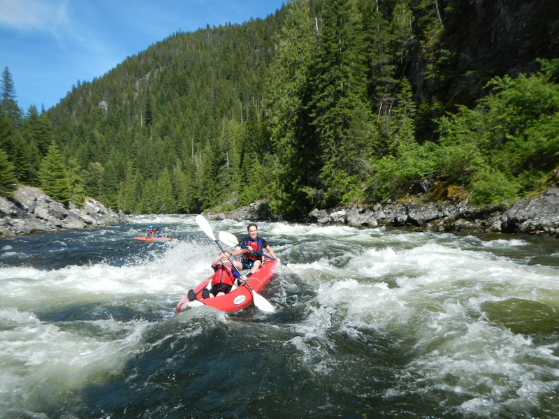
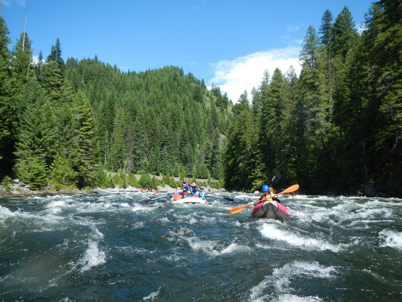
From the start of the run where the Lochsa forms at the confluence of the Crooked Fork and Colt Killed Creek, the river is mostly swift but straightforward class II. You will pass by a few cabins and the Powell Ranger Station complex in the first couple miles. In this upper segment, the river valley is a little wider and flatter than the downstream sections. About six miles in, you will encounter the first significant rapid known as Cold Storage. This drop is a class III+ rapid that is right along the road and can be easily scouted on the drive up. It is the biggest rapid on this segment where the river drops through a series of big waves in narrower section of the channel constrained by bedrock. The line is generally down the tongue to the right of center. The runout continues for at least another half mile downstream with lots of fun features.
The next 10 miles or so down to Colgate are full of fun class II with a few distinct rapids that are in the class II/III range that are relatively easy to boat scout. Although the current is swift throughout this reach during the spring snowmelt, all of the rapids have good recovery sections at the end.
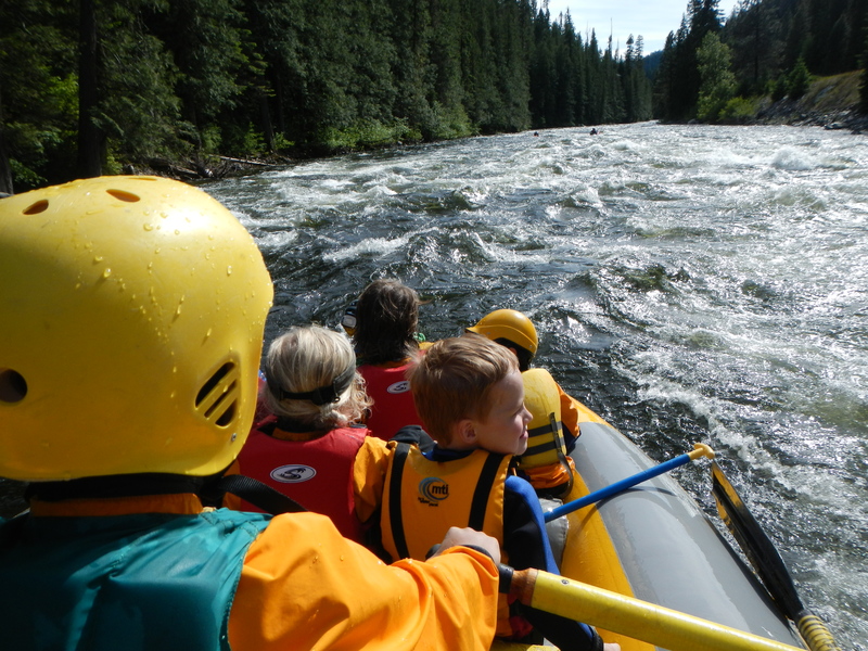
From Colgate it's about a nine mile run down to White Pine and this run is a nice beginner whitewater trip that can be done on its own. Just downstream of the dispersed camping area at Colgate, the river flows over a fun class II/III rapid with a couple of waves at the top and a nice tongue right of center. Below here the river is mostly lively class II. Below the Mocus Point Pack Bridge, about halfway into the run, the river is punctuated by a few more distinct class II/III drops. The run finishes off with Indian Grave Rapid before it takes a big bend to the left through a section with a couple islands. that marks the approach to the take-out at White Pine.
As an added bonus to the whitewater on this run, two of the most accessible hot springs on the Lochsa are along this section, making a soak after your run a nice addition to the day. Jerry Johnson Hot Springs is accessible from the Warm Springs Trailhead at Highway 12 mile 151.4 by crossing the pack bridge to river left and heading about a mile up the trail. Weir Hot Springs is accessible from a small unsigned parking area at Highway 12 mile 142.1. The 0.5 trail up the creek to the hot spring forks to provide either an upper trail or lower trail option but both arrive at the same place, a beautiful pool that sits on a slab of bedrock overlooking the creek and the forested valley below.
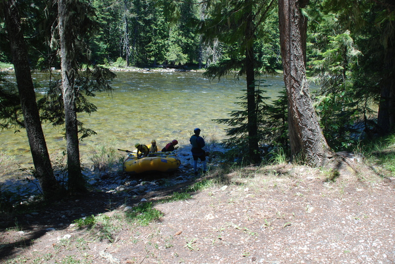
Logistics: White Sands Campground is the start of this 25 mile run. From Highway 12 mile 163.5 turn down the Forest Service road to White Sand Campground. It's 1.2 miles down to the confluence of the Crooked Fork and Colt Killed Creek, where you turn right into the campground and will find a day use area with river access.
The small community of Powell that includes Lochsa Lodge (lodging, dining, gas, and basic supplies), a Forest Service ranger station complex, and a campground is at Highway 12 mile 161.8 but there is no formal river access. Kayaks can find a couple spots in the campground or along the road but options for rafts are not great.
For those looking for a shorter run you have a few options. You can put-in at White House Campground at mile 158.5. This puts you in about a mile upstream of Cold Storage, a class III and the biggest drop on this section.
For a short beginner run, the Colgate access is a dispersed camping area at Highway 12 mile 147.7 that serves as a nice alternate put-in.
The take-out for this section is at White Pine at Highway 12 mile 138.5. The run is also described as ending at Indian Grave Creek as this tributary enters the Lochsa just upstream of the take-out. Make sure you recognize the take-out as downstream of this point the pace picks up considerably as you enter the classic "Upper Lochsa" run with several class IV rapids.
While there are several camping options along the entire Lochsa River, including some nice undeveloped sites, Wilderness Gateway Campground at Highway 12 mile 122.7 (cross the bridge to the campground on river left) offers the most sites and is a popular gathering place for whitewater paddlers in the spring.
Difficulty
Class II-III
Length
26.0 mi
Gradient
28 ft/mi
Rapids
6
Access Points
Difficulty Classes
I Easy
II Novice
III Intermediate
IV Advanced
V Expert/Extreme
VI Unrunnable
Current Conditions
5-Day Forecast
Whitewater data from
American Whitewater
American Whitewater