1.) The "Big Piney" (Alhambra to VA. 827 ['Perkins Mill Rd'] Woodson)
Gauge Conditions
Runnable: 450.0 – 1,000.0 CFS
400 to 450 is a good guide to minimum flow. The upper range of flow will, of course, vary depending on individual groups' skill level and disposition.
Data from American Whitewater & USGS
Run Map
Run Time Estimate
Select put-in and take-out to estimate time.
Plan This Trip
See wind-adjusted speed maps, forecast planning, and detailed time estimates.
Sign in to generate an AI timing estimate for this run.
Whitewater timing varies with scouting, portages, and group pace. Use as a planning baseline.
Description
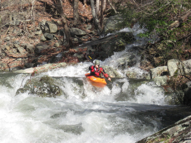
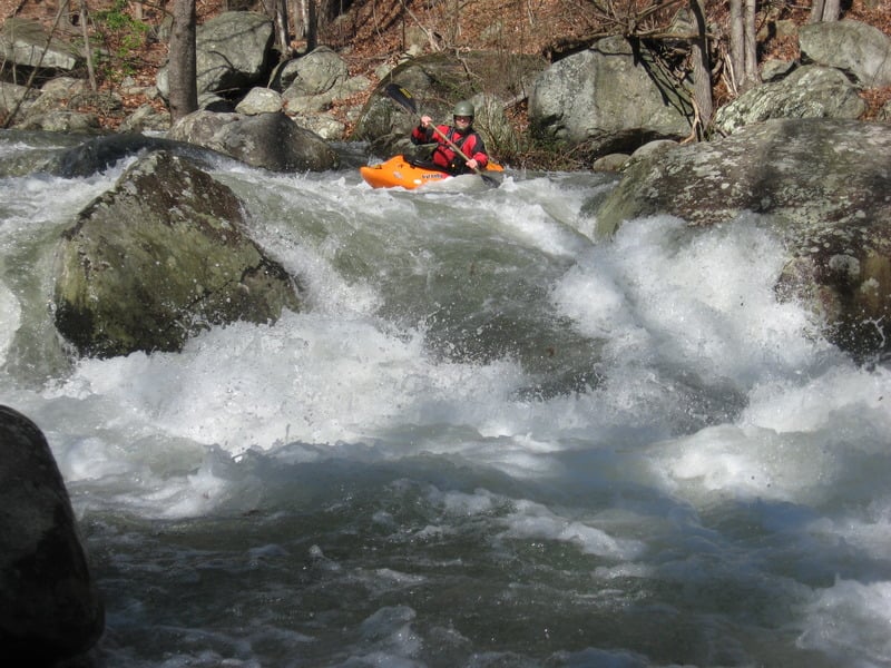
'The Big Piney:' This gem of a whitewater stream is the uppermost section of the Piney River, below the confluence of its North and South forks. Big Piney could very well be one of Virginia's nicest whitewater rivers. Cold, clear mountain water tumbles down a narrow, steep, valley shaded by tall pines and hemlocks. The whitewater is conistent technical class III+ to IV- boulder garden. The heavily wooded scenery is interrupted only by a few scattered homes along the river, even though the run is almost entirely roadside. The consistent mid-grade whitewater, cool vibe, and roadside access make the Big Piney a great introduction to light 'creeking' / technical river running for intermediate paddlers with precautions taken for possible wood in the riverbed and the low-water bridges described below.
*'There ain't no cold like the Big Piney river. Hottest day of summer it'll still make you shiver.' -* lyrics from 'Cannonball,' on Nelson County singer/songwriter, Byron Massie's album 'I still Think Of You.'
Warnings: There are several low-water bridges in this stretch that form lethal hydraulics or hazards at high water! Take care around the low-water bridges at all levels. At least one has dangerous culvert pipes *under* the bridge that have trapped at least one boater, resulting in a close call and a lost boat. Scout these bridges on your shuttle ride upriver. With appropriate precautions these bridges don't really interrupt the flow of a paddling trip down this wonderful stream.
This river section has a history of landowner/visitor conflicts going back to the 1980's. Shots have been fired. Currently everyone is getting along fine, so let's keep it that way. Please be respectful, quiet, and discrete as possible when in this area. Drive slowly and stay off of people's land. Please don't change clothes in public. Let's not give anyone reason to be hostile toward boaters. Put-in within the National Forest. Take-out below the bridge near Woodson.
Shuttle: *Take-out:* Park about 75 yards downstream of the intersection of Rte. 666 ('Woodson Rd' or 'Dickie Rd') and Rte. 827 ('Perkins Mill Rd'). There is a small grass pull-in spot on the south side of the road beside the river. Please be discreet, clean, quiet, and respectful of the people who live nearby.
*\*\*There aren't many eddies near the take-out so most folks eddy-out on the river-right above the bridge and climb over the guardrail, then walk downstream to the parking area.\*\* Respect No Trespassing signs at all times.*
*Put-in*: Drive around 4 miles upstream from the take-out. You can park at the large U.S. National Forest sign in the pullout across the road from the river. Another option is to continue driving upriver as far as you'd like but you will then be venturing into the steeper and more difficult South Fork Piney section.
Difficulty
Class III-IV
Length
3.5 mi
Gradient
130 ft/mi
max 260
Rapids
6
Access Points
Difficulty Classes
I Easy
II Novice
III Intermediate
IV Advanced
V Expert/Extreme
VI Unrunnable
Current Conditions
5-Day Forecast
Whitewater data from
American Whitewater
American Whitewater