1. US Route 501 to Route 1614
Gauge Conditions
Runnable: 160.0 – 5,000.0 CFS
Upper limit for best boatability uncertain. Please help your fellow boaters with a comment or report.
Data from American Whitewater & USGS
Run Map
Run Time Estimate
Select put-in and take-out to estimate time.
Plan This Trip
See wind-adjusted speed maps, forecast planning, and detailed time estimates.
Sign in to generate an AI timing estimate for this run.
Whitewater timing varies with scouting, portages, and group pace. Use as a planning baseline.
Description
Data from Joe Greiner, local ex
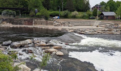
This section of the Flat is probably less popular than the lower, which goes to Lake Michie but it is decent and on par with other similarly rated rivers around. However, unlike the section further downstream, there is no permit required for parking if you take out earlier than the suggested one. There is some limited parking on Red Mountain Rd. Another option that gets the best stuff and shortens the trip a bit is to park on the shoulder of Moore's Mill Rd, but make sure you stay on the Durham County side before the No Parking Signs start at the line for Person County. This avoids two miles of flat water for this section and the parking fee at State Forest Rd, which is either $60/year or $13/day for a day pass, which can be purchased here if preferred.
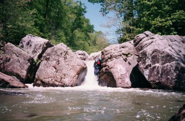
At 3.35 miles from the South Flat put in, there is Moore's Mill busted dam. It can be run at low water and is probably worth portaging at higher levels. Scouting is recommended regardless, getting out well ahead of the drop since current is strong at higher levels. After the dam, there are two ledges before Moore's Mill Rd and one similar and slightly tricky ledge immediately after the bridge. I would love to know the names of these if they ever had them if anyone knows. ZCS
Rapids in this Run (2)
Hazards & Portages (1)
Caution: The following locations may require scouting or portaging. Always check current conditions.
Difficulty
Class I-III
Length
8.4 mi
Rapids
2
1 Portage
Access Points
Difficulty Classes
I Easy
II Novice
III Intermediate
IV Advanced
V Expert/Extreme
VI Unrunnable
Current Conditions
5-Day Forecast
Whitewater data from
American Whitewater
American Whitewater