13. Grand Junction Town
Gauge Conditions
Runnable: 1,000.0 – 20,000.0 CFS
Data from American Whitewater & USGS
Run Map
Description
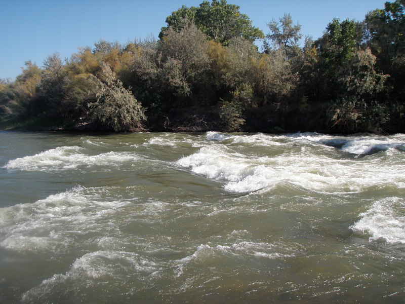
The Colorado River through Grand Junction is mostly flat. There is is a significant rapid with waves just upstream of the 29 Road bridge.
Put in: RiverBend Park in Palisade is just downstream of some diversion structures across the river. Elevation is 4688 feet. There are other put in options at several public parks along the river.
Take out: I-70 just west of Fruita, take exit 15 to Road 139 south. Turn left on Kokopelli Trail and follow it around towards the river. The road turns to gravel about 300 or 400 yards before reaching the river. Just past a dirt parking area, turn left down to a primitive boat ramp.
There are a number of public parks and access points along the river, allowing a variety of shorter trips.
Playspots (1)
Difficulty
Class I
Length
31.6 mi
Gradient
8 ft/mi
Rapids
0
Access Points
Difficulty Classes
I Easy
II Novice
III Intermediate
IV Advanced
V Expert/Extreme
VI Unrunnable
Current Conditions
5-Day Forecast
Whitewater data from
American Whitewater
American Whitewater