15. New River Dries: Hawks Nest Dam to Gauley Bridge
Gauge Conditions
Runnable: 10,500.0 – 40,000.0 CFS
The Hawks Nest Project typically diverts 10,000 cfs, so 10,500 on this gage is around 500 in the Dries. There is a 4 hour travel time from this gage to the Dri
Runnable: 4.8 – 18.0 FT
Data from American Whitewater & USGS
Run Map
Run Time Estimate
Select put-in and take-out to estimate time.
Plan This Trip
See wind-adjusted speed maps, forecast planning, and detailed time estimates.
Sign in to generate an AI timing estimate for this run.
Whitewater timing varies with scouting, portages, and group pace. Use as a planning baseline.
Description
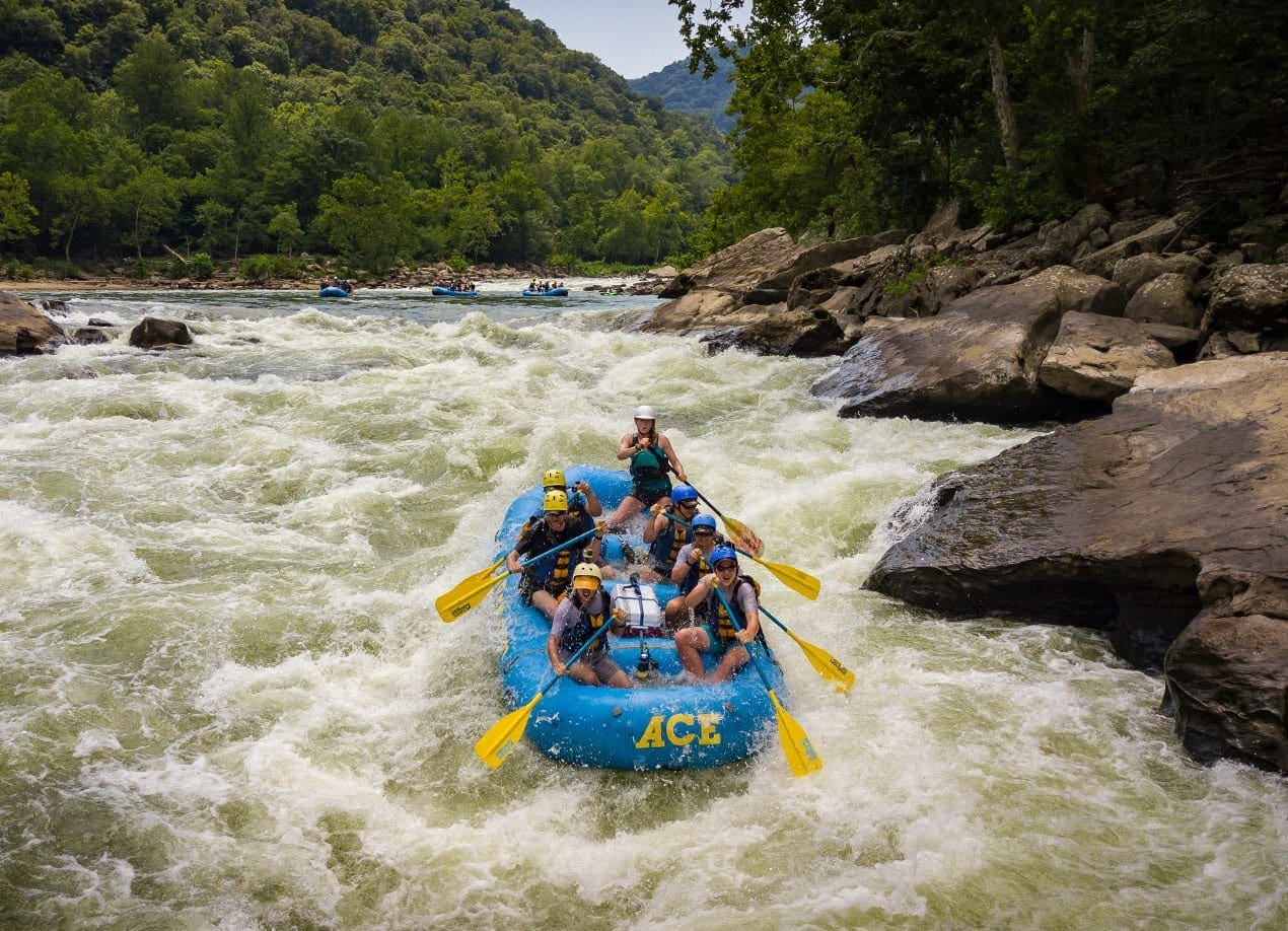
The New River Dries is renown for its world class wave surfing when high inflows overwhelm Hawks Nest Dam and water spills into the Dries. American Whitewater negotiated seven summer releases were initiated in 2019 at the natural base flow of 2,200 to 2,500 cfs. At these flows the river is technical Class III+ with some largely out-of-play undercuts to avoid. At all flows the river offers paddlers some good surfing, fun moves, gorgeous scenery, and an easy quick shuttle. At summer release levels expect a river more like the Lower Yough than the Upper Gauley, and at high flows expect the opposite.
American Whitewater negotiated scheduled releases on the New River Dries, two in March and 7 in late June through August, and the relatively low flow of 2200-2500 cfs. These releases will not occur if flows are above or below certain flow thresholds. Releases will be provided if inflows to the dam are between 3,800cfs and 12,500cfs. At flows under 3,800 there is insufficient flow to provide releases, and above 12,500 the dam is spilling and releases are moot. The USGS gage at Thurmond is the best predictor, but more information on releases is available at
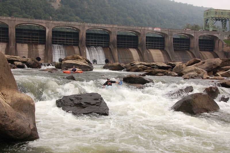
At release levels you can expect technical moves, and many choices of different slots, generally with lots of eddies and time to make your moves. Note that some slots appear obviously sieved and some rocks are obviously undercut, though there are clear routes through each rapid. If you hike up and put in at the dam you'll get a nice challenging rapid immediately below the dam, a small ledge drop, and some good surfing before arriving at Cotton Hill Bridge. Immediately below the bridge is a fun rapid ending in a good surf wave that has tricky but doable eddy access. Some easy rapids lead a convoluted section of tightly-spaced boulder strewn rapids that at high flows is one rapid called Mile-Long, then a break in the action, then another series of technical rapids including Landslide before reaching the powerhouse and the reservoir.
At high flows the Dries is a surfers paradise although at high water levels you will have to catch some of the waves on the fly. About 2/3 of the way down the river you will find a long class III+ rapid that ends in a big pool. At the bottom of the pool are several huge boulders. This is Landslide rapid. There are 5-6 slots between the boulders. The cleanest slots are the 2nd and 3rd from the right. The leftmost slots have a potential for pinning and should be avoided. You can check the Hawks Nest gage for realtime flow in the Dries, and use the photos of the conversion tables to calculate instream flow. Alternately you can look at the Thurmond gage and know that the dam diverts as much water as possible up to 10,000 cfs and any additional flows spill into the Dries.
Putin: Park at the Cotton Hill bridge on Rt. 16, and either hike up to the base of the dam on Hawksnest Trail #3, or put in near Cotton Hill Bridge (Hawksnest Trail #1). Both trails are accessed by hiking up the gravel road that goes upstream from Cotton Hill (on river left). An additional put in has been built downstream of Cotton Hill Bridge that will open in the fall of 2021 or early 2022. This site is your best bet if you are rafting since a trail hike-in is not required, but you'll miss a couple rapids.
Takeout: Brookfield built a new public takeout at the upstream end of the campground on the reservoir just upstream of the town of Gauley Bridge. There are other spots to park along Rts. 16 & 60 above Gauley Bridge, including by the bigs rocks just below the railroad bridge and a bit upstream and across the road by a nice waterfall if you are willing to hike your kayak up to the road.
Rapids in this Run (6)
Difficulty
Class III-IV
Length
6.0 mi
Gradient
18 ft/mi
Rapids
6
Access Points
Difficulty Classes
I Easy
II Novice
III Intermediate
IV Advanced
V Expert/Extreme
VI Unrunnable
Current Conditions
5-Day Forecast
Whitewater data from
American Whitewater
American Whitewater