16. Cisco (Rose Ranch) to Moab
Gauge Conditions
Runnable: 2,000.0 – 15,000.0 CFS
Data from American Whitewater & USGS
Run Map
Run Time Estimate
Select put-in and take-out to estimate time.
Plan This Trip
See wind-adjusted speed maps, forecast planning, and detailed time estimates.
Sign in to generate an AI timing estimate for this run.
Whitewater timing varies with scouting, portages, and group pace. Use as a planning baseline.
Description
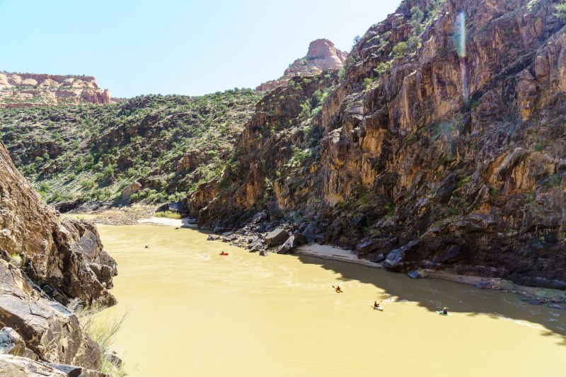
Colorado River through the Professor Valley can begin at the take-out for the popular Westwater Canyon run. The first 24 miles to Hittle Bottom are a mellow Class I float. Some come specifically for this sections while many bypass it by putting in at Hittle Bottom or Dewey Bridge at the Dolores confluence. For those who paddle this first section the absense of others and the presence of wildlife is notable from upstream or downstream.
While there's not any real action, a few whitewater rapids (class II/III), do break up the scenic float once you enter the Professor Valley past Hittle Bottom.
This 18 mile stretch in the middle of the run makes a good overnight trip.
It IS popular so don't expect to have the river to yourself and camping is restricted to designated sites with roadside ranger enforcement.
Boaters can continue their trip downstream to Cataract Canyon (Permit required past the Green River confluence) or take advantage of boating opportunities on the upstream sections of the Colorado or Dolores which come together just downstream of the Rose Ranch put-in:
- 07) Colorado River, Loma (CO) to Westwater, Horsethief and Ruby Canyon, 27 miles, I-II
- 08) Colorado River, Westwater to Cisco (Rose Ranch), Westwater Canyon, 17 miles, I-IV
- 1) Dolores River, Bradfield Launch to Dove Creek Pump Station, 19 miles, II-III
- 2) Dolores River, Dove Creek Pump Station to Slickrock, 28 miles, II-III+(IV)
- 3) Dolores River, Slickrock to Bedrock, 50 miles, II+(III)
- 4) Dolores River, Bedrock to Gateway, 44 miles, II+
- 5) Dolores River, Gateway to Colorado River below Rose Ranch, 30 miles, II+(IV)
Other Reaches of the Colorado River:
01\. Hot Sulphur Springs to Hwy 40 bridge (Byers Canyon) (CO, IV)
02\. Gore Canyon (CO, IV-V)
03\. Pumphouse campground to Rancho Del Rio (Pumphouse) (CO, III)
04\. Hanging Lake Exit 125 (I-70) to Shoshone Power Plant Exit 123 (I-70) (Barrel Springs) (CO, IV-V \[V+\])
05\. Shoshone Power Plant, Exit 123 (I-70) to Grizzly Creek, Exit 121 (I-70) (Shoshone) (CO, III-IV)
06\. Cameo Dam (Big Sur / Lucky 7) (CO, III)
07\. Loma to Westwater (Ruby / Horsethief Canyons) (CO-UT, II)
08\. Westwater to Rose Ranch (Westwater Canyon) (UT, I-IV)
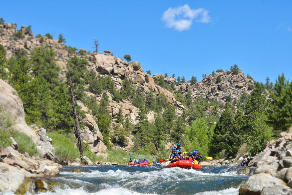
09\. Cisco (Rose Ranch) to Moab (Professor Valley) (UT, I-III)
10\. Moab to Powell Reservoir (Cataract Canyon) (UT, I-IV)
11\. Lees Ferry to Lake Mead (Grand Canyon) (AZ, I-V)
12\. Black Canyon (AZ-NV, I)

Difficulty
Class I-III
Length
46.7 mi
Gradient
5 ft/mi
Rapids
5
Access Points
Shuttle Info
To reach the **put-in:** take one of the Cisco exits off I-70 and continue towards Cisco. Take the dirt road heading southeast out of Cisco and continue on towards the river. Take the left fork to reach the access ramp at Rose Ranch (easy put-in for rafts).
To reach the **take-out:** head back to Cisco, turn left, and then take a second left on Highway 128 which parrallels the run through the Professor Valley and goes all the way to Moab. The road makes for an easy shuttle and the lower reaches are a popular day trip for folks in Moab.
Alternate river access:
_Dewey Bridge_ (river left) and Hittle Bottom (with ramp, restrooms, and camping) which puts you just above the rapids on this section.
_Big Bend_ (about 6 miles upstream of Moab) is a take-out just below the last rapids of the Professor Valley Run.
Difficulty Classes
I Easy
II Novice
III Intermediate
IV Advanced
V Expert/Extreme
VI Unrunnable
Current Conditions
5-Day Forecast
Whitewater data from
American Whitewater
American Whitewater