2) Bear Creek Confluence to Rumsey
Gauge Conditions
Runnable: ? – ? CFS
Approximate reading: This gauge is 12.5 miles away on Cache Creek. Use as a general reference only.
Data from American Whitewater & USGS
CDEC Flow Data California
Data from California Data Exchange Center (CDEC)
Run Map
Run Time Estimate
Select put-in and take-out to estimate time.
Plan This Trip
See wind-adjusted speed maps, forecast planning, and detailed time estimates.
Sign in to generate an AI timing estimate for this run.
Whitewater timing varies with scouting, portages, and group pace. Use as a planning baseline.
Description
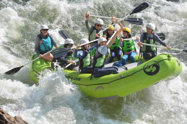
This is the standard Cache Creek run. On any given summer weekend thousands of people float this stretch in inner tubes or 'Kamakazee Rafts' (So called because they are manned by people with little or no training who seem bent on running over YOU.)
During the spring or on weekdays, this is a very pleasant run. The crowds are pretty much absent and the water is still playful.
The big advantage of this run is that it often has water when almost nothing else does. The water is released to meet the needs of farmers in the Sacramento River Delta. You can expect reliable flows during much of the late spring and into August and usually September.
The water can come from two places. The North Fork water flows out of Indian Valley Reservoir (see the description of the 'Wilderness' run) and is clear and cold while the water from 'Clear' Lake is warm, cloudy, and often, smelly. Generally, the water is a mix of the two and the water quality is acceptable.
There are several possible put-ins and take-outs. All of the land bordering the first 6 miles of this run is open to the public. The most common run puts in at the 'Bear Creek Confluence' (a.k.a. The 'Rusty Truck') and takes out at 'Camp Haswell' (a.k.a. The 'Boy Scout Camp') - This puts you in above the first and takes you out below the second class III rapid. You can also take out below Camp Haswell at a bridge in Rumsey.
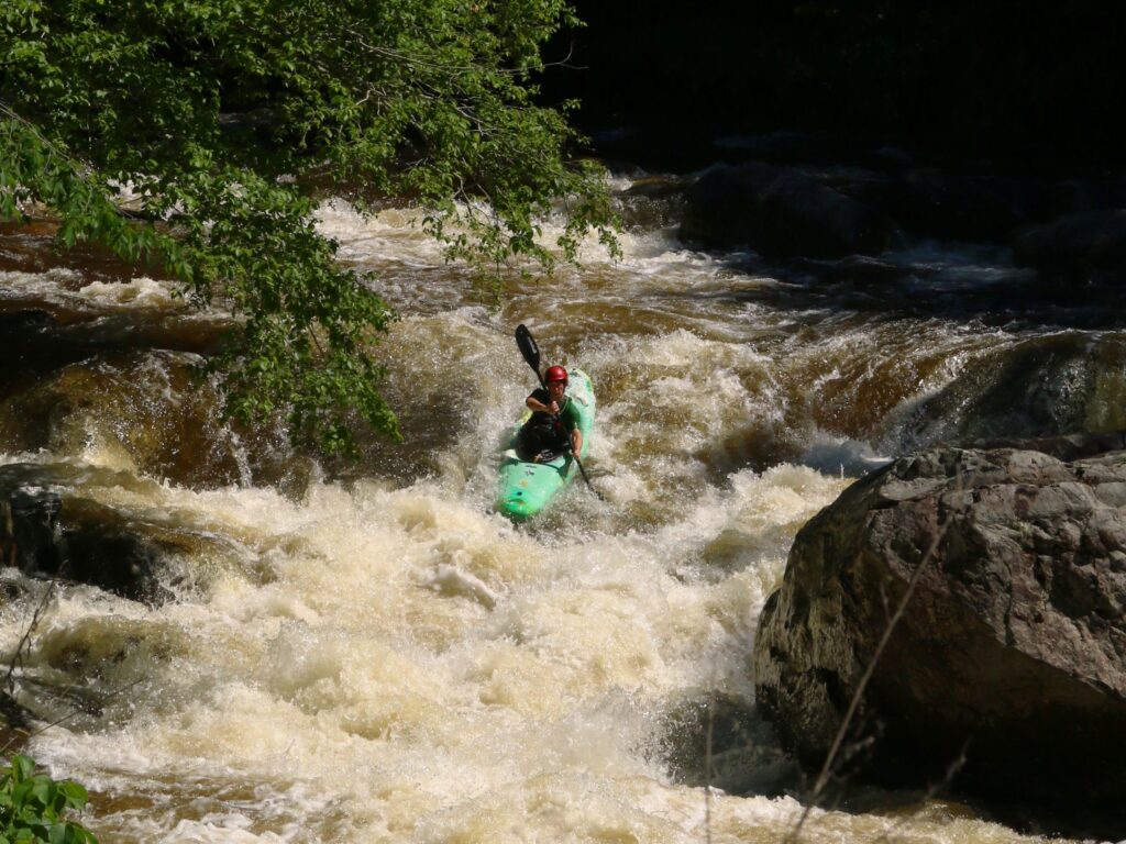
While this run has many fun rapids, only two are Class III. The first is called 'County Line' as it straddles the line between Colusa and Yolo Counties. It is the second rapid below the put in. It involves a sharp drop through a hole and a left facing 90 degree turn. Fun stuff.
The second Class III drop is called 'Rowboat Rapid' although the local outfitters call it 'Mother.' It was named 'Rowboat' because a boat was lodged in it for years that had been carried down from Clear Lake. The boat finally disappeared for good about 7 - 10 years ago. This is the rapid below the Highway 16 bridge at close to mile 5. This is a fun and steep multi-part drop. Most scout it on the left by pulling out under the bridge.
There are also numerous II and II+ rapids along this whole stretch. Camp Rapid (Just below the public campground - Mile 1.5 or so), Taft's Tumble (Just above the 'Low Water Bridge' - Mile 2.5), the unnamed rapid just below the new County Road 40 bridge (About mile 3), and Rock Garden (In left-hand channel just below Camp Haswell - Mile 5.8) all are II+ rapids and often cause beginners trouble.
There are play spots all along this route. A particularly good 'Park-and-Play' spot is right below the public campground. There are two consecutive holes where people with short boats can show-off.
Other information sources:
- California Creeks
- BRT Insights: Cache Creek guide
- Yolo County Flood Control and Water Conservation District
- _Cache Creek_ Natural Area, Ukiah Field Office, BLM
- _Cache Creek_ Conservancy
Rapids in this Run (2)
Difficulty
Class III
Length
8.4 mi
Gradient
25 ft/mi
Rapids
2
Access Points
Difficulty Classes
I Easy
II Novice
III Intermediate
IV Advanced
V Expert/Extreme
VI Unrunnable
Current Conditions
5-Day Forecast
Whitewater data from
American Whitewater
American Whitewater