2. Blackberry Mountain Road to DNR Take-out on Cartecay River
Gauge Conditions
Runnable: 1.7 – 8.0 FT
After a couple of floods the guage has changed and the concensus from several local paddlers is that 1.7 foot is the new low for Clear Creek.
Data from American Whitewater & USGS
Run Map
Run Time Estimate
Select put-in and take-out to estimate time.
Plan This Trip
See wind-adjusted speed maps, forecast planning, and detailed time estimates.
Sign in to generate an AI timing estimate for this run.
Whitewater timing varies with scouting, portages, and group pace. Use as a planning baseline.
Description
So your friends are running the Cartecay AGAIN for the 100th time this weekend and it just rained. The idea seems horribly boring so you are thinking there must be something else you can do.
There is an alternative, Clear Creek. Clear Creek is the small stream that confluences with the Cartecay at the base of Clear Creek Falls. Perhaps you have looked up it wondering what could be found upstream in that flood scoured riverbed.
Clear Creek was once fairly congested with trees, but the massive and I mean massive 2004 floods following the hurricanes gouged the creek bed free of almost all strainers and debris.
There is no direct gauge for Clear Creek. The nearest stream Fausset Creek is a good indicator. A quarter inch of rain is good enough to make it run since the watershed has been badly damaged by the floods. The creek is as a result rather flashy and drops quickly.
To reach the put in turn right onto Lower Cartecay Rd. after leaving the ÂRiver Right put in from the Cartecay and drive about 200 yards. Take a right on Old Clear Creek Rd. Drive till you see Parker Dr. on your left. Go right here and almost immediately turn right again on Blackberry Mnt. Rd. Basically Stay on Blackberry Mountain Rd. as it twists and turns around along the ridgelines. You will eventually drop down into a river valley with a small bridge this is the put in. If it looks good then you have enough water. The takeout is at the Cartecay DNR takeout. Just go back to Lower Cartecay Rd and go left. Drive till the Rd. ends at Hwy 52. Take a left and drive till you see the DNR sign at the dump and go left again. Drive around the dump and down to the Cartecay river takeout. (THIS IS NOT THE BLACKBERRY TAKEOUT). The shuttle takes about 20 minutes.
Clear Creek could be a great beginner creeking trip. The only downsides are the unreliable water and possibly less an optimum water quality. The creek does drain some farmlands so expect the runoff to have some input from cattle.
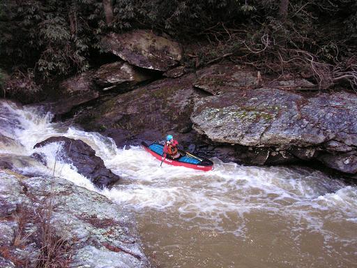
Clear Creek starts off as a fairly easy Class I stream with some small shoals and occasionally overhanging trees. The floods of 2004 removed almost all strainers but some trees will require ducking under them. High water could require some short portages.
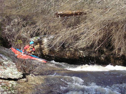
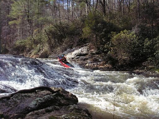
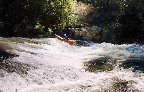
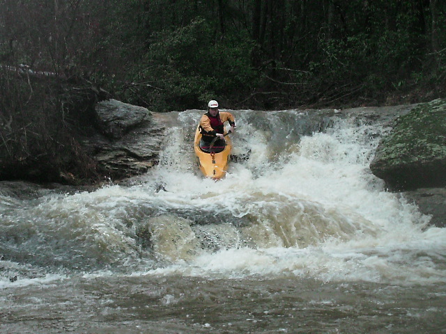
After about 10 minutes of floating, most boaters will notice the change in stream morphology and the massive rock island and outcrops blocking downstream view. This is the approach to Timber Falls. The medium to low water line is on river right. The drop is a double drop rapid with an undercut left wall. The high-water line is on river left over a single drop.
Almost immediately downstream with river makes a 180 degree turn around a rock outcrop and drops over a ledge into a tight flume. Stay left on the ledge to avoid the pinning rock in this drop.
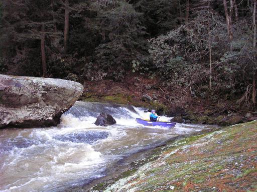
Clear Creek then pools up above Headless Horseman, the hardest drop. This drop is a single rocky ledge into a narrow flume. The river is undercut on the left and will smack you in the face if the water level is high and you miss the line. There are some shallow rocks on the approach that can nock boats around.
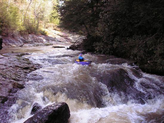
After Headless Horseman the river calms down till you reach the final sliding drop. Both the center and left side of this rapid are good to go. Approximately 100 yards below Finale, Clear Creek confluences with the Cartecay River at the base of Clear Creek Falls.
Rapids in this Run (6)
Waterfalls (1)
Difficulty
Class I-III+(IV)
Length
4.0 mi
Gradient
60 ft/mi
Rapids
6
Access Points
Difficulty Classes
I Easy
II Novice
III Intermediate
IV Advanced
V Expert/Extreme
VI Unrunnable
Current Conditions
5-Day Forecast
Whitewater data from
American Whitewater
American Whitewater