2. Camp Four to Five Mile Bridge (The Middle)
Gauge Conditions
Runnable: 800.0 – 2,000.0 CFS
The maximum used to be listed as 1200, but that was for a different gauge estimate. This is still class III at 2000 cfs.
Data from American Whitewater & USGS
Run Map
Description
This run flows through pine forests in the Chewuch Valley, with only a few distractions of civilization that are mostly near the end. You will find plenty of camping at one of three Forest Service Campgrounds or at any of the dozens of dispersed camping areas along the river. Expect a lot of campers along the river Memorial Day weekend, when flows are typically ideal.
Most of the run is swift-moving class I-II with some braided channels but there are three good class III rapids at the start, middle, and end of the run. Don't come looking for continuous whitewater but if you enjoy a nice float with some good picnic spots along the way, this is a beautiful river. With some effort, the class III rapids can be scouted on the shuttle, but confident intermediate paddlers will be able to boat scout them.
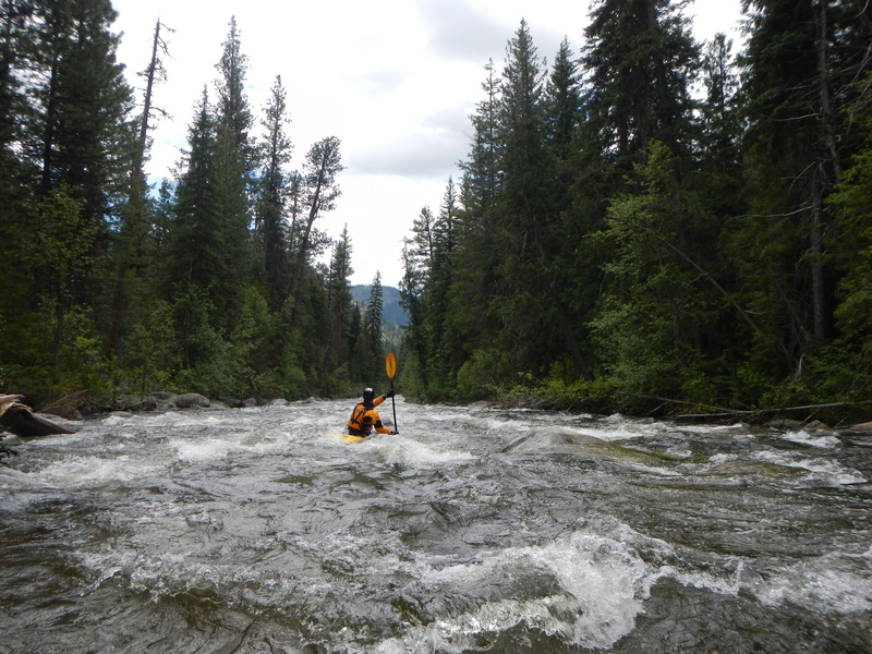
After a mile of intermittent class II, you will reach the first class III rapid, Twentymile Creek Rapid, which is a narrow, straight boulder garden. You will catch a glimpse of this rapid on the shuttle between Chewuch and Camp 4 Campgrounds. Although trees partially obstruct the view, the river runs along the road.
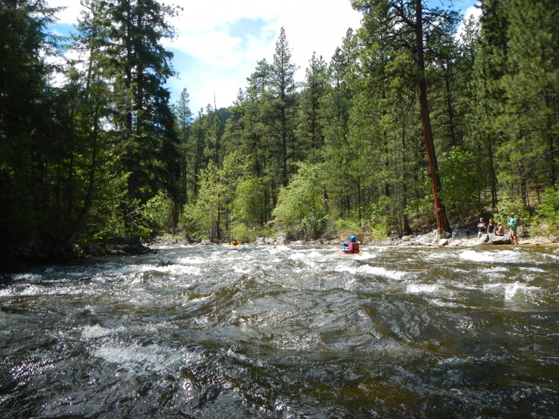
The next class III- is Fall Creek Rapid at Fall Creek Campground, which is about 6 miles into the run. Look for the campground fences on the right. The rapid starts around a blind curve, but it is easier than it looks from the scout.
After this rapid, the paces again slows down to a nice float. Continue to stay alert for wood hazards. Some private lands start to line the river bank and you will begin to encounter riverside cabins.
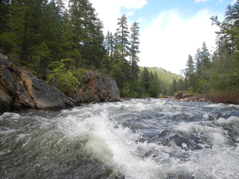
The final class III+ rapid, Boulder Creek Rapid, comes just below some old bridge abutments. This rapid is a continuous boulder garden rapid that is nearly a mile long with an irrigation dam near the end. At lower flows the rapid is more of a sequence of rapids with short recovery pools in between but at higher flows it is more continuous. Confident class III paddlers should not have a problem boat scouting but you can check it out on the shuttle or you can easily take out above it--at the river right bridge abutment. Stay right as you approach the Chewuch Diversion Dam and run the narrow fish passage channel on river right to avoid going over the main drop of the dam. In 2008 the dam was modified to provide fish passage and enhance boater safety. The main drop of the dam is now a grouted rock ramp which prevents the formation of a recirculating hole that used to be an extreme hazard at this site. The irrigation gate and structure associated with it make it easy to spot from above. You will also be able to see it by looking upstream from the take-out bridge.
Logistics: On the west side of Winthrop at Highway 20 mile 192.6, turn north on West Chewuch Road (next to the town ball field and across from the Red Barn). Continue on this road for 6.8 miles and turn right to the bridge that crosses the Chewuch River. The standard take-out is here within the bridge right-of-way.
To reach the put-in continue upstream along river right on West Chewuch Road. In 0.6 mile you will reach the Okanogan National Forest Boundary and it becomes Forest Road 51 (the boundary sign is mile 0 on FR 51).
At mile 0.3 on FR 51 you will see the turn for 5100-015 spur that heads down to the river at an old bridge crossing. This is a dispersed campsite but it is also a possible take-out if you do not want to run the last, and most challenging, class III+ rapid.
You will pass other campgrounds along the way including Falls Creek Campground (FR 51 mile 4.6), Chewuch Campground (FR 51 mile 7.8), and Camp 4 Campground (FR mile 10.5).
At mile 10.6 on FR 51 (just past Camp 4 Campground) you will reach FR 5010. Turn onto this road which immediately crosses the river. There is a good put-in access on the upstream river right side of the bridge.
Rapids in this Run (3)
Hazards & Portages (1)
Caution: The following locations may require scouting or portaging. Always check current conditions.

Difficulty
Class II-III
Length
13.0 mi
Gradient
32 ft/mi
Rapids
3
1 Hazard
Access Points
Difficulty Classes
I Easy
II Novice
III Intermediate
IV Advanced
V Expert/Extreme
VI Unrunnable
Current Conditions
5-Day Forecast
Whitewater data from
American Whitewater
American Whitewater