2. Chilkoot Campground to Bass Lake
Gauge Conditions
Runnable: ? – ? CFS
Approximate reading: This gauge is 5.4 miles away on Willow Creek. Use as a general reference only.
Data from American Whitewater & USGS
Run Map
Interactive run map
Loads as you approach this section.
Run Time Estimate
Select put-in and take-out to estimate time.
Plan This Trip
See wind-adjusted speed maps, forecast planning, and detailed time estimates.
Sign in to generate an AI timing estimate for this run.
Whitewater timing varies with scouting, portages, and group pace. Use as a planning baseline.
Description
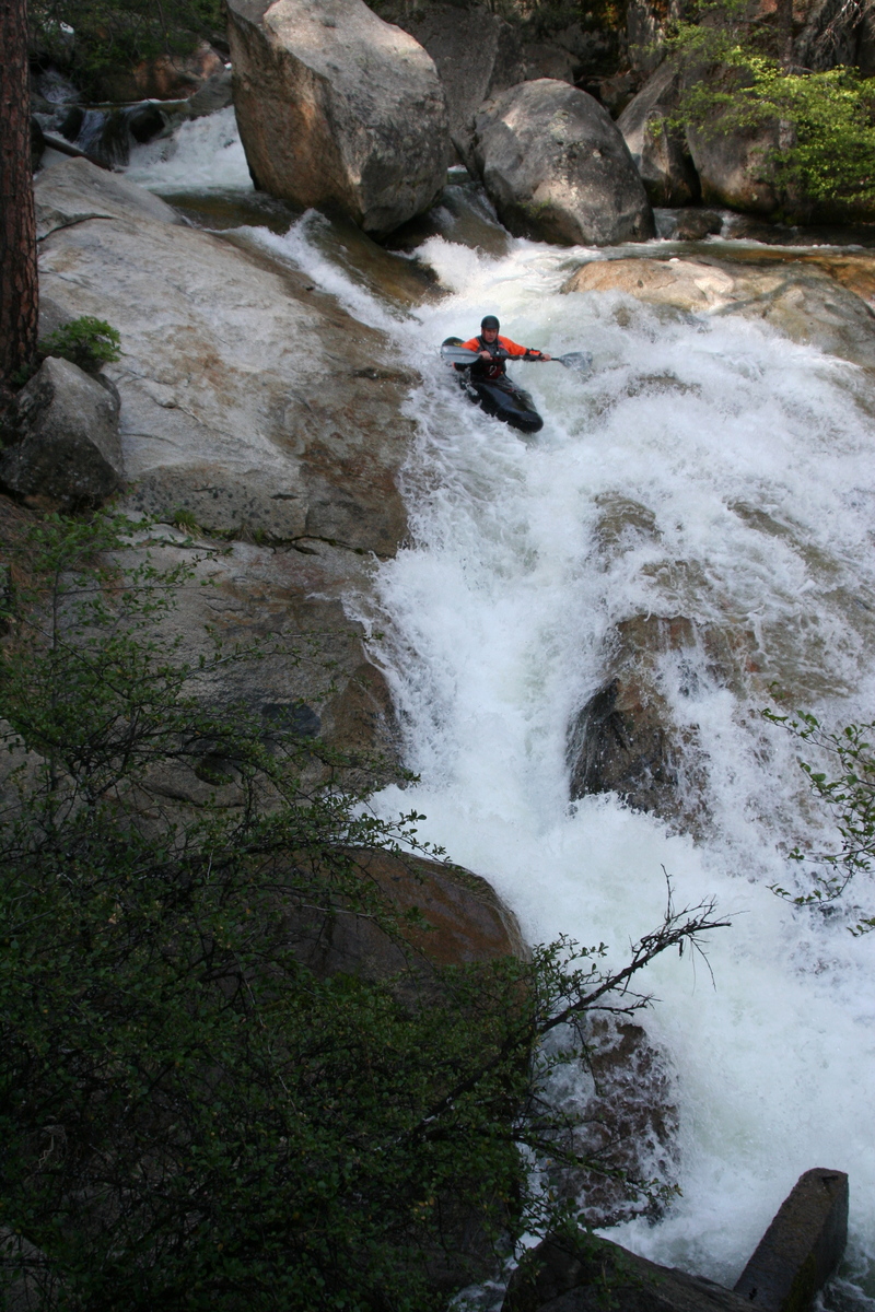
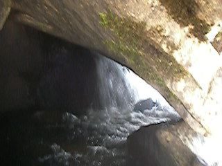
This lower run is better than the upper section because it has a lot less junk, has more big drops and has many bigger drops. The run starts off with a 7' waterfall into a small pool.

Chilkoot Falls
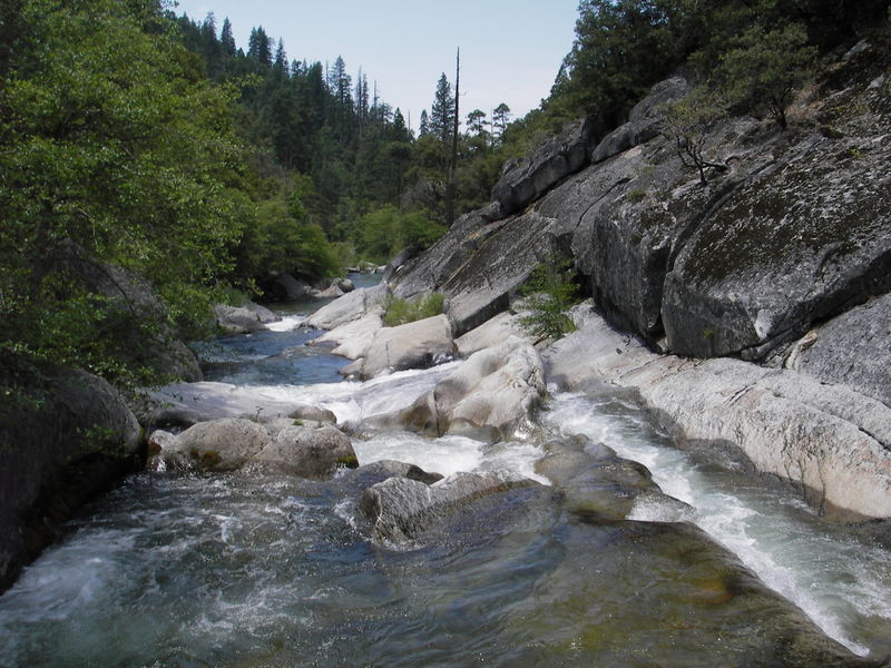
From there, the river is tight and technical rock bashing. One must negociate dozens of rocky rapids that often have wood in them. Most of the drops are read and run, and generally the cleanest line is where the most water is flowing. After a mile or so you will see granite on the right bank, you will want to boat scout here, for this is the first large drop.

Cave Man

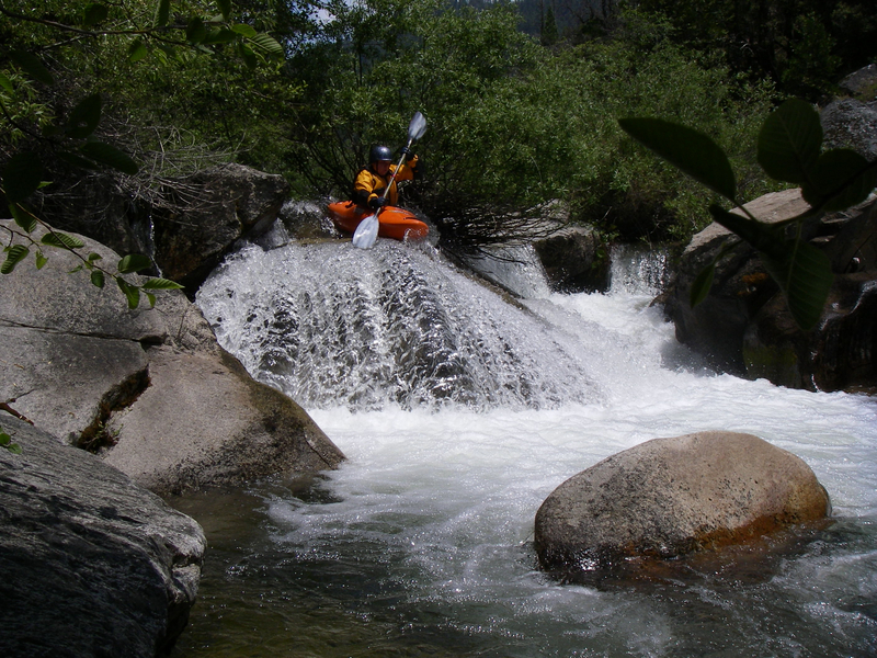
After the aforementioned drop, the run opens up into small slides and boofs.

Dead End Slide
After a few fun rapids, you will see a bus size rock on river left. This rock is the midway point of the run. Following the rock, the creek flattens out and the scenery is quite pretty. In 2008, there was one log portage and several log limbos, before the creek opened into the gorge section.

Halfway point
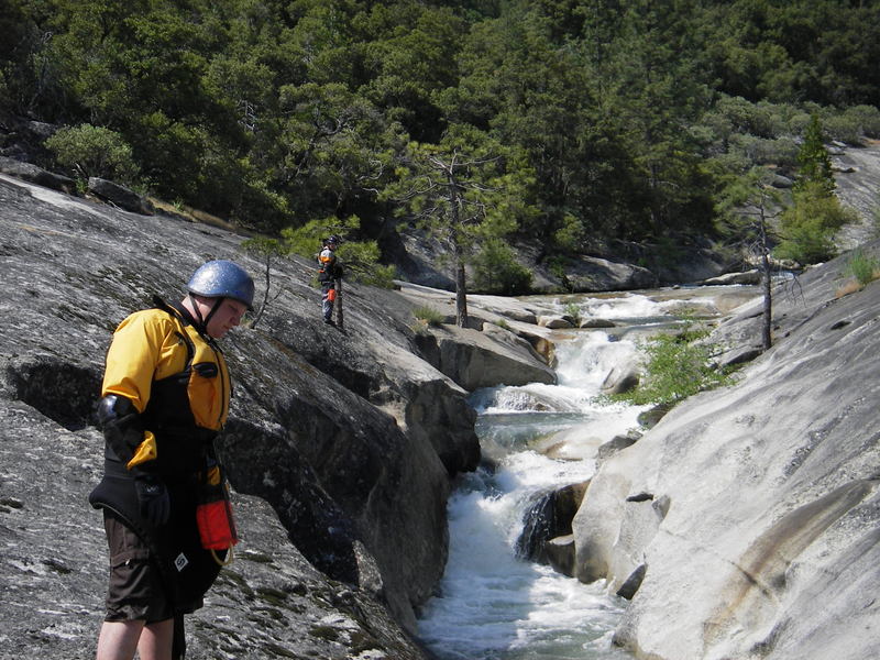
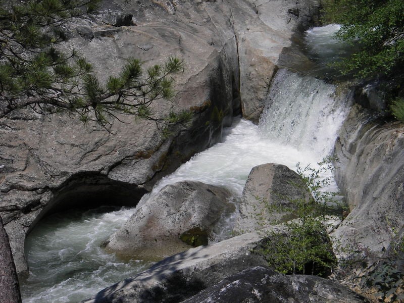
The Gorge section consists of several slides and small drops. The entire gorge can be scouted on river right. None of the drops are bigger then 5-7' but the entire section is boxed-in, so swimming would be bad and rescue would be tricky. Below the last drop of the Gorge, the current dies down and you can slowly paddle into the last eddy. This is a no-stress move, but don't miss the eddy. The drop that follows is big and can be scouted on the left or the right.

The Willow Gorge
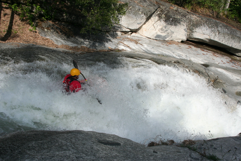
The following drop has been dubbed Mike's Drop. Partly because a Mike got the first D, and another Mike sprained his ankle in the pot hole. If you run it on the right, you will slide 20-30+ feet and land in a large pot hole. Then you come rushing out of the pot hole, hitting a rooster tail, and slide into a small pool. The rock wall on the bottom right looks sketchy but generally is not in play. Other lines can be run on Mike's drop, but they are much more dangerous.

Broken Ankles
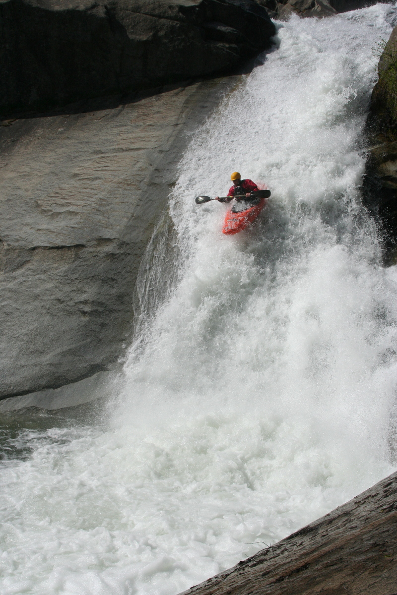
After Mike's drop there are 3-4 long slides that can be boat scouted. Once you hit the bottom slide, you will see a large rock in the middle of the creek. Beyond this rock is the horizon line of Devil's Slide. Devil's is the largest drop on the run, and consists of five distinct drops. It's hard to estimate the gradient of Devil’s slide, but over one hundred feet would not be an exaggeration. If you are not up to run the entire section, you can hike down on river left and seal launch into the last slide.

Devil's Slide
After Devil's Slide, there are a couple more read and run slides and then the creek flattens out again. Keep paddling until you come upon another granite gorge. This gorge is a Mandatory portage. If you've come this far, this gorge will look fairly easy, however what you can't see is that much of the creek flows under a boulder in the last drop. One boater got sucked into this sieve and was barely able to crawl out of his boat before his boat was completely sucked under the rock. It took multiple attempts, over several days,to retrieve the boat. The retrieval required two come-a-longs, and several broken ropes. The boat was folded and had a crack along the stern. Please walk this one.
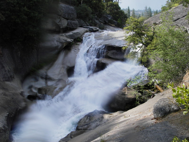
A little ways after the portaged gorge, you will see Angel's Falls. This is a large slide into a pool. The slide is straight forward, just be sure to avoid the piton rock on the left. The landing zone is a small pool above an unrunnable rapid. Be sure to set safety, so that no boater gets washed into rapid that follows the slide.

Angel's Falls
There are several drops below Angel's Falls. Some runnable, some not so much. From Angel's Slide, there is a trial on river right that will take you back to your car, if you choose to portage the remaining drops.

Bleeding Pit Of Death

Happy Endings
A trail follows this creek for the lower half of the section on the river left, though it is often high on the hill. Logs and log jams can be a problem anywhere in the run, so always be on the lookout.
Take-out: Take highway 41 to the Oakhurst area and to the Bass Lake road. Go to Bass Lake and veer left to the east side of the lake. The highway crosses the creek within a mile or two. There is parking on the river right side near the bridge. There is also a lower road that gives access to the lake if you run the final waterfalls into the lake. Trails lead upstream on both sides of the creek. The river left trail is shown on maps, but the river right trail is more direct and has easier access to the Devil's Slide pools. Above the Devil's Slides there is a log crossing connecting the two trails. The river left side trail continues upstream.
Put-in: Continue on the highway past the creek to Beasore Rd. Take Beasore to Chilkoot campground and hike the short ways down to the creek.

Google earth has fairly high resolution images of this area, so one can distinguish many of the bedrock sections. One can also see potential access points, but it is difficult to see where Chilkoot campground is.
Here is a video rundown of Lower Willow Creek. The flow was between 48-55 cfs. The video starts at the top of the run and sequentially takes you down the rapids.
More footage can be found here.

Other Information Sources:
Land Stewardship Council - PG&E lands proposals
Rapids in this Run (5)
Waterfalls (5)


Hazards & Portages (2)
Caution: The following locations may require scouting or portaging. Always check current conditions.
Difficulty
Class V
Length
3.6 mi
Gradient
300 ft/mi
Rapids
5
2 Hazards
Access Points
Difficulty Classes
I Easy
II Novice
III Intermediate
IV Advanced
V Expert/Extreme
VI Unrunnable
Current Conditions
5-Day Forecast
Whitewater data from
American Whitewater
American Whitewater