2. Daniels Dam through Elkridge
Gauge Conditions
Data from American Whitewater & USGS
Run Map
Run Time Estimate
Select put-in and take-out to estimate time.
Plan This Trip
See wind-adjusted speed maps, forecast planning, and detailed time estimates.
Sign in to generate an AI timing estimate for this run.
Whitewater timing varies with scouting, portages, and group pace. Use as a planning baseline.
Description
This long reach can be broken up into much shorter runs, and it usually is. The Old Frederick Road Bridge to Ellicott City run, for instance, is only about 4.0 miles. See below for a description of these access points, and click on the Map tab to see them.
Time: varies with water level. As little as 1.5 hrs to Ellicott City, and another 1.7 hrs to Avalon/Glen Artney after very heavy rain with no play, or around 3 hours to Ellicott City and another 3 hours to Avalon/Glen Artney at a mild pace under average conditions.
Difficulty: I-III at up to about 3' (828cfs) on the Hollofield gauge, with some areas drifting into III+s above 4-5'+ (1880+cfs) range.
Fun Factor 6.5 out of 10. (High water can add 2 or more to this total)
Water Quality: Mostly good, with some suspicious-looking hues of brown during a heavy runoff. Tends to be warm after rain due to the vast amounts of warmed impermeable surfaces in the watershed.
History: Amazingly, this river was once a route for barrels of tobacco to get from Catonsville to the even more amazingly once-navigable tidal waters at the Route 1 bridge in Elkridge. Visit this portion some time and try to imagine a sailboat coming upstream at you. It ain't easy.
The Patapsco river is a convenient local conundrum to the paddlers of Baltimore in that it features too much whitewater for recreational boaters, and too much flatwater for some whitewater boaters. If you have the gumption in the first case, the patience in the second, or you like to experience a multitude of conditions from straight-forward rapids, to narrow chutes, to big, lake-like, half mile paddles, then this is the place for you.
It offers several shorter sections easily done by traveling paddlers or those looking for some post-work water. You can park-and-play in the flatwater at Daniels Dam; do laps of Oella/Suicide Rapids through Doughnut Bend by parking at the public parking near the Trolley Stop, putting in upstream of the Old Ellicott City bridge and taking out river left just after Ellicott's Mill; ambitious parties can easily add on Bloede Rapid to that section or complete the traditional run of the Green Bridge off of Old Frederick road (downstream of Daniels Dam) to Trolley Stop.
Put in below Daniels Dam (\[mile 0\] at the end of Daniels Rd., just off Old Frederick Rd.). To trim another couple of mostly flat miles out, begin even farther down at the Old Frederick Road bridge \[mile 1.8\], where Old Frederick Road crosses the river. You'll still have a good four miles down to Ellicott City, and more than two more should you choose to continue to Illchester. (Click on the Map tab to see the location of these access points.)
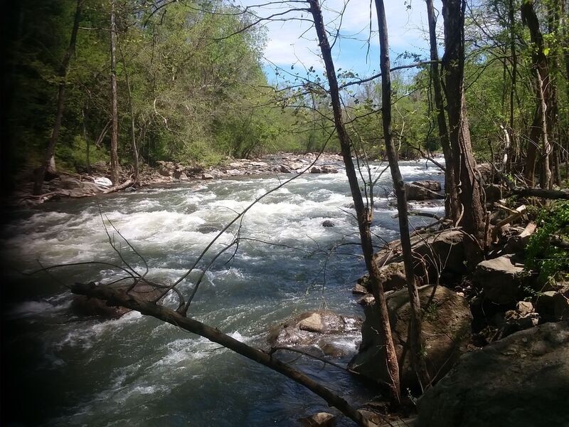
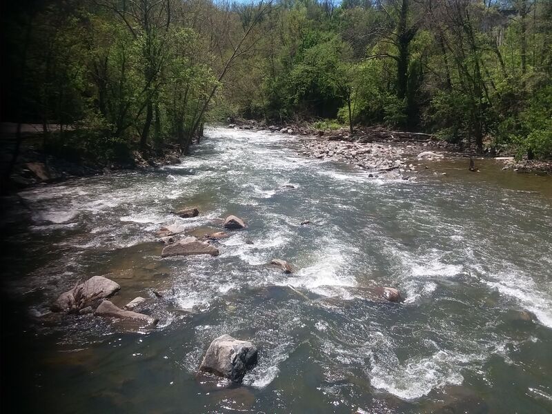
If you have difficulty getting over the sandbar just a few yards downstream, it may still be runnable for the rest of the way: this is probably the shallowest spot on the entire river. The next mile is a mostly pretty run through the deepening gorge of the state park, that features a few class 2- rapids here and there. At high water this is a nice pushy, mostly rapidless run with trees (living, not fallen) being the biggest hazards.
Just below the US 40 bridge \[mile 8.1\], there is a small increase in gradient resulting in a Class II rapid which becomes a wave train at higher water levels. This rapid is all that's left of the once deadly and now removed Union Dam. There are still some remnants of the dam on river left and the river is still adjusting from it's removal. The next mile or so features a variety of easy class 2 rapids, and a labyrinth of rock gardens that will test all of your boat control skills at lower levels. There are a few interesting ledges with very scrapy chutes, and some long pools that continue until the rocks begin turning into boulders. Soon after you can make out the old Oella mill on river left, marking the beginning of the drops through Oella.
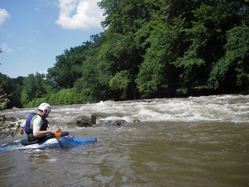
Make your way down on river right until you see the first decent rapid called 'Oella Falls' \[mile 5.2\]. It's a fairly long, bumpy (class 2+ at lower water and 3+ or above at 3.5+'\[~1,100+ cfs\]) ride, generally right to left, culminating in a steep class 3 center left. At >500cfs there is a decent surfing wave near the bottom with eddy service on the right, if you can catch it. Oella Falls ends in a nice recovery pool. After the pool at the river split (marked by a giant rock in the center/right plastered with strainers), there is a short section of class II boogy water that culminates in 'Suicide' \[mile 5.3 - Class III+\], that begins below a house sticking out of the cliff on river left. 'Suicide' proper begins with a slight right turn and takes a drop (take the drop center right; then move to center) then twists left (move to right) down into the backwater pool before Ellicott City. There are many lines here, and a decent surfing wave at the bottom of Suicide at some levels, if you can catch the river left eddy. All these rapids are easy to eddy-scout at up to about 2.8' (~680 cfs) or so. Much beyond 3' (~828 cfs), and the eddies get smaller, making them more challenging. More experienced paddlers may try to catch them and execute various lines. Others may opt for a wild III+/-IV run all the way from the river split to the bottom of Suicide. At these higher levels, there are some sneaky holes with stopping potential through here, so keep a sharp eye out at the top of every big wave. One of notable pourover is center/right about 100' below suicide. One move is to boof this pourover and catch the eddy on the right; just don't go sideways into it. Whatever your line, a long pool after Suicide takes you to the Ellicott City/MD 144 bridge \[mile 5.8\] where you can take out on river left, just before the bridge.
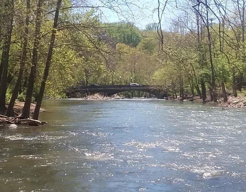
If you decide to continue, the fun begins again. A major flood occured July 31, 2016 and again May 27, 2018. The floods changed the river considerably in the 'Doughnut Bend' rapid \[mile 5.9 - Class III or Class III+ above 900 cfs\] below the 144 bridge. After the floods, the line below the bridge is to stay river left through the first part of the rapid, moving generally to the center. Beware of debris from the floods scattered throughout this rapid, particularly some metal pipe described in the rapids section. After this, there is a big, long, bouncy wave train which takes you down the left-turning bend with a couple of rocks to avoid around the corner. When you see the old flour mill train bridge, there is a nice boof opportunity at center river (>700 cfs) if you choose, but boof well because this hole can be retentive at times. Just following the bridge is a common takeout, but since this is private property, you may want to takeout just past this (0.2mi), across from High's Gas Station.
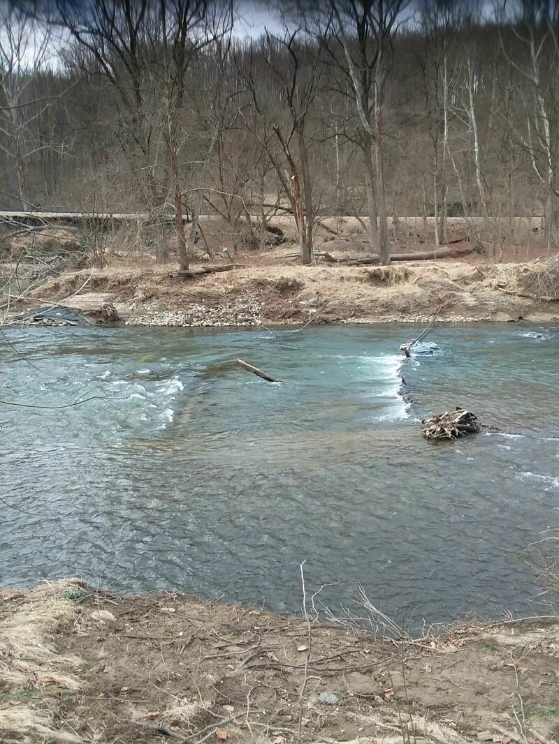
If you decide to continue paddling the two miles to Bloede rapids, your next likely takeout would be at Ilchester. The ride mostly settles with small class 2 rapids and some riffles. The river begins to cut through sand/gravel bars which were deposited in the backwater of the now removed Simkins/Thistle Dam. On the Baltimore County side, a bridge (River Road) over Thistle Creek was washed out in the May 2018 flood, which has resulted in a rocky shoal that extends into the river from river left. A rapid (hard to notice at low water; class II+ at higher water) occurs where the Dam once was located \[mile 7.7\]. Shortly below here is the Ilchester Road bridge \[mile 8.0\] which is a common put-in for the 'Bloede Rapids' section of the river.
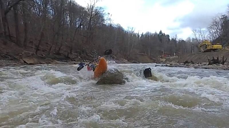
Below Ilchester Road, the river picks up gradient and begins what is now called Bloede rapid through where the now removed Bloede Dam once was located. 'Bloede' (class 3/3+ at ~1000cfs) starts with Godzilla rapid on river left under the Grist Mill walking bridge and continues 0.5 mile. After Godzilla, just as the river curves sharply left, there is a notoriously swirly eddy on the far right bank. This can be fun for skilled paddlers but beware because the slope of the walls make this a difficult section. The ride continues below thhis with romping class 3/3+ rapids that include some surfable waves and quite a few stopper holes. There are few eddies to catch on the way down. If you parked at Ilchester road and plan to walk back up, the typical takeout is a gravily beach area on river right about 0.5 miles downriver from Grist Mill walking bridge. If you decide to continue, the next takeout is the Patapsco State Park, Avalon area \[modest fee required\], where you may set shuttle at either the Avalon or Orange Grove areas.
For the class II boater that only wants to see the lower river through Patapsco State Park, enter the Avalon area of Patapsco State park \[fee required\] turn left across the bridge to the Howard County side and drive up to the Orange Grove area to put-in. Below here, there are some fun class 2+ rapids (turning into wild wave trains at higher levels).
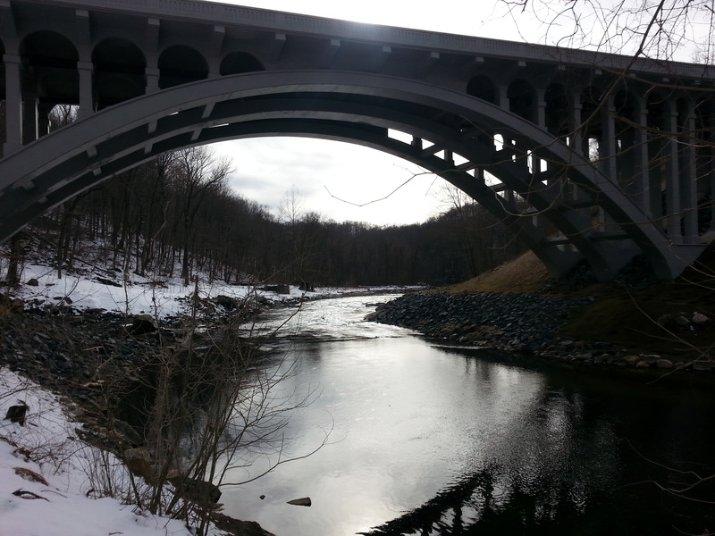
The rest of this run is a pleasant drift through Patapsco State Park, featuring lots of easy riffles, some precariously shallow gravel bars at low water, and interesting scenery, including a swinging bridge, plenty of heron, and the occasional marauding beaver in colder weather. Takeout is at the Avalon/Glen Artney area \[mile 11.2\] of the Park, marked by a brick bridge running over the water just past some ballfields and no-swimming sign on river left. If you continue on to Elkridge, you'll get to see the Thomas Viaduct \[mile 11.9\] a largely unmaintained, ancient stone train bridge (still used) that's a bit unnerving if you happen to be under it when a train comes by. The next takeout is at the Route 1 bridge on river left in Elkridge \[mile 12.5\]. If your shuttle happens to be a motorcycle, enjoy a beer at Daniel's, one of the last drive-up motorcycle bars on the continent. And don't ask for a draft...
Rapids in this Run (8)
Hazards & Portages (3)
Caution: The following locations may require scouting or portaging. Always check current conditions.
Difficulty
Class I-III
Length
12.0 mi
Gradient
14 ft/mi
max 30
Rapids
8
3 Hazards
Access Points
Shuttle Info
To get to the Daniels area of Patapsco State Park or the Old Frederick Road bridge from I-70, go north from I-70 to US 29. US 29 almost immediately ends at a stoplight at which you turn right onto Rogers Ave. Take Rogers Ave. to a traffic circle at which you circle about 270 degrees to exit onto Old Frederick Road. Once on Old Frederick Road you can either turn left onto Daniels Road to go to the Daniels area put-in or follow Old Frederick Road down to the river where if you turn right before the bridge (coming from the west), there is some parking along the river next to the railroad.
To shuttle to the Ilchester Road take-out (Howard Co. side), take Old Frederick Road to the traffic circle. Take the first exit from the circle to Rogers Avenue North/West to the stoplight at US 29. Take US 29 South to the MD 103 exit. Take MD 103 South/East to Ilchester Road. Turn left onto Ilchester Road and follow it down to the Ilchester bridge over the Patapsco River. Reverse directions to get back to the put-in. (The once more common shuttle from the Baltimore County side of the Ilchester bridge through Ellicott City is currently longer and more difficult because the bridge over Thistle Creek is out \[destroyed by the May 2018 floods\] that has closed both River Road and Thistle Roads on the Baltimore County side.)
Difficulty Classes
I Easy
II Novice
III Intermediate
IV Advanced
V Expert/Extreme
VI Unrunnable
Current Conditions
5-Day Forecast
Whitewater data from
American Whitewater
American Whitewater