2. Floriston (or Farad) to Verdi, NV
Gauge Conditions
Runnable: 450.0 – 5,000.0 CFS
Data from American Whitewater & USGS
Run Map
Run Time Estimate
Select put-in and take-out to estimate time.
Plan This Trip
See wind-adjusted speed maps, forecast planning, and detailed time estimates.
Sign in to generate an AI timing estimate for this run.
Whitewater timing varies with scouting, portages, and group pace. Use as a planning baseline.
Description
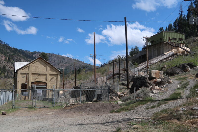
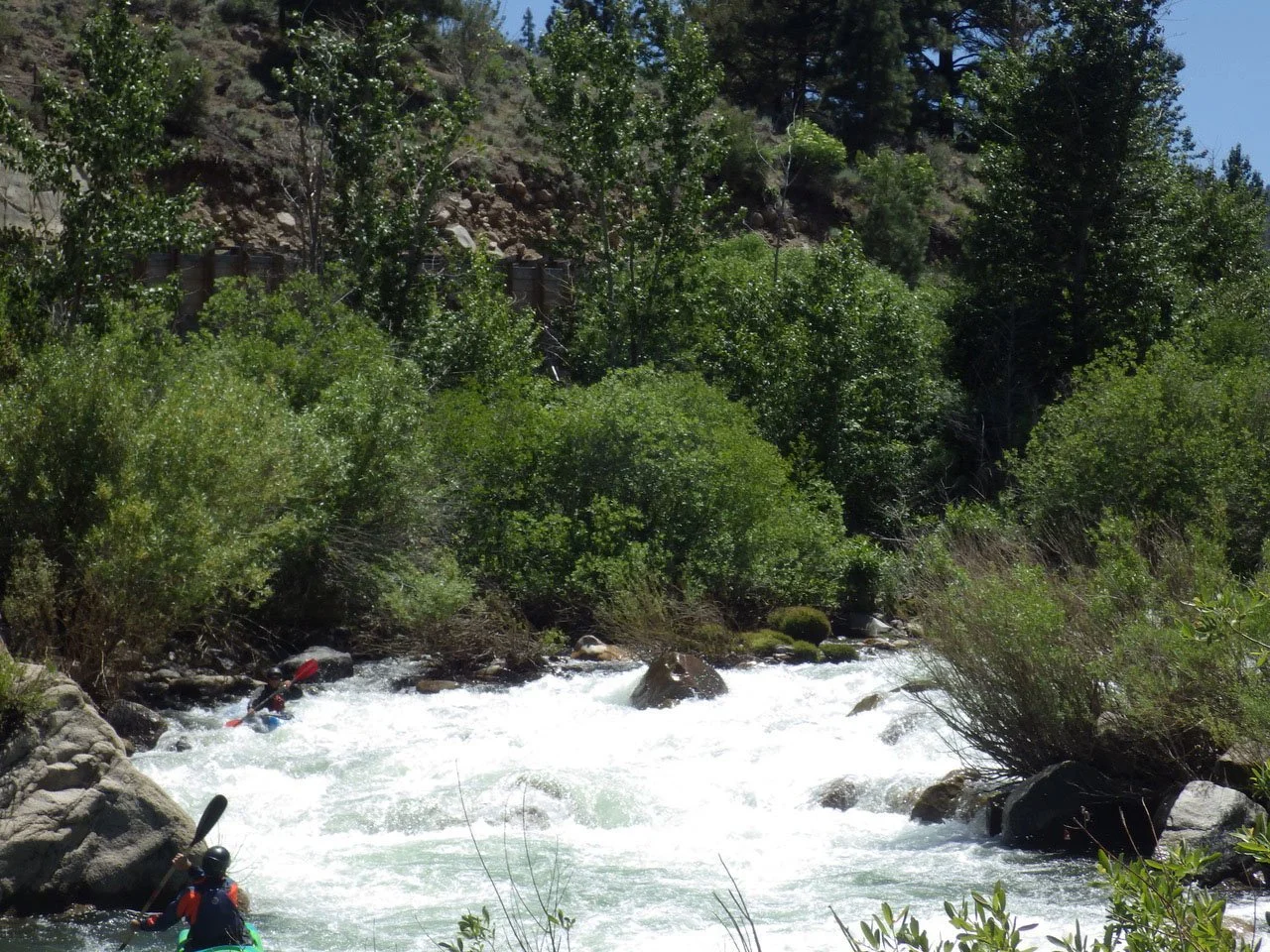
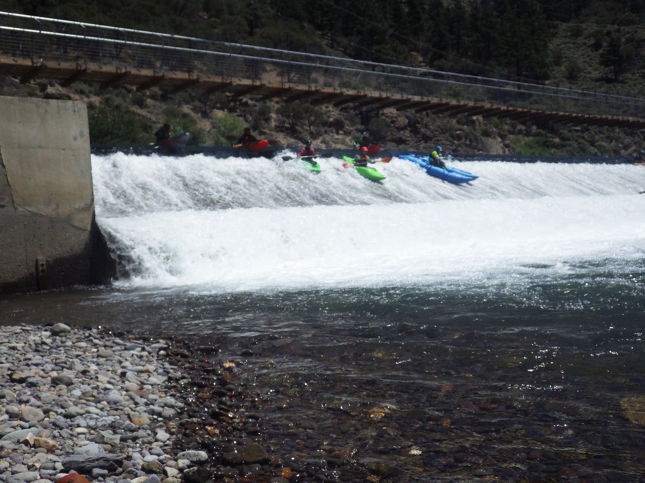
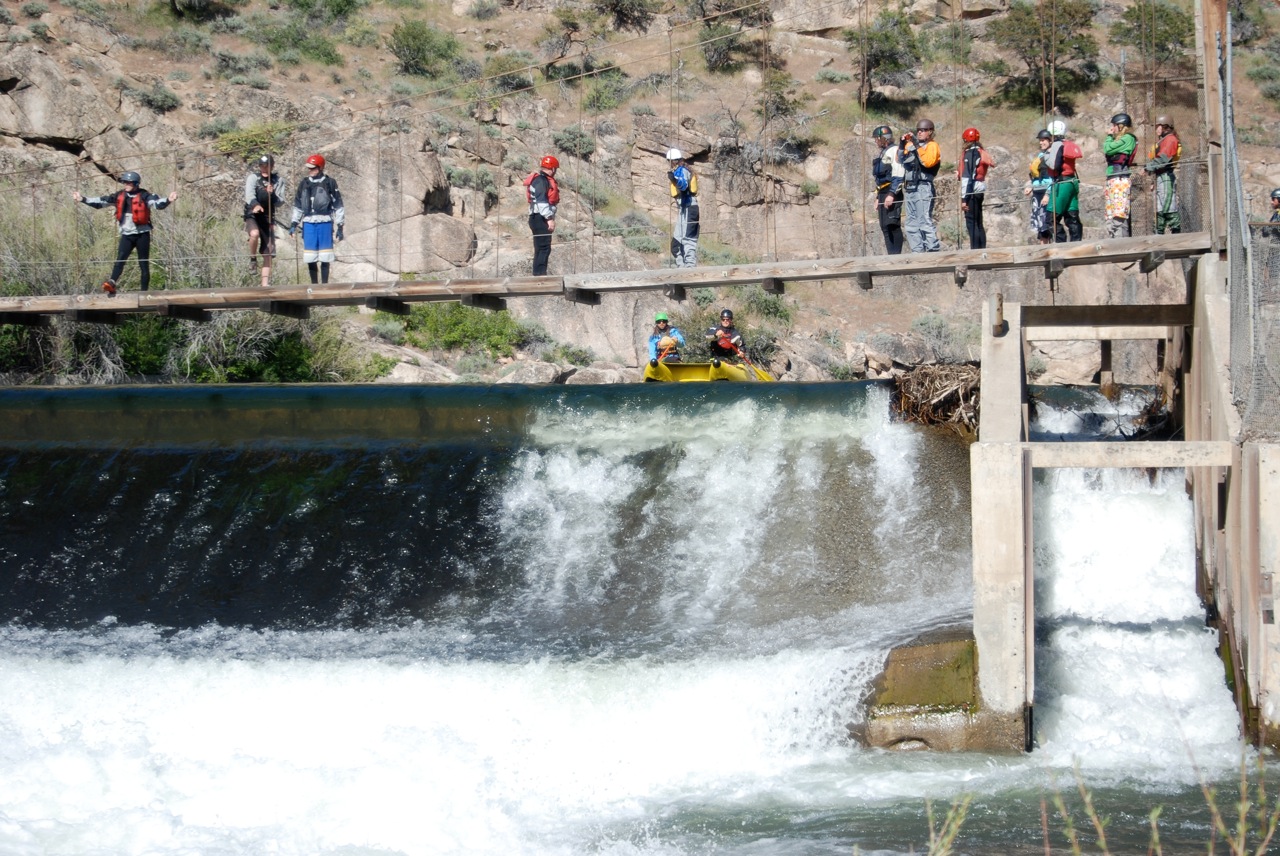
If you start out your run at Floriston you can hike up a short distance to run Bronco which is the last rapid on the section above this one ( Alpine Meadow Road to Floriston). Most of this run consists of class II rapids which become fun class II/III at higher flows. Beware of three diversion dams on this section particularly as flows increase. Although they have been run at various times, they can also be deadly at certain flows. The most significant rapid on this section is Deadman's which can push class IV at higher flows with some big hydraulics. Here the river piles up against bedrock on river right.
Logistics
Access for this section is available at Floriston which is Exit 199 off I-80. After exiting, head underneath the highway to a parking spot on river right near the railroad tracks. If you are going to start your run with Bronco just head up the dirt road on river right between the river and the railroad tracks. It's about a 15 minutes walk to the top of the rapid. Alternate put-in access is available 1.7 miles downstream at Farad at exit 201. A decent take-out that avoids one of the diversion dams is available off Quilci Ranch Road but it's a little tricky to find and it helps to have a decent guide. Alternatively you can continue down to Crystal Creek Park in Verdi where access is available on the upstream river right side of the 3rd Street Bridge.
Additional Information
The Truckee Meadows Water Authority publishes a river recreation map. Download the pdf from the map link to the right or you can pick one up at their offices in town. Call 775-834-8000 or visit the office at 1155 Corporate Blvd. in Reno.
Additional Sections
1. Alpine Meadows Road to Floriston (27 miles)
2. Floriston (or Farad) to Verdi, NV (9.8 miles)
3. Verdi to Mayberry Park (8 miles)
4. Mayberry Park to Cottonwood Park (10 miles) see also Reno Whitewater Park at Wingfield
5. Cottonwood Park to Pyramid Lake
Rapids in this Run (9)
Hazards & Portages (3)
Caution: The following locations may require scouting or portaging. Always check current conditions.

Difficulty
Class III
Length
10.0 mi
Rapids
9
3 Hazards
Access Points
Difficulty Classes
I Easy
II Novice
III Intermediate
IV Advanced
V Expert/Extreme
VI Unrunnable
Current Conditions
5-Day Forecast
Whitewater data from
American Whitewater
American Whitewater