2. Goodell Creek to Copper Creek
Gauge Conditions
Runnable: 1,500.0 – 15,000.0 CFS
Data from American Whitewater & USGS
Run Map
Description
Season
Throughout the year. Dam release modulates the annual hydrograph, but weekly hydrographs are closely tied to power demand. Seattle City Light works to operate their dams in a manner that is protective of the rich fishery resources of the Skagit River.
Fun Fact
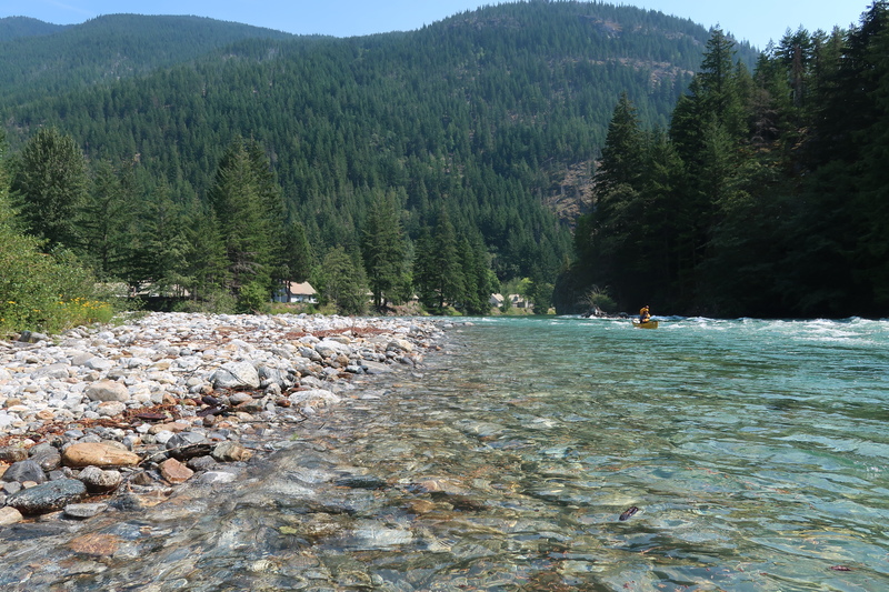
Consistent dam release flows along a beautiful river
Description
In the 1970's Seattle City Light pushed for construction of a 108 MW hydropower project at Copper Creek that would have inundated this section of river. As opposition from environmental groups, fishermen, whitewater boaters, and tribes increased however the Seattle City Council decided to shelve the project in August 1981. This section remains free flowing but unlike the section just downstream it is not protected under the Wild and Scenic Rivers Act.
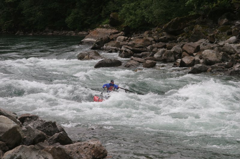
The Skagit River is a great place for advanced beginners to go and learn from an experienced paddler. If you don't have a solid brace swims are just about always guaranteed, but the big wave trains in S-Bends (aka Shovel Spur Rapids) are fun and it's normally not too much trouble to pick up the yard sale at the end (the waves could be a fun surfing spot if you're not busy chasing swimmers).
The run starts at the putin with easy class II rapids. It's a good section for practice with strong eddy lines and ocassional wave trains. The excitement of the run comes with the S-Bends, a series of three distinct rapids separated by short stretches of flatwater in between. The big wave trains can be either exciting or terrorizing for first-time paddlers. They normally rate class III. They become bigger and faster with higher water levels (> 6000 cfs), but it would be hard to call them anything more difficult than III+. There is a hole that could cause trouble near the middle of the rapid, but otherwise they flush straight through. The S Bends can be scouted from the road between mile 114.1 (upstream end and start of rapid) and mile 113.5 (downstream end).
The river calms down considerably after leaving the S bends and continues along at any easy pace to the takeout.
Logistics
_Putin_ Goodell Creek Campground at mile 119.4 on Highway 20. There is a boat launch and information sign at the downstream end of the campground. Be sure to leave room for rafters to access the launch by parking cars outside the campground on the dirt road. For those who are curious as to what lies upstream, the parking area for the Gorge Powerhouse is at Highway 20 mile 120.9 but there is no formal river access.
_Takeout_ At mile 111.7 on Highway 20 there is a dirt road (NPS Road 213) leading south to the river (it's just before you reach the Ross Lake Recreation Area sign). Follow the dirt road and take the left fork to a takeout about 200 yards from the highway. Parking options are limited here. Leave room for others including commercial rafting groups that use the takeout. If you have a large group, extra vehicles should be parked at the put-in.
_Shuttle_ Highway 20 parallels the run.
Rapids in this Run (3)
Difficulty
Class II-III+
Length
8.5 mi
Gradient
15 ft/mi
Rapids
3
Access Points
Difficulty Classes
I Easy
II Novice
III Intermediate
IV Advanced
V Expert/Extreme
VI Unrunnable
Current Conditions
5-Day Forecast
Whitewater data from
American Whitewater
American Whitewater