2. Gorge Section: Garden Hole Road (Breaks Park), VA to Breaks Park River Access, KY takeout (4 miles)
Gauge Conditions
Runnable: ? – ? CFS
Approximate reading: This gauge is 2.0 miles away on Russell Fork. Use as a general reference only.
Data from American Whitewater & USGS
Run Map
Interactive run map
Loads as you approach this section.
Description
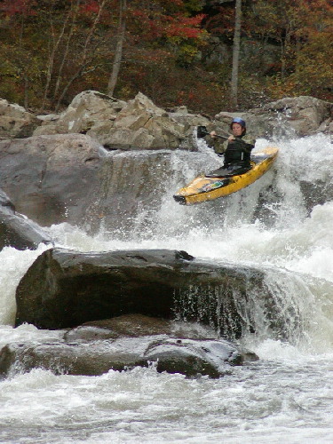
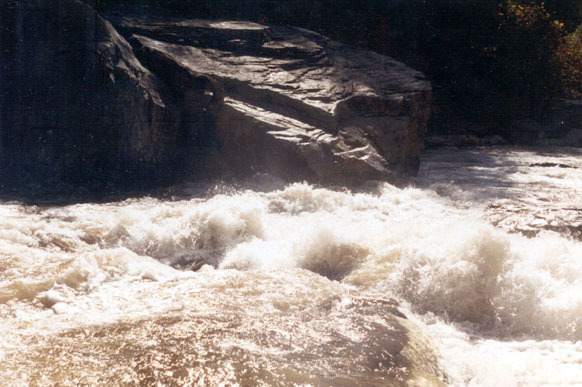
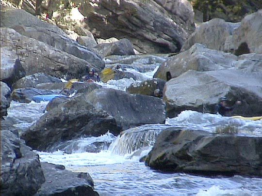
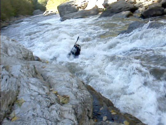
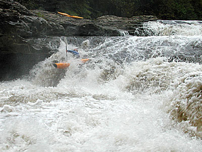
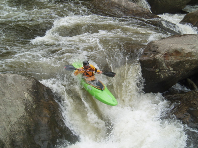
The Russell Fork is one of the classic Class V creek runs in the United States. The river is run year round and relies on a combination of natural flow and dam release from the Flanagan Reservoir on the Pound River. Every October, the Corp of Engineers draws the reservoir down over 4 weekends, putting anywhere from 800-1100 cfs into the Russell. Paddlers from all over the world converge on the Breaks to sample the awesome whitewater, reputation and sheer beauty of the 1600ft gorge.
While best known for its extreme push and danger in October, many are running the Fork at much lower flows. Below around 400cfs, the gorge is a good Class IV+ creek run. Extremely technical, but the pool/drop nature of the stream bed allows time to regroup between rapids and time to take in the incredible canyon. There are a couple of Class V drops at lower water, but you can easily sneak or portage.
Levels: Here are the flow ranges:
150-250ELF, but very enjoyable in the main gorge. Great level to see the caves at Fist and under El Horrendo.250-350Low Flow, but good padding! GREAT first time level for the solid Class III/IV creeker.350-600Medium Level. The teeth are coming out, more pronounced holes, but good lines all the way through.600-800Other than extreme high water, the TOUGHEST levels. Lines are kinda in between the medium and high water lines at all the big rapids. Not for the squeamish.800-1100Release range, solid Class V creeking. Pushy, very technical, but very pronounced lines. A bit easier than the 600-800 level.1100 and higher Getting on the extreme upper end...VERY PUSHY and VERY BIG HOLES.
Very high end boaters have been pushing the upper envelope of gorge runs. Several 4,000+cfs runs now. The upper and lower sections have been run up to 10,000cfs. Big, but manageable for Gauley comfortable boaters.
See also the Russell Fork,KY and Pound River,VA
Shuttle Directions
Russell Fork Gorge Takeout
Follow 80 over the Russell Fork bridge coming from Elkhorn City.KY and go about 2 miles. Look for the big sign for Ratliff Hole on the right that signals the steep road down to the takeout/park for the RF Gorge. There is some boater's camping and a nice park n' surf play hole.
For the putin follow 80 and climb east towards the Breaks Interstate Park. The Breaks has some spectacular views of the Tower rock/rapid and Fist rapid - it would be worth a brief stop to take it in. There is a lookout pull-off just inside the Park and another just off 80 past the Park entrance. There is good camping at the Park as well but be aware that 'quiet time'is strictly enforced.
Garden Hole Putin:
Continuing past the Park on 80 you will come to the Garden Hole Rd on your right. This is a steep in spots gravel road (2-wheel drive is ok but if it's raining the mud might make it interesting for some) that is used as a putin by folks who don't want to paddle the upper class III section from the putin at Bartlick Bridge (or the third putin on the class I-II section from Flannagan Dam).
Bartlick Putin:
If it is your first time down I recommend that you might want to paddle from Bartlick Bridge (look for VA611 on your right off 80 5-6 miles past the Breaks Park). The class II-III(+) section to Garden Hole is relatively short (maybe 2-3miles) but can make a nice warm up for the Gorge section.
Haysi Putin:
If the natural flow is above 400cfs, add 2-3 miles to your upper run by skipping the turnoff for Bartlick and driving on into Haysi. Class II with two Class III ledges. Great play above 800cfs. Same distance shuttle, longer paddle. Stay on 80 into downtown Haysi and do not turn off that road (80 will turn left). The putin is a parking area just before you get to Kiwanis Park (old site of the Rendezvous).
Flannagan Dam putin:
Following 611 from Bartlick take the first road to the left and go maybe 2-3 miles till you cross over the dam. Take the access road on the left down to the dam tailwaters putin which is developed as a picnic area with large bathrooms, tables, covered pavilions, and a playground. By putting in here paddlers can gain another mile of class II whitewater before Bartlick Bridge. LONGEST SHUTTLE of the upper putin options.
For more great Russell Fork photos and information, check out the Russell Fork Info.
**Click here for Doug Arrington's Step-by-Step of the Major Rapids!\*\*\*\*Click here for Jim Michaud's Harrowing Pin at Fist!**
Rapids in this Run (6)
Difficulty
Class IV-V+
Length
4.0 mi
Gradient
140 ft/mi
max 190
Rapids
6
Access Points
Difficulty Classes
I Easy
II Novice
III Intermediate
IV Advanced
V Expert/Extreme
VI Unrunnable
Current Conditions
5-Day Forecast
Whitewater data from
American Whitewater
American Whitewater