2. Hangman's Bridge to Hwy 395
Gauge Conditions
Runnable: 400.0 – 4,000.0 CFS
Data from American Whitewater & USGS
Run Map
Run Time Estimate
Select put-in and take-out to estimate time.
Plan This Trip
See wind-adjusted speed maps, forecast planning, and detailed time estimates.
Sign in to generate an AI timing estimate for this run.
Whitewater timing varies with scouting, portages, and group pace. Use as a planning baseline.
Description
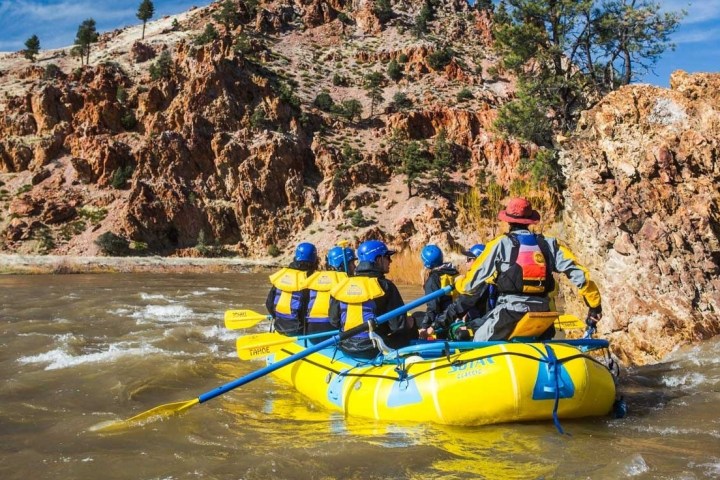
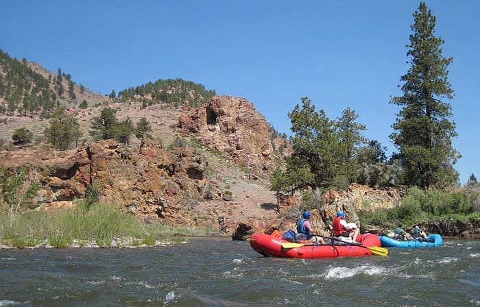
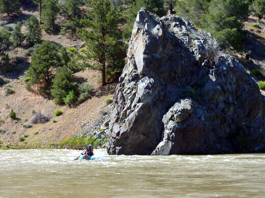
The East Fork Carson is a popular and scenic class 2 stretch, but it is more difficult in two respects than the rating can indicate. The water is very cold, so swims could lead to hypothermia. While the rapids are not difficult, they are non-stop in the early miles. The current constantly pushes towards one bank or the other and those banks are undercut cliffs in many areas. Constant manuvering is required to stay in the center of the channel.
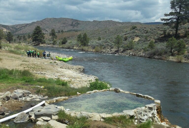
People often take two days and camp at Carson River Hot Spring, but one day runs are also feasible.
The run is popular for boaters with whitewater open canoes with float bags and strong whitewater canoeing skills.
There are toilets at Hangman's Bridge put in, at the take out, and one pit toilet about halfway down. Those camping on the river should bring their own toilet systems, though they are not required.
Access: To reach put-in, drive south on highway 89/4 to Markleeville, and continue about a mile past town to Hangman's Bridge, where there is an outhouse. You can find better put-in spots upstream between the highway and river. Even on Friday nights, campsites are often available at a USFS campground down a dirt road before the bridge. Shuttles are readily available by inquiring at stores in Markleeville. River Rats Shuttle Service, a family operation since 1986, is run by Teo and Laura Rocha and they can be reached at 775-901-6492. Paul and Gloria Washam operate a long-time company, Family Shuttle Service at 530-694-2966.
To reach take-out, drive north to highway 88, turn right, and descend into Nevada. You can take a shortcut by turning right on Centerville Lane, and left across a bridge before Dresslerville, although going all the way to Minden and turning right on highway 395 thru Gardnerville works too. On 395 just past the Lahonton Fish Hatchery, turn right onto a dirt road where the highway starts climbing a hill. The BLM parking lot is uphill at the end of the dirt road. This take-out has a reputation for overnight vandalism.
Other Information Sources:
Description in Bill Tuthill's California Creekin.
Cassady & Calhoun, Holbek & Stanley, Gerald Meral.
Rapids in this Run (5)
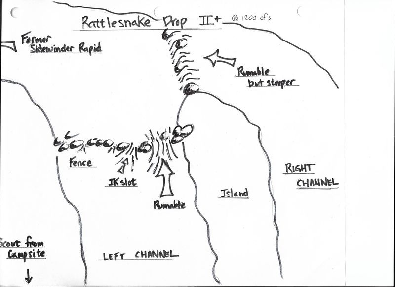
Waterfalls (1)
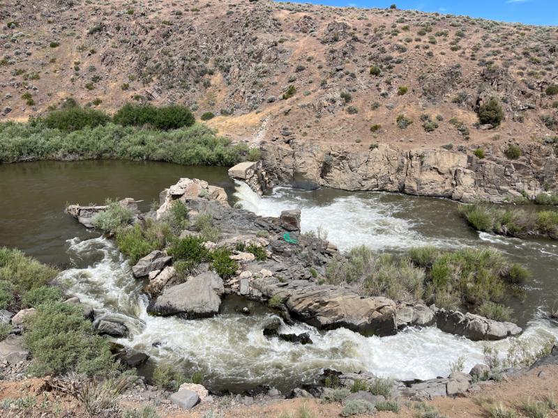
Hazards & Portages (1)
Caution: The following locations may require scouting or portaging. Always check current conditions.
Difficulty
Class II+(III)
Length
19.1 mi
Gradient
25 ft/mi
Rapids
5
1 Hazard
Access Points
Difficulty Classes
I Easy
II Novice
III Intermediate
IV Advanced
V Expert/Extreme
VI Unrunnable
Current Conditions
5-Day Forecast
Whitewater data from
American Whitewater
American Whitewater