2. Highway 20 to Marysville
Gauge Conditions
Runnable: ? – ? CFS
Approximate reading: This gauge is 3.3 miles away on Yuba. Use as a general reference only.
Data from American Whitewater & USGS
CDEC Flow Data California
Data from California Data Exchange Center (CDEC)
Run Map
Run Time Estimate
Select put-in and take-out to estimate time.
Plan This Trip
See wind-adjusted speed maps, forecast planning, and detailed time estimates.
Sign in to generate an AI timing estimate for this run.
Whitewater timing varies with scouting, portages, and group pace. Use as a planning baseline.
Description
This wide meandering valley river passes through an area that had major gold mining via dredger. The dredger tailings cover a vast area and extend along the river for about 7 miles. Farmland borders the river near Marysville.
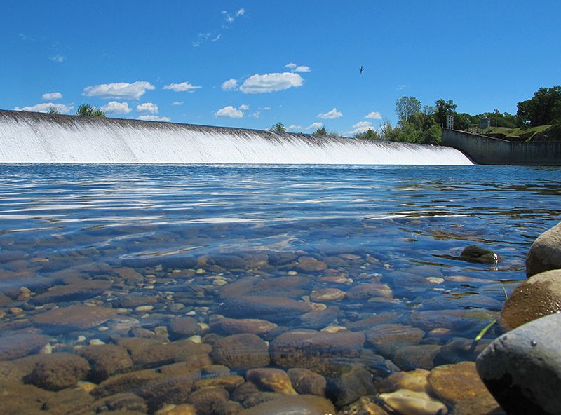
Daguerre Point Dam: at mile 6.4, is a dangerous hazard. Portage on river left. The reversal at the base of the dam has drowned a number of people. The Army Corp places large signs 500 feet upstream of the dam to warn people away.
Other Information Sources:
YubaRiver.org
Lower Yuba River Accord - River Management Team
Yuba County Water Agency
Daguerre Point Dam: Fish Passage Project
Drowning Deaths at Daguerre Point Appeal Democrat news story
"Sierra Whitewater" by Charles Martin
Rapids in this Run (1)
Hazards & Portages (1)
Caution: The following locations may require scouting or portaging. Always check current conditions.
Difficulty
Class I
Length
17.4 mi
Rapids
1
1 Hazard
Access Points
Difficulty Classes
I Easy
II Novice
III Intermediate
IV Advanced
V Expert/Extreme
VI Unrunnable
Current Conditions
5-Day Forecast
Whitewater data from
American Whitewater
American Whitewater