2) Iron Bridge to washed-out crossing
Gauge Conditions
Runnable: 200.0 – 2,000.0 CFS
Best levels unknown. Help us out! Add a comment.
Data from American Whitewater & USGS
Run Map
Run Time Estimate
Select put-in and take-out to estimate time.
Plan This Trip
See wind-adjusted speed maps, forecast planning, and detailed time estimates.
Sign in to generate an AI timing estimate for this run.
Whitewater timing varies with scouting, portages, and group pace. Use as a planning baseline.
Description
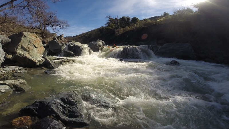
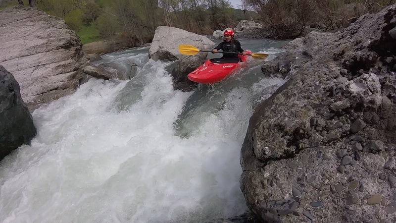
Just of Hwy 101 in Cloverdale. Access is questionable, Ive been told by stopping cars that we were trespassing or walking through private property. The iron bridge does not have any signs forbidding parking or passage on the east (after you cross it) side. For take out there are some spots off the side of the road close to the creek where you probably wont get hasseled above the final Class V+. Constant landslides cause changing conditions following every storm. Scout. Very challenging run for anyone in the bay area. Winter creates challenging big water after storms, spring rains bring the level up enough to run but its usually too low for rafts.
A GUIDE TO THE BEST WHITEWATER IN THE STATE OF CA, HOLBEK & STANLEY, 1988
Lat/longitude coords are very approximate.
Rapids in this Run (2)
Difficulty
Class IV-V
Length
9.3 mi
Rapids
2
Access Points
Difficulty Classes
I Easy
II Novice
III Intermediate
IV Advanced
V Expert/Extreme
VI Unrunnable
Current Conditions
5-Day Forecast
Whitewater data from
American Whitewater
American Whitewater