2) Jones Beach to Klamath River Scenic
Gauge Conditions
Runnable: 800.0 – 3,000.0 CFS
Data from American Whitewater & USGS
CDEC Flow Data California
Data from California Data Exchange Center (CDEC)
Run Map
Put-in
Take-out
Rapids/Hazards
Scenic
Recreational
Run Time Estimate
Select put-in and take-out to estimate time.
Plan This Trip
See wind-adjusted speed maps, forecast planning, and detailed time estimates.
Sign in to generate an AI timing estimate for this run.
Whitewater timing varies with scouting, portages, and group pace. Use as a planning baseline.
Description
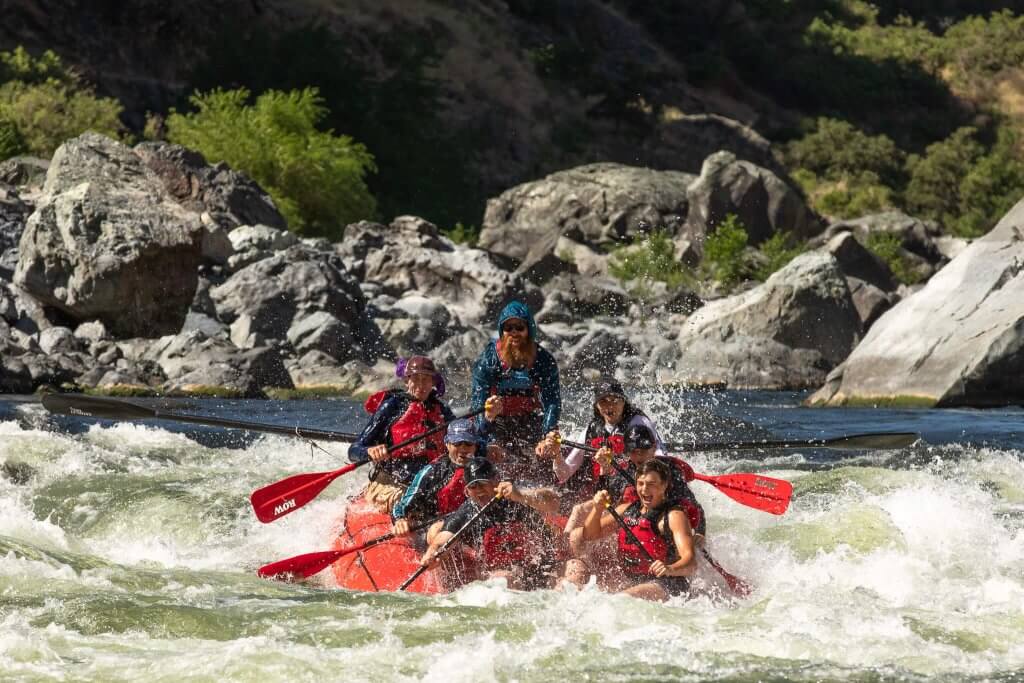
The Scott River is a whitewater gem in far Northern California that was first boated in 1969, making it one of the earlier boating runs in this area. Originating in the Scott Mountains of the Trinity Alps Wilderness and the Salmon Mountains of the Russian and Marble Mountain wildernesses, it flows through the pastoral Scott Valley before plunging into a rugged horseshoe-shaped canyon as it wraps around the Scott Bar Mountains. For more than 20 miles, the Scott delivers varied and exciting whitewater before joining the Klamath River at Steelhead, California.
The Scott River Canyon is very scenic too. From a point on the river just upstream of Deep Creek, the upriver view to Boulder Peak rises more than 6,000 vertical feet above the river. There are some gorgeous rocks in the river, particularly near Kelsey Creek, where swirled marble boulders have washed down from Marble Mountain and the Kings Castle. The downriver end of the canyon shows signs of wildfires on both sides of the river, most recently from the 2022 McKinney Fire.
Despite its spectacular setting and excellent whitewater, the Scott is often overlooked, partly due to its brown, sediment-laden water from valley runoff—unlike the typically clear, emerald-green rivers and streams nearby. Catching it at good flows is also challenging, as a drying climate and agricultural diversions in Scott Valley have shortened its season and volume considerably, sometimes even eliminating a boating season altogether. The valley’s alluvial aquifer, heavily drawn for irrigation, must recharge through rains and snowmelt before the river downstream will reach boatable flows.
The Scott offers a number of diverse runs downstream of Scott Valley: 1) a Class II/III section in the upper canyon that is rarely boated, 2) a Class IV/V reach below Jones Beach featuring the highly technical Boulder Creek Falls, 3) the more commonly run Class IV stretch from Bridge Flat to Scott Bar, and 4) a few miles of Class II from there to the Klamath River. Multiple access points, both signed and unsigned, provide options for boaters. While much of the canyon is public land managed by Klamath National Forest, numerous private properties exist along the river, especially near Scott Bar.
Flows & Season
The Scott River’s hydrology is heavily impacted by its history of post-settlement development and, in particular, by ongoing agricultural diversions and groundwater pumping in Scott Valley, compounded by a drying climate and declining snowpack. It once had reliable winter and spring flows, predictable and regualr enough to support several whitewater rafting outfitters. However, since the early 2000s, boatable flows have become increasingly rare and unpredictable. While nearby streams a fraction of the Scott’s size may run at 1,500 cfs, the Scott itself often trickles by at a mere 100 cfs. It doesn’t reach boatable flows every year, but in wet years, it can run fairly regualrly—feast or famine.
In good years, the Scott may start running in late December or January, usually after warm rain with a snowmelt component. If the valley’s depleted aquifer recharges during winter then late winter and spring rains and snowmelt are more likely to produce sustained boatable flows. As spring arrives with warmer temperatures and less rain, the river transitions from rainfall-driven flows to a greater reliance on snowmelt. If winter has been wet and snowpack is solid, a spring runoff season in April and May can occur—though agricultural diversions and groundwater pumping resume on April 15. In exceptional years, the Scott may even run into late May or early June.
More often, however, the Scott fails to reach boatable flows until late winter or spring, if at all. When it does, the window is short, with flows spiking and dropping rapidly, usually related to a storm. Watch the gage and be ready to seize the opportunity. Water quality can also be poor in these years due to a lack of flushing flows. If flows are too low, nearby alternatives include the Salmon River, the creeks near Happy Camp, or the Klamath.
Once in the cell-free Scott River canyon, you can check the latest flow reading using the public phones at the Bridge Flat River Access or in Scott Bar, which also has free WiFi at the post office. Call Waterline at 1-800-452-1737 and enter 063492 for the Scott River near Fort Jones. The USGS gauge is located at the upstream end of the canyon.
The USGS gage sits at the top of the canyon, upstream of the primary boating runs. Tributaries like Canyon, Boulder, Kelsey, and Middle creeks—flowing in from river left—add significant water below the gage, meaning boaters downstream of Jones Beach should expect higher flows than the reading provides.
Logistics
*Put-ins*
Jones Beach is the furthest upriver national forest river access site and is easy to find along Scott River Road just inside the Klamath National Forest. A paved parking area leads to a trail down to a sandy beach on river right. Launching here provides a warm-up before the action-packed section downstream, which includes Boulder Creek Falls (a solid V) and Canyon Creek Rapid (IV).
However, most boaters choose to avoid Boulder Creek Falls and put in below the falls either at Buker Bridge or, more commonly, at Bridge Flat River Access. This eliminates some excellent whitewater but avoids the challenge and drama of Boulder Creek Falls, which is suited only for expert kayakers who like tight, congested drops.
*Take-outs*
It's possible to take out in the little town of Scott Bar, using the county road bridge right-of-way for legal access (everything else is private property). If you're looking for a few more miles of Class II/III or a less urban take-out, continue past Scott Bar to take out at Steelhead, just upstream of Highway 96 and the Klamath River confluence.
Regardless of what put-in and take-out you choose, Scott River Road follows the river’s length, though at times it runs high above the canyon, with no direct river access. The Scott is an easy river to bike shuttle and the one-lane paved road is pretty quiet and very scenic.
Additional Info
The best guidebook for this run is Dan Menten's 2016 classic, *The New School Guide to Northern California Whitewater,* p. 55.
Other books: Cassady & Calhoun, Holbek & Stanley (p. 68), Schwind
Rapids in this Run (20)
Rapid
III
Unnamed Rapid
Rapid
V
Boulder Creek Falls
Rapid
IV
Canyon Creek Rapid
Rapid
Buker Bridge
 Rapid
III
Rapid
III
Unnamed Rapid
 Rapid
Rapid
Unnamed Rapid
Rapid
III
Island Rapid
Rapid
IV-
Kelsey Creek Rapid
Rapid
III
Big Rock
 Rapid
III
Rapid
III
Unnamed Rapid
 Rapid
III+
Rapid
III+
Unnamed Rapid
 Rapid
III
Rapid
III
Unnamed Rapid
Rapid
IV
White House
Rapid
III+
Tompkins Creek Rapid
Rapid
Tompkins Creek River Access
Rapid
III
Gold Flat Rapid
Rapid
Gold Flat River Access
Rapid
Townsend Gulch River Access
Rapid
IV
Schuler Gulch Rapid
Rapid
Scott Bar Bridge
Difficulty
Class IV-V
Length
17.0 mi
Gradient
47 ft/mi
Rapids
20
Access Points
Difficulty Classes
I Easy
II Novice
III Intermediate
IV Advanced
V Expert/Extreme
VI Unrunnable
Current Conditions
5-Day Forecast
Whitewater data from
American Whitewater
American Whitewater