2 - Kanaskat Palmer State Park to Flaming Geyser State Park
Gauge Conditions
Runnable: 1,000.0 – 4,000.0 CFS
Data from American Whitewater & USGS
Run Map
Run Time Estimate
Select put-in and take-out to estimate time.
Plan This Trip
See wind-adjusted speed maps, forecast planning, and detailed time estimates.
Sign in to generate an AI timing estimate for this run.
Whitewater timing varies with scouting, portages, and group pace. Use as a planning baseline.
Description
The Green River Gorge is one of the best whitewater trips close to Seattle with fun drops, good play spots, and easy access for a day trip all in one of the region's most scenic river gorges. It's a place many can't get too often enough with some great intermediate to advance whitewater. The catch is finding the river with water in it. The ever increasing demands of urban growth and endangered salmon come before paddlers (see King County's Green River Watershed site for the latest information), but after a day or two of intense winter rains you are nearly always guranteed to find the gorge with water particularly after the first heavy rains in October and continuing through the early spring snow melt season. Another trick to this run is figuring out what the engineers will be doing with the gates--will they open the gates and let more water in or will they shut them down by the time you arrive? Although discharge from the dam often remains constant through the weekend, the engineers do adjust flows over the weekend at high flows of most interest to boaters. The Green River Clean-Up hosted by Washington Recreational River Runners typically occurs during one of the first weekends in May.
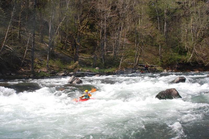
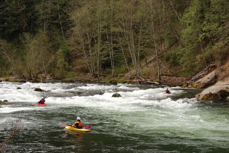
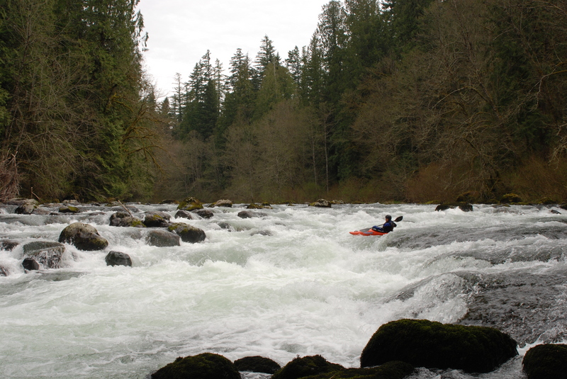
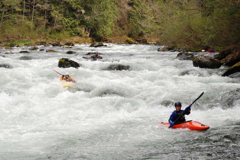
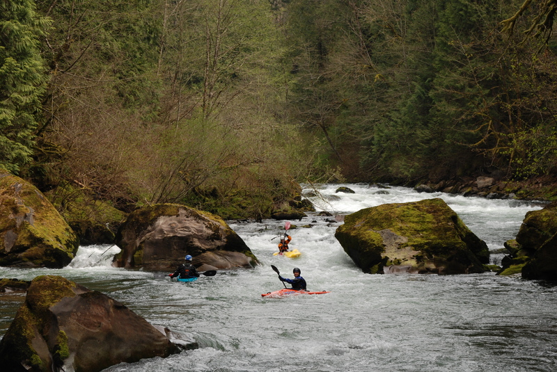
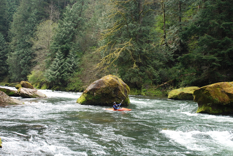
Once you get to the river the action starts within the first 50 yards at Ledge Drop 1. At higher water Ledge Drop 1 can be a fun play wave. The river then snakes along the edge of the park, you pass a second access point at a nice set of surfing waves, and then enter the gorge (marked with warning signs). There are several fun rapids (class III and IV) in the gorge. At the lower limit of flows rapids are less continuous with plenty of space to collect yourself before the next drop, but at higher flows these rest spots start to disappear and the class III sequences start to push class IV and the run becomes more continuous.
After about a mile and a half containing several class III rapids you'll reach Pipeline. This rapid can push class IV but if you're on your line it's fairly straight forward. The drop is at sharp right bend with a boulder bar that extends out from river right. As you round the corner head back hard to river right to avoid the large reversal on river left--the Pipeline which can be hard to see until you're right on top of it.
A few bends after the Pipeline you'll come to the most significant class IV sequence on the run at Mercury and the Nozzle. You can recognize the approach from the powerlines overhead followed by an island with most of the flow going to river right. From this point it's one class III rapid down to the top of Mercury. It's a bad place for swims so be sure your skills are solid if you enter the gorge. If you swim at the entrance to these drops, rescue is very difficult until you've gone through a rather long sequence of rapids and there have been accidents here. The drops are a hoot if your skills are up to it, but can be a real drag if you're chasing swimmers. Be especially careful at low water levels (under 1000 cfs). Although the gorge is sometimes run at these levels some dangerous sieves begin to appear.
You can normally boat scout Mercury and the Nozzle. As you come around the right side of the island head left and you'll quickly be in Mercury. After going through Mercury, which is a fairly open rapid, there is a good eddy on river left to get set up for the Nozzle at flows up to 4000 cfs. As flows increase you'll probably want to grab the eddy to river right. The Nozzle is a chute between two large boulders and the preferred line is to take this center slot. At high flows (above 5000 cfs) the boulders form two large holes. You can still thread them but it's a little intimidating as the drop is very hard to scout and has few landmarks (it pushes class V). The hole to the right is particularly sticky and rescue is basically impossible. At higher water (around 9000 cfs) another option is to run the far right slot, but there is a dangerous sieve here that becomes a death trap at low water. After running the Nozzle there are several challenging class III+ rapids through a large boulder field before the river settles down for a brief recovery and more good class III rapids all the way to the take-out at Franklin Bridge.
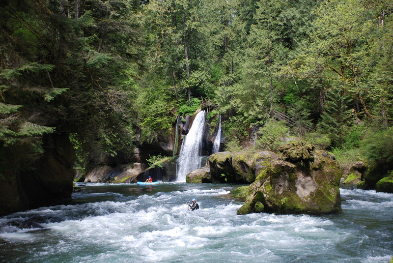
As Franklin Bridge comes into view far overhead you are nearing the end of the run (note that rafters typically continue on down through the class II and III rapids to Flaming Geyser State Park). Paradise Ledge is a fun playspot that comes shortly after the bridge to the river right side of a large rock. You can hike up to the parking lot on river right at a muddy trail just below the ledge. Alternatively, you can continue down through the next set of class III rapids and pull out to the lower access. Pay attention as you boat through this section as it's easy to miss the take-out. There are a few spots where you can climb up and your choices are basically a long gradual climb or a steep muddy scramble.
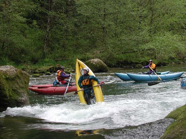
The run from this point down is a fine beginner-intermediate run, and many kayakers use the Franklin Bridge access as a put-in for the scenic float down to Flaming Geyser State Park.
Access Logistics:
Take-Out: Most kayakers take out below Franklin Bridge at our just below Paradise Ledge. This bridge is where Green River Gorge Rd. crosses the river. The pace of whitewater slows considerably a short distance beyond the bridge. Although rafters continue the float through the gorge down to Flaming Geyser State Park, most kayakers are ready to call it a day at the bridge (alternatively, kayakers can put-in at Franklin Bridge for a beginner-intermediate trip down to Flaming Geyser). To reach Franklin Bridge from Black Diamond take Lawson St. which becomes Green River Gorge Rd. 4 miles east out of town to the bridge across the Green River Gorge. The takeout is on river right just before you reach this bridge at a gated parking area that is clearly marked as private property. The gate is usually not locked, but if it is closed make sure you pull the gate shut when you leave. Check with the Washington Kayak Club for current access information and the combination. The club has arranged for kayaker access from the landowner (make sure your dues are paid up). Be sure you keep your trash picked up. It is a bit of a hike up from the river to the parking area but not too bad as long as you're on the trail. If your group does not know where the takeout is, it's worth a quick hike down to the river from the parking lot. One trail heads down the hill at the far corner of the parking lot. To reach a slightly lower take-out, follow the road at the end of the parking lot and take an immediate left down another road that extends about 100 yds. From here, head to your right and a short trail that ends at the river.
Put-in: From the take-out continue across Franklin Bridge and in 0.5 miles turn left up SE Green River Rd. In 1.8 miles this road will swing hard to te left and becomes 352nd. Continue another 0.3 miles and then turn left on to Cumberland-Kanaskat Rd. (you'll see a sign for Kanskat-Palmer State Park here). Continue 2.3 miles on Cumberland-Kanaskat Rd. and turn left into Kanskat-Palmer State Park (Discover Pass required). Follow the kayaker signs and when you get to a junction indicating you can go either way, head right to reach the upper put-in. If you follow the other road towards the left, an alternative put-in, you will miss Ledge Drop 1.
Shuttle: This would be a tough one to hitch. Make sure your navigator is on task and beware of shuttle drivers who 'think' they remember the sequence of turns. Be sure to watch your speed as you drive through Kanskat-Palmer State Park.

Difficulty
Class III-IV
Length
12.1 mi
Rapids
11
Access Points
Difficulty Classes
I Easy
II Novice
III Intermediate
IV Advanced
V Expert/Extreme
VI Unrunnable
Current Conditions
5-Day Forecast
Whitewater data from
American Whitewater
American Whitewater