2. Lost Creek to Loop 360 (Austin) (4.5 miles)
Gauge Conditions
Runnable: 300.0 – 3,500.0 CFS
Runnable: 300.0 – 3,500.0 CFS
Data from American Whitewater & USGS
Run Map
Run Time Estimate
Select put-in and take-out to estimate time.
Plan This Trip
See wind-adjusted speed maps, forecast planning, and detailed time estimates.
Sign in to generate an AI timing estimate for this run.
Whitewater timing varies with scouting, portages, and group pace. Use as a planning baseline.
Description
_Barton Creek doesn't usually have enough water to be runnable, but when it does, it creates one of the best Class III runs in the state of Texas, right through the heart of Austin. Barton does not generally rise as quickly as other area creeks, but it can definitely go from low to raging in a matter of hours after a heavy rainfall. Because the creek does not always flow, there are often trees and strainers throughout the run, particularly if the creek has been recently dry._
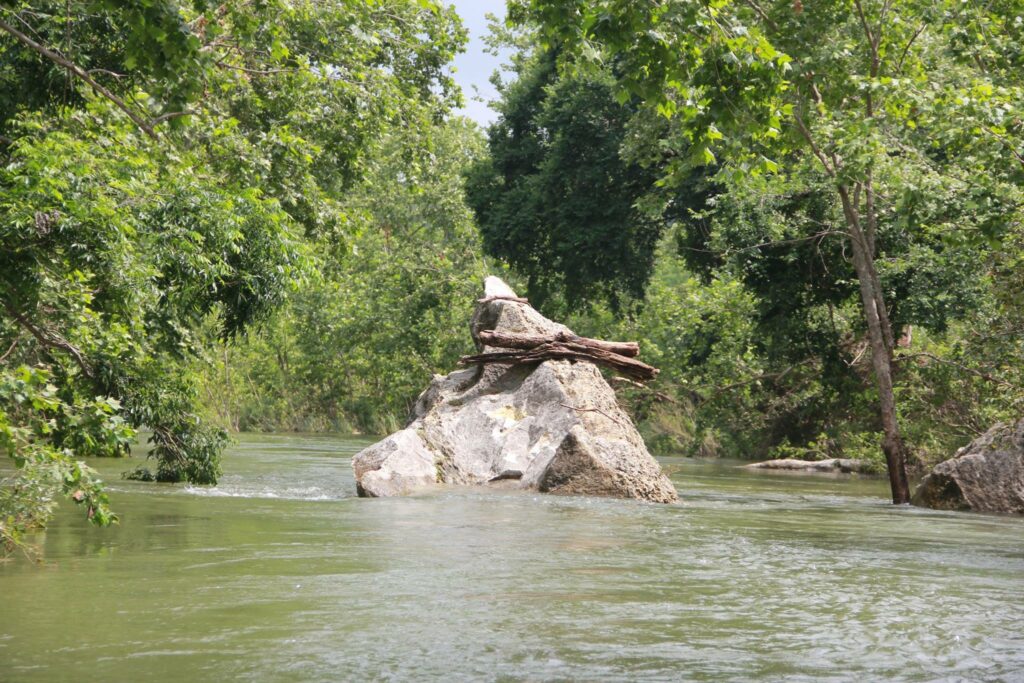
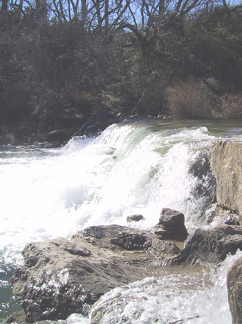
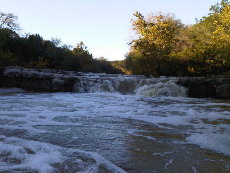
_Most of the run involves Class II wave trains, rock gardens, and small drops, such as Sculpture Falls. Some of these drops are surfable at moderate flows (500-1200-ish.) The only three consequential rapids are a seven-foot dam, about a mile from the put-in; another dam about 1/4 mile below that (only consequential at low levels); and Twin Falls, which is near the Mopac bridge (see descriptions below.)_
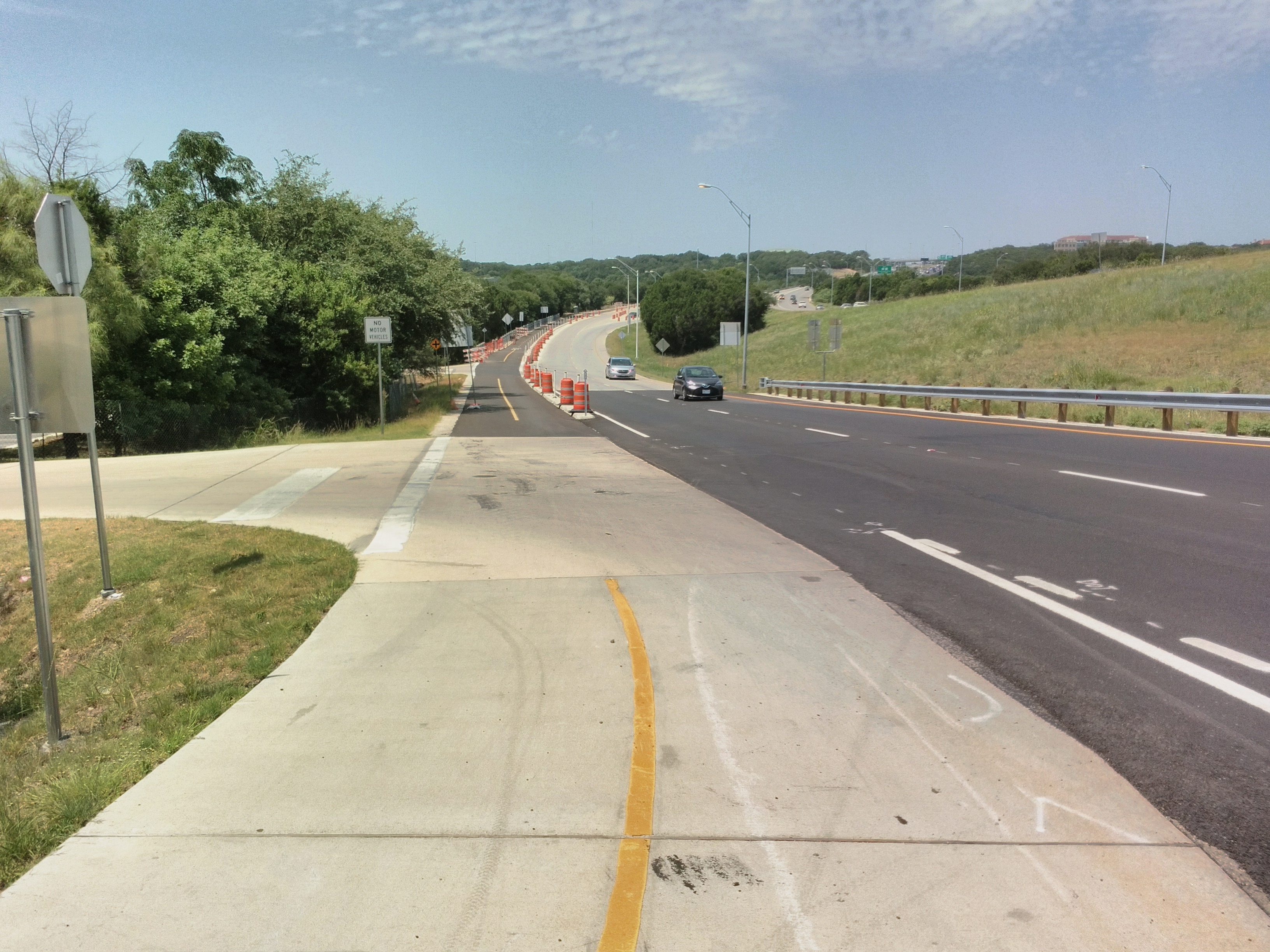
_Put-in parking is typically available on Bend of the River Dr., the abandoned low-water crossing adjacent to the Lost Creek Blvd bridge. If full, additional parking is available on one of the nearby cross streets. Do not park on the low-water crossing itself. At somewhere between 3000-4000 cfs, the creek will start flowing over the low-water crossing. Police will shut off access to the parking area whenever this happens. Area residents seem to be very supportive of local boaters, and vehicles tend to be safe._
Takeout vehicles can be parked at the Barton Creek Greenbelt trailhead next to the Loop 360 Bridge where Mopac and Highway 360 intersect. If the trailhead parking area is closed (which it sometimes is after a heavy rain), then parking is also available in the adjacent dirt lot. From the water, watch for the wooden fence on river right just after you go under the 360 bridge to avoid missing the takeout. Follow the trail about 300 yards up to the parking area.
Many continue on for the remaining 4 miles and take out at Zilker Park to take advantage of some of the best rapids and play spots on the creek.
A note about boating bans:
As a result of the July 3, 2002 accident at the low-head dam near the Hill of Life that killed Austin firefighter Rob Horne, AFD instituted a policy whereby boating could be banned on area creeks during periods of high flow. Throughout the rest of the 2000s, however, there was reportedly a handshake agreement between the fire chief and the Texas Rivers Protection Association (TRPA) whereby boating bans would be issued only if the creeks were exceptionally high and dangerous. Unfortunately, this handshake agreement was seemingly abandoned with the appointment of a new fire chief in 2009. In 2010, the City of Austin began issuing blanket boating bans on all area creeks during heavy rainfall runoff events. These boating bans are not always well-publicized, and historically speaking, they have rarely been reflective of actual navigability dangers. After Tropical Storm Hermine, for instance, a boating ban was issued and was not lifted until Barton Creek dropped to 150 cfs (below runnable.) During Hurricane Harvey, a preemptive week-long boating ban was issued before rain even began falling, and since the hurricane largely missed Austin, few creeks within the city limits even became runnable during that ban. The city seems to be basing its authority to issue these bans on § 31.092 (a) of the Texas Water Safety Act, which allows the "governing body of an incorporated city or town, with respect to public water within its corporate limits and all lakes owned by it" to "make rules and regulations relating to the operation and equipment of boats which it deems necessary for the public safety." As of this writing, the Austin Homeland Security and Emergency Management Dept. considers issuing boating bans whenever the creek is above 1500 cfs. At times, Barton Creek has run clear at 2000 cfs on a sunny day, and it has been safely navigated at much higher flows than that, so local boaters are of the opinion that automatically closing the river at levels above 1500 cfs represents a regulatory overreach on the part of the city. However, that's not an argument that can be won on a river bank, so if you intend to paddle the creek at flows above 1500 cfs, check for a boating ban announcement on the HSEM web site first. If the creek is running really high (thousands of cfs) and there is a boating ban in place, then there will often be police or fire officials stationed at the Zilker Park takeout (river left.) They can issue fines or even impound boats in certain cases if they catch paddlers breaking the ban.
Distances and gradient measured using GIS tools in 2015.
This video shows local paddlers running various parts of Barton Creek below Lost Creek. This was mostly shot after the Halloween Flood of 2013 when the creek was running about 2000 cfs.
Rapids in this Run (2)
Playspots (1)
Difficulty
Class II-III+(IV)
Length
4.6 mi
Gradient
19 ft/mi
Rapids
2
Access Points
Difficulty Classes
I Easy
II Novice
III Intermediate
IV Advanced
V Expert/Extreme
VI Unrunnable
Current Conditions
5-Day Forecast
Whitewater data from
American Whitewater
American Whitewater