2. Lower Pigeon
Gauge Conditions
Runnable: 1,200.0 – 2,500.0 CFS
Data from American Whitewater & USGS
Run Map
Run Time Estimate
Select put-in and take-out to estimate time.
Plan This Trip
See wind-adjusted speed maps, forecast planning, and detailed time estimates.
Sign in to generate an AI timing estimate for this run.
Whitewater timing varies with scouting, portages, and group pace. Use as a planning baseline.
Description
Put in at one of the many outfitters along river right. Make certain that you have the permission of the outfitter before parking at their place. Similarly at the take-out make certain to park near the bridge.
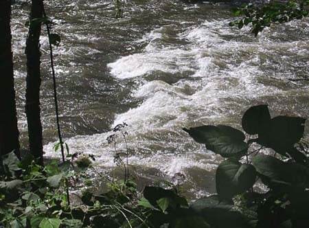
From the bridge, the river works down several Class I-II ledge drops. Then the current slows and the river is impounded by a lake that lasts nearly half a mile. The pattern then resume of working down small ledges. At mile 2.8 the river passes underneath I-40 for the first of two times. As the river turns to the left, you soon encounter the Ledges, a series of Class II+ drops.
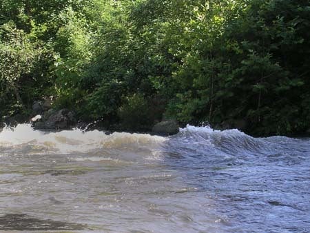
After the last ledge the current briefly calms then quickly loses gradient for the next quarter mile. These shoals offer many holes and rocks to negotiate through fast current. After another series of Class 1-2 drops the river calms as it turns to the left. Here is the river is divided by Brown Island, just above the most significant rapid on the river, Maytag \[Class II(III)\]. Work to either the right or the left of the bridge support for I-40. After another small drop, the river passes underneath the bridge for Greasy Cove.
A few hundred feet on the right is the public take-out.
Rapids in this Run (1)
Playspots (1)
Difficulty
Class II(III)
Length
4.8 mi
Gradient
17 ft/mi
Rapids
1
Access Points
Difficulty Classes
I Easy
II Novice
III Intermediate
IV Advanced
V Expert/Extreme
VI Unrunnable
Current Conditions
5-Day Forecast
Whitewater data from
American Whitewater
American Whitewater