2 - Mashel River to Mckenna
Gauge Conditions
Runnable: 1,000.0 – 2,500.0 CFS
Data from American Whitewater & USGS
Run Map
Run Time Estimate
Select put-in and take-out to estimate time.
Plan This Trip
See wind-adjusted speed maps, forecast planning, and detailed time estimates.
Sign in to generate an AI timing estimate for this run.
Whitewater timing varies with scouting, portages, and group pace. Use as a planning baseline.
Description
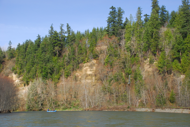
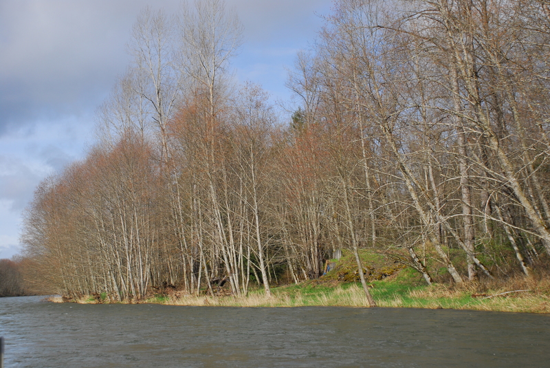
If you use the Highway 7 bridge across the Mashel as your put-in you will be treated to a nice float and some gravel bar rapids through an impressive stand of low elevation forest--something you don't see very often around Puget Sound. Check the Mashel description for more information on the whitewater (upstream of Highway 7) to be found on this neat little run. Once you paddle out on to the Nisqually the power picks up considerably. There are a couple of rapids with some fun little waves and strong eddy lines within the first couple miles or so, but after that things begin to calm down a bit. You won't find anything much more difficult than class II+ but the river packs plenty of power and there are several log jam hazards that would keep novice paddlers on their toes. Much of the run flows through thick forests but as you make your way down the river you start to see more evidence of human presence along the banks.
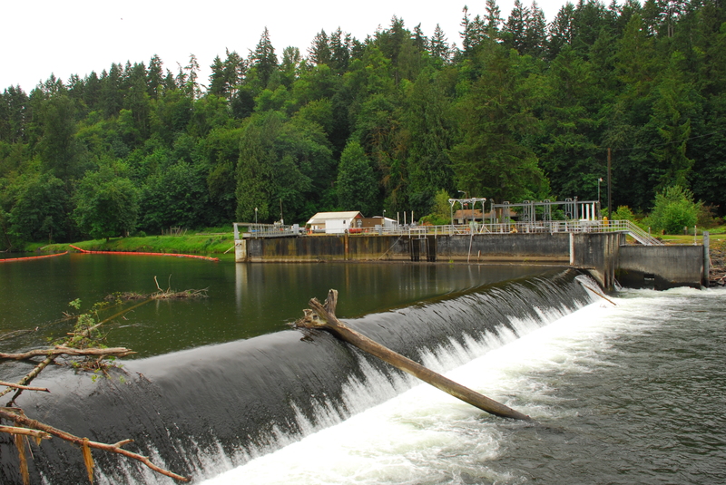
Although the river does not provide a lot of whitewater, the access issues will mean that you will have the river all to yourself. Packrafts open up possibilities to more easily hike in and experience this river. The only hazard to be aware of is the Centralia Dam, low-head dam midway through the run. This is a very serious hazard and a definite drowning machine. It's easy to recognize as you approach from upstream and there are warning signs. The portage trail is on river right. Don't even think about paddling up to the edge for a peak.
Logistics: Finding a put-in for this section of the Nisqually is problematic as the access roads are gated.
Mashel River Bridge: Public access is available at Highway 7 Bridge across the Mashel River. From here it is a 3.4 mile paddle through a meandering low gradient reach of the Mashel before you reach the Nisqually. You can expect several wood portages and most would prefer to put-in right at the confluence. This is an option for kayakers with small boats that are easy to portage but it would be a bigger project to get a raft down. The access and parking for this bridge are on downstream river left side.
Nisqually River, Mashel River confluence: This is a good access but the road is gated. If you have any contacts in UW Forestry they might be able to get you the key for the road that goes down to the Mashel River Confluence (the land is part of the Pack Research Forest). To find this access road take Highway 161 south out of Eatonville until you reach the T junction with Highway 7. At this junction, you should see an unpaved road that heads west. This is the road (normally closed with a locked gate) that goes 1 mile down to the put-in. Note that although some maps show this road actually crossing the Nisqually, the bridge no longer exists (some concrete evidence remains). A better put-in is a bridge across the Mashel just before it dumps into the Nisqually. It is reached by taking a short spur road just before you reach the dead end at the Nisqually. If you can't get the key, it's a 1 mile hike in (some have used carts to transport a raft or you can hike in with lighter boats).
Nisqually State Park, Ohop River confluence: From Highway 7 turn right onto Mashel Prairie Rd/Medical Springs Rd towards Nisqually River State Park and head 1.1 mile to a gated road on the right. It is 1.5 miles down this road to the Nisqually River at the Ohop River confluence.
Peissner Road: This old road crossing is a potential access on Tacoma Public Utility land but it's a 3 mile hike down a gated road. It is upstream of the Centralia Dam so could serve as a potential take-out when the dam is diverting and flows are lower.
Highway 507 Bridge in McKenna: A public park and boat access on the upstream river right side of the Highway 507 Bridge across the Nisqually is a public access river access maintained as a condition of the hydropower license for the Yelm Hydroelectric Project.
Rapids in this Run (2)
Hazards & Portages (1)
Caution: The following locations may require scouting or portaging. Always check current conditions.
Difficulty
Class II
Length
17.0 mi
Rapids
2
1 Hazard
Access Points
Difficulty Classes
I Easy
II Novice
III Intermediate
IV Advanced
V Expert/Extreme
VI Unrunnable
Current Conditions
5-Day Forecast
Whitewater data from
American Whitewater
American Whitewater