2 - Miami Bar to Oak Flat Wild
Gauge Conditions
Runnable: 500.0 – 3,500.0 CFS
Data from American Whitewater & USGS
Run Map
Interactive run map
Loads as you approach this section.
Put-in
Take-out
Rapids/Hazards
Wild
Scenic
Recreational
Description
PERMITS: Permits are required year-round for all river trips on the Wild Section of the Illinois River between Briggs Creek and Nancy Creek, and group size is limited to 12. Permits are free of charge and available 24 hours a day at a self-issue display at the entrance to the Selma Market at the intersection of Highway 199 and the Illinois River/Deer Creek Road in Selma, OR. Deposit your copy of the permit in the box at the Oak Flat take-out to verify your safe return.
Drones are not permitted and Leave No Trace Principles must be followed.
SEASON: Although boatable flows can occur throughout the winter rainy season, the typical season for the Wild Section of the Illinois River is March through mid-May. Although you may be blessed with beautiful spring weather, it can typically be cold and wet so be prepared and remember that this is a wilderness trip.
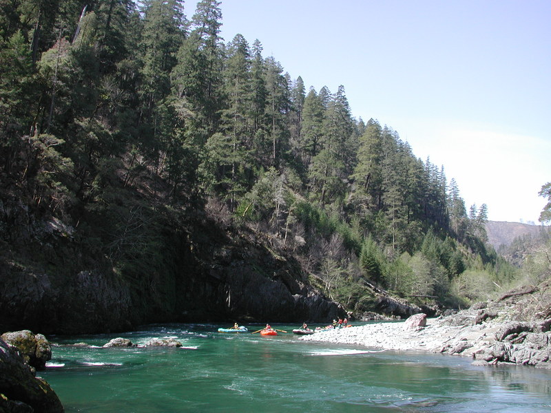
CAMPING: Camping is limited at the put-in although you can likely find a spot along the road if you pull in late (try around Sixmile Creek). The other option is to grab a hotel room in Grants Pass or Cave Junction. Once on the water, the Illinois River offers one of the Pacific Northwest's premiere opportunities for an overnight wilderness trip.
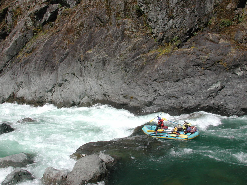
Although an experienced group can make it down in a long day at higher flows, most do the trip as an overnight. Those who prefer an even more relaxing pace spend two or three nights on the river. Good sites for large groups can be found at Pine Flat, approximately eight miles into the trip. There are a couple spots here and then half a dozen additional sites through the next few miles. Once you pass South Bend there aren't any good campsites, aside from a couple 'desperation camps' that for all practical purposes are only accessible to small groups of kayakers, until you pass through the more challenging rapids of the main canyon and reach Submarine Hole.
There are a couple of sections with good campsites in this lower section of the river. River runners must bring a wilderness toilet system to pack out human waste.
ACCESS: From the Grants Pass exit 58 on I-5 take Highway 199 west 22 miles to Selma. The Selma Market is located at Highway 199 mile 20.2 at the intersection with Deer Creek and Illinois River Road. Stop here to get your required but free Forest Service permit at the self-issue station outside the store, grab any last minute provisions, and then start down Illinois River Road which then becomes FR 4103.
The first good access is at Sixmile Creek where the road dips down to the river 7.8 miles from Highway 199 (FR 4103 mile 5.2), but see description for upper run regarding required portages at Illinois River Falls and Rancheria Bridge, which can be difficult for rafts. Another option is to put in at the Rancheria Bridge (at McCaleb Ranch where Forest Road 4103-087 crosses the river) which avoids these portages. There are a couple informal access points before the road climbs up away from the river and then comes back down again 16.2 miles from Highway 199 (FR 4103 mile 13.6) at Miami Bar river access at Oak Flat where most groups put in.
Although there is an outhouse here, you won't find drinking water or other services. Unless you want to spend a day on each end running your shuttle, most river runners arrange for a shuttle service. Most shuttle companies on the Rogue River also do shuttles on the Illinois River.
There are two basic shuttle routes. The primary route from the put-in to take-out is to take Highway 199 from Selma to Crescent City, then north on Highway 101 to Gold Beach, and then go 27 miles up the Rogue River on Forest Highway 33 to the Illinois River near its confluence with the Rogue. After crossing the Illinois River bridge on Highway 33, turn right on Oak Flat Road and follow it for 3.4 miles to the Oak Flat take-out. This scenic route is approximately 150 miles. The other route, the 'shortcut' over Bear Creek Road (FR 23), cuts through the mountains between the Illinois and Rogue rivers, a distance of just over 100 miles, but it is normally snowed in when the Illinois is running: be sure to check before attempting this route.
DESCRIPTION: The Illinois River is a designated National Wild and Scenic River that cuts across the northern part of the Kalmiopsis Wilderness, located within the rugged Siskiyou Mountains of southwestern Oregon. The river gets its name from early miners who named the river in honor of their home state. The river was a regionally important gold mining area since the time of the first gold discovery in 1851. The first recorded journey down the river took place in August 1857 when three prospectors went in search of gold. Very few ventured down the river over the next century, and the river did not become a recognized whitewater destination until the 1970s.
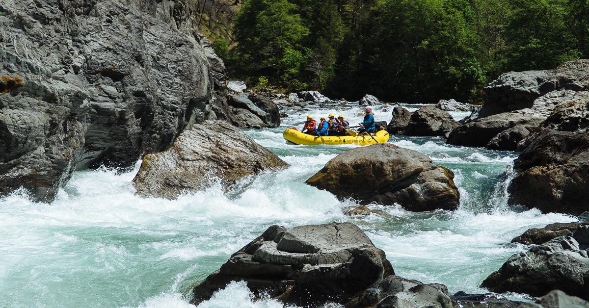
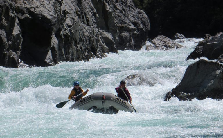
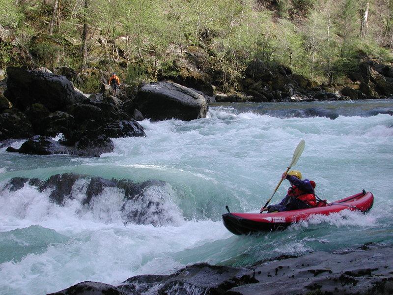
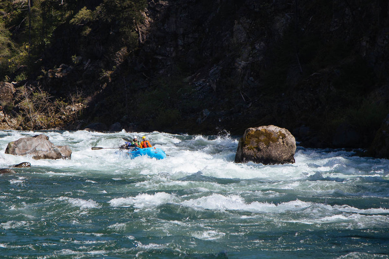
This is a great wilderness self-support trip with at least ten class IV rapids (including York Creek, Pine Creek, Fawn Falls, Little Green Wall, and Submarine Hole) and one class V known as the Green Wall. Rapids can be very difficult to portage especially for rafts. Use extreme caution when committing to the run. It's a great run for groups who are well-prepared and take proper safety precautions, but once you leave the put-in you have no practical access to outside assistance. There are no roads along the river and even the trail is far away from the water, only approaching the river in a couple of places.
Most trips on the Illinois begin at Miami Bar after a bone- and suspension-jarring ride down Illinois River Road, which was constructed during WW I to access the rich chrome mines along this section of the river. For a longer trip you can start as high up as the Highway 199 bridge or the alternate access at Sixmile Creek and run the upper section, although this requires a couple portages that can be a problem with rafts (see Hwy.199 to Miami Bar).
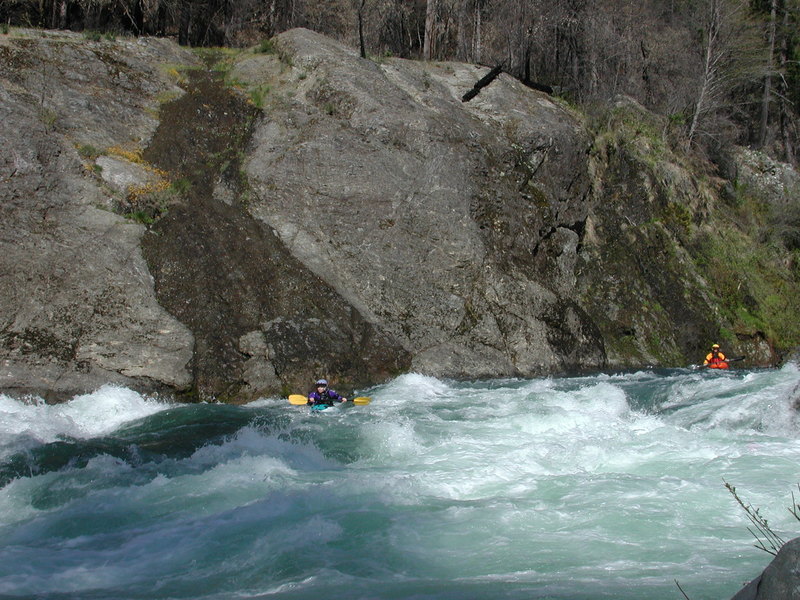
Class V kayakers may be interested in starting out on Briggs Creek, which is about 3.5 miles long and enters the Illinois River about two miles downstream of Miami Bar on river-right.
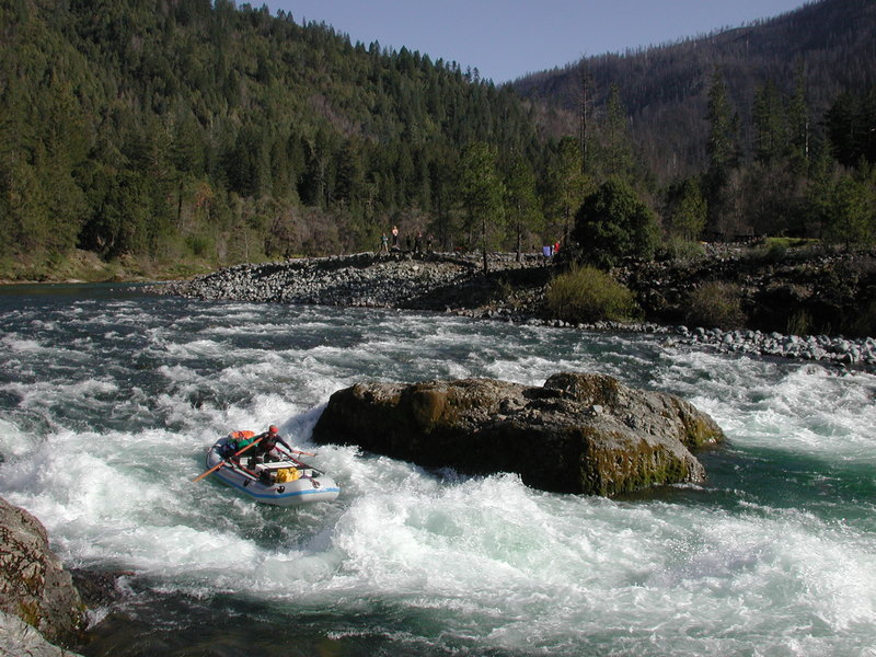
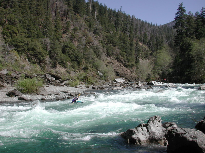
Starting from Miami Bar you have a nice warm-up with easy class II as you pass the last couple cabins along the river. Then, three miles into the trip, the action begins to pick up as you pass Panther Creek which enters from river right. The next three miles down to Pine Flat contain more than a dozen excellent class III and IV pool-drop rapids. The rapids can all be boat scouted, and clear lines should be evident to experienced paddlers. At recommended flows there are good recovery sections in between the drops, and you'll be treated to impressive canyon scenery. The action in this section ends with a bang at Pine Creek Rapid.
Pine Flat is an excellent camping area and you'll recognize it by the expansive benches up above both sides of the river. Pine Creek Rapid is characterized by a midstream boulder and a bedrock shelf extending out from river right that makes an easy scouting or filming platform. You can challenge the holes of the river right chute, which also create great play features during certain levels or you can sneak the drop on the left. In either case, the river eases in difficulty following this drop.
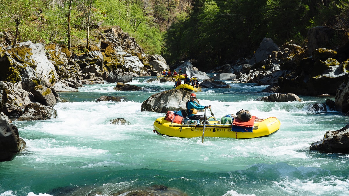
The next 2.5 miles are characterized by relatively easy class II/III rapids. There are various camp sites in this area including a couple of nice benches above the river and several smaller sites tucked in among the large boulders and bedrock shelves. If flow is on the way up use caution in selecting your site as the river has been known to rise rapidly with heavy rain. Once you pass Klondike Creek which enters from the left the action begins to pick up again with ten class III rapids over the next three miles. There are a few camps in this area, but by the time you pass Deadman Bar and then South Bend, the river canyon becomes more constricted again and you are effectively committed to the most challenging section of the run. This approximately six-mile section is not really all that more difficult than the first section of concentrated rapids at the start of the run, but what sets it apart is the Green Wall which is easily the most challenging drop on the run.
Once you reach Fawn Falls, originally but no longer known as Prelude Falls, it's time to start paying attention. You have a couple different options at this rapid. You can take a fun center line that involves a slide off a smooth ledge or you can punch the hole on the far left. There is also a striaght forward line down the right. Not all the lines are obvious from above, so hop out for peak on river left if necessary. After a good-sized recovery section, the Green Wall is just around the corner.
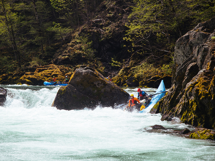
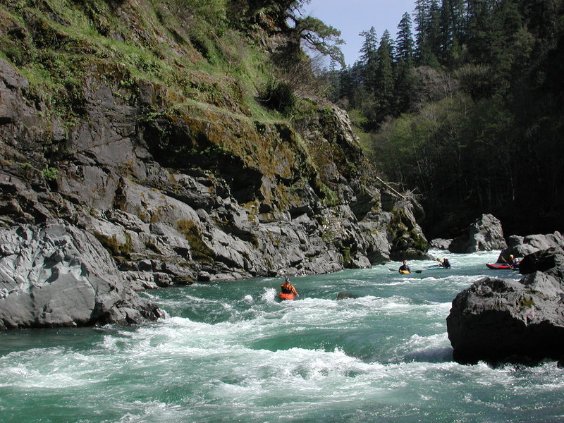
The Green Wall starts with a class III+ lead-in and the name Prelude that was once applied to the next rapid upsriver has migrated down to refer to this short entry stretch. Although it's a long portage, you can start from the top of this lead-in rapid along river left. At medium to higher flows you should scoutr Green Wall from the top of Prelude because there may not be anywhere to stop again before entering Green Wall. If you run Prelude, you're looking to catch a generous but tight eddy on river left behind a large boulder right at the upstream edge of the Green Wall, unless your plan is to continue directly into Green Wall without stopping. From this river left eddy at the lip of Green Wall, it's a short scramble up onto the boulders along river left to scout out your line. If you don't like the look of things, the portage for kayaks is not too bad but with a raft it's another story, and for all practical purposes you're committed to the run. The rapid starts with a crux move right away. You can take a more challenging move down the center or sneak the top section down the left. You generally want to stay away from far river right where a hole forms that extends out to the left as flows increase. After the entry move you'll want to work your way into the main current, and as you enter the bottom half of the rapid you want to stay generally down the center off the right wall and away from holes on river left. The main hazard with this rapid is the potential for trouble at the first entry hole that could lead to a swim with significant down time through the holes sprinkled over the rest of the rapid. There is a good recovery section at the bottom, making it relatively easy to pick up the pieces at moderate flows, but it would not be fun to tumble through all the holes out of your boat.
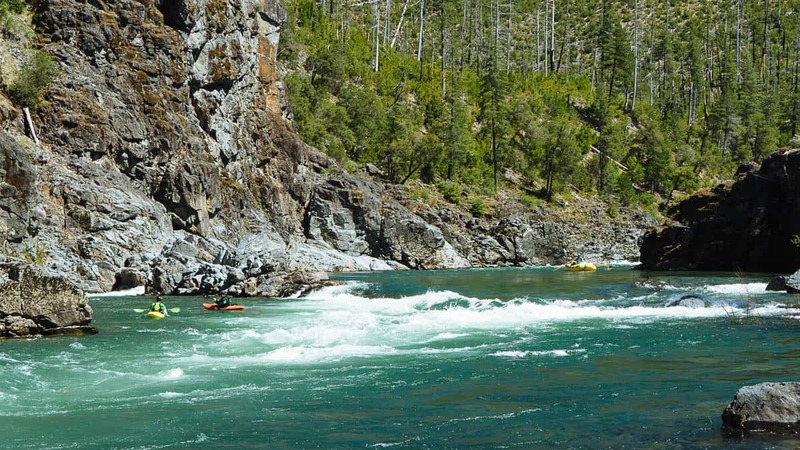
After the recovery pool below Green Wall, the river squeezes between the narrowest constriction in the canyon. There are a couple easy rapids before you arrive at Little Green Wall. This rapid is a widely spaced boulder field with a couple of holes to zigzag your way through. Although much less powerful than the Green Wall upstream, this one does present a technical challenge with a couple of options.
There are a few more fun rapids including one with some big fluffy holes until you get to Submarine Hole which is the last major drop of this section. You can run Submarine Hole on the far left to sneak the hole which grows as flows increase.
Once you pass through Submarine Hole and eventually reach Collier Bar, you are finished with the main drops on the Illinois. It's ten miles from Collier Bar to the take-out. There are a couple good campsites in this area for those who want to spend another night on the river. The rapids are mostly widely separated class II but with a couple of class III drops thrown in to keep things fun. There are also a few nice surfing waves and the of course the scenery. There are tons of _Darlingtonia californica_ (pitcher plants) near the confluence with Indigo Creek.
The take-out at Oak Flat is on river right across from the confluence with Lawson Creek.
A new USGS was installed on the Illinois River a short distance downstream from the Oak Flat take-out in September 2024. This gage only provides river stage and not volumetric flow. Nonetheless, it will provide a critical look at the river level at the end of the run, allowing boaters to use the gage near Kerby along with this gage near Agness to determine the magnitude of flow increase in the wilderness river canyon. The new gage is viewable at https://waterdata.usgs.gov/monitoring-location/14378200/#parameterCode=00065&period=P7D.
Additional Information
- Dan Menten's _New School Guide to Northern California Whitewater_, p. 226
- Steve Stuckmeyer's Illinois River trip report at Oregon Kayaking
- Margi Lifsey's story Fear of Flood at Oregon Kayaking
- John Garren's Oregon River Tours has good maps with key rapids and designated campsites
- Quinn's Handbook to the Illinois River Canyon has detailed aerial photo maps of all the key rapids. It has an interesting section on history but is almost a little too detailed as a river guide.
- Soggy Sneakers and Western Whitewater also have basic descriptions
- February 2007 Green Wall video
- Will Volpert trip report from Nov. 2008, at Oregon Rafting
- Whitewater Guidebook Description of the Illinois River
Rapids in this Run (13)
Waterfalls (1)
Difficulty
Class IV(V)
Length
30.6 mi
Gradient
23 ft/mi
Rapids
13
Access Points
Difficulty Classes
I Easy
II Novice
III Intermediate
IV Advanced
V Expert/Extreme
VI Unrunnable
Permit Required
Self-issued permits required and available prior to launch from Selma Market.
Get Permit
Current Conditions
5-Day Forecast
Whitewater data from
American Whitewater
American Whitewater