2) NH Rte. 101 Bridge to Wilton
Gauge Conditions
Runnable: 400.0 – 4,000.0 CFS
Data from American Whitewater & USGS
Run Map
Interactive run map
Loads as you approach this section.
Run Time Estimate
Select put-in and take-out to estimate time.
Plan This Trip
See wind-adjusted speed maps, forecast planning, and detailed time estimates.
Sign in to generate an AI timing estimate for this run.
Whitewater timing varies with scouting, portages, and group pace. Use as a planning baseline.
Description
### Technical info
```
Put in elevation........420'
Take out elevation......335'
Total drop..............85'
Average drop/mile.......60'
Distance................1.4 miles
River width average.....35'
River geology...........schists, small boulders, some ledge especially at
Horseshoe falls
River water quality.....neutral to good, clarity; neutral to dark. Some
leaching from dump.
Scenery.................Poor, upper reaches pass dump, lower reaches extend
into the Wilton urban area. Middle section good.
Wildlife................Occasional deer, merganzers, beaver
```
Rapids in this Run (1)
Waterfalls (1)
Hazards & Portages (1)
Caution: The following locations may require scouting or portaging. Always check current conditions.
Difficulty
Class III
Length
1.3 mi
Gradient
60 ft/mi
max 75
Rapids
1
1 Portage
Access Points
Shuttle Info
### Put in
From Manchester NH take state route 101 west approximately 25 miles.
Just pass the town of Wilton state route 31 merges with 101 continue west pass this intersection approximately 1.2 miles.
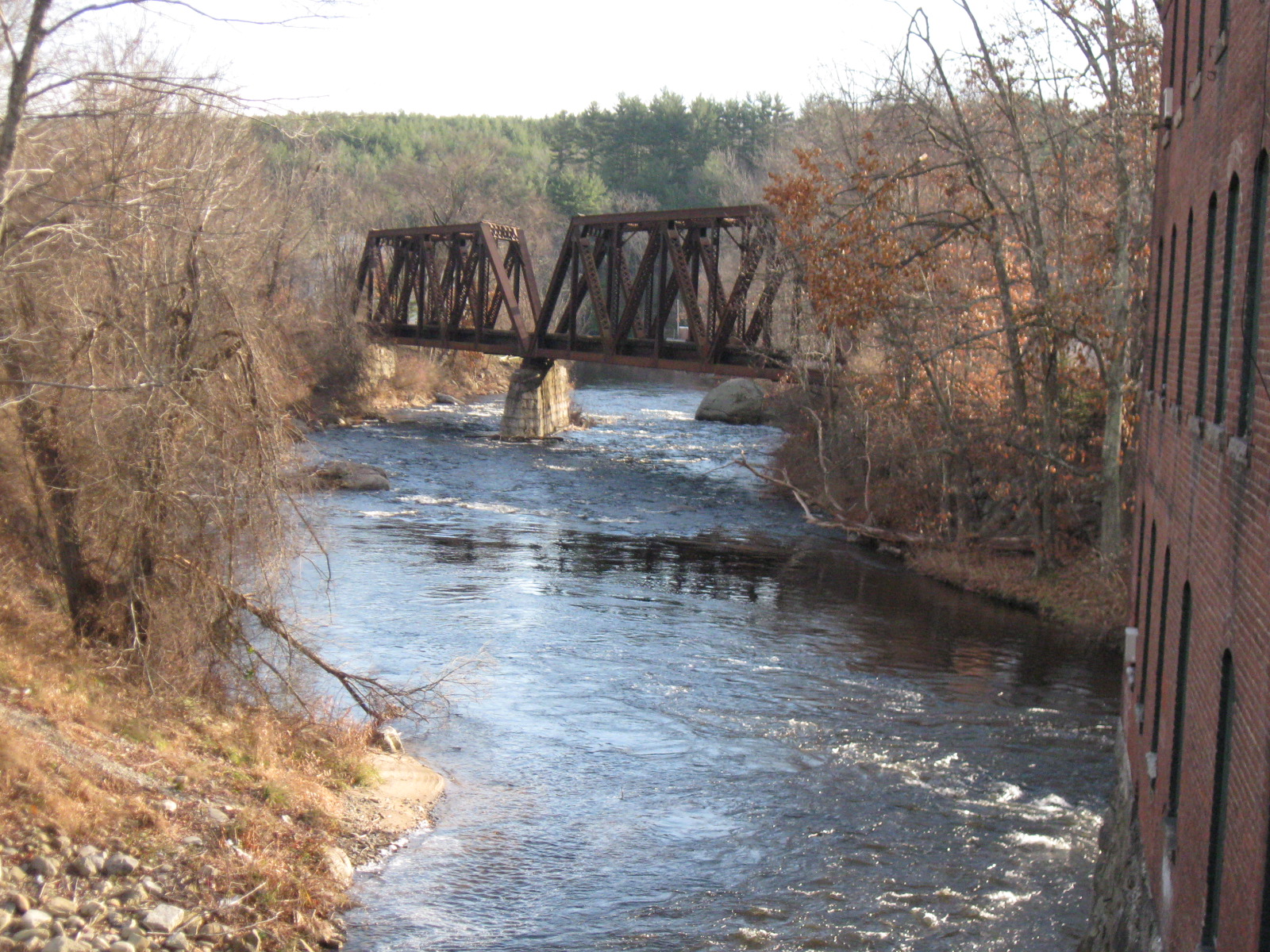
After passing the Wilton recycling center pull into a small parking area on the left just before the bridge over the river.
### Take out
Head back in the direction you just came from back to the intersection with route 101/31.
Take a left here on 31 north then take a right on Mill street at the bottom of the hill.
Pull into the parking lot for Label Art manufacturing company on your left.
Park on the downstream side behind the building.
Difficulty Classes
I Easy
II Novice
III Intermediate
IV Advanced
V Expert/Extreme
VI Unrunnable
Current Conditions
5-Day Forecast
Whitewater data from
American Whitewater
American Whitewater