2 - Prettyboy Dam to Falls Road or Masemore Rd.
Gauge Conditions
Data from American Whitewater & USGS
Run Map
Run Time Estimate
Select put-in and take-out to estimate time.
Plan This Trip
See wind-adjusted speed maps, forecast planning, and detailed time estimates.
Sign in to generate an AI timing estimate for this run.
Whitewater timing varies with scouting, portages, and group pace. Use as a planning baseline.
Description
The river level of this reach is best described by the Parkton gage.
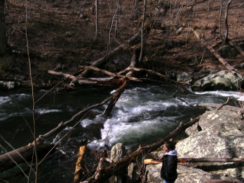
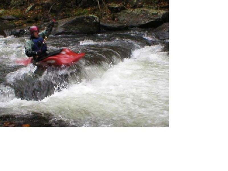
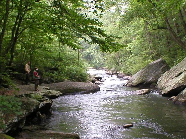
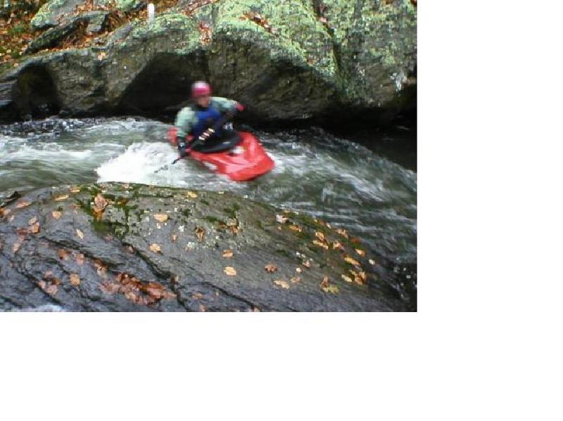
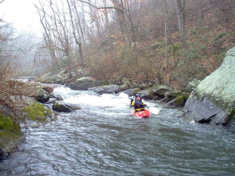
Prettyboy Reservoir to Falls Road Bridge -- Put In Very difficult to put in at the Prettyboy Dam, due to the 100 ft canyon walls and the fact that reservoir personnel frown upon it. I typically put in approximately 0.5 miles downstream of Prettyboy Reservoir. This put in is located approximately 0.5 miles south of the takeout bridge where Falls Road crosses the Gunpowder. When you cross the bridge coming from the North or river left side of the bridge, continue 0.5 miles up the hill. At the crest of the hill on the right side is a small parking area. There is a gated fire road entrance. Follow the fire road until it bears to the right; it then turns into a foot trail. From the gate to the water is approximately a 0.5 mile hike, all downhill. The hike is not bad and the trail is not very steep. Take Out The takeout is at the Falls Road bridge, either upstream or downstream of the bridge on river right. Do not park at the takeout itself. There is a parking lot approximately 1/8 mile up the hill on the right hand side as you walk South on Falls Road. You should have passed it on your way to the Put In. Except for the two designated parking lots, parking along Falls Road is now prohibited. If parking space runs out, the Masemore Rd. river access is available downstream. It will involve and addition half mile moving water paddle and a shuttle. River Description The first 0.25 mile is Class I-II warmups. The next 0.5 mile is Class III. The last 0.25 mile is Class I-II. CAUTION: You need to watch out for Strainers and Fishermen on this stretch. This creek is not very wide, and very popular with fishermen. If possible, try to stay behind them. So be respectful and friendly in order to to keep this run open. Reference Maryland and Delaware Canoe Trails, by Ed Gertler, for more details on this section.
Buddy Hihn access comments 2025:
Prettyboy Dam Rd.
North: Top of Hill
-State Park Boundary, Trail head
3-5 cars
There are no restrictions from top of hill till the dam. However, there are three parking areas on this side of the bridge. One is next to the dam on the west side of the road, the second is on the east side of the road and is clearly marked for parking with a green parking sign. This sign resembles a no parking sign but has a green circle and no diagonal bar. This was the location of the long closed bio break building. The third is on the west side further up the hill. There is a sign but someone has painted over it.
South: Dam to top of hill.
East side of dam is the spillway parking lot. This holds the most cars but is highly trafficked by sight seers and those using the stairs for exercise. There is a trail at the end of the lot leading to the river. The 20 minute limit parking sign has been removed from this lot. Additional 20 minute parking is on the West side. After this there is no more parking on city property. Immediately beyond city property is GSP parking on the south side. Enough for a few cars but far from any water.
Falls Rd.
No parking except in designated areas. One small lot on the west side but not near any water. This was the location of the Beagle Club for several decades.
The parking for the Gorge is at the top of the hill at the park boundary. This is across from the Highland Trail. Do not block any gates or you risk being towed. Basically just a chain drag with out care.
The next and only parking lot is on the west side near the bridge. This lot is hugely popular, used by hikers, fishermen, and of course boaters.
Do not park at the tempting areas near the bridge. But they are often used for the loading and unloading of boats.
There is no other parking on either side all the way to Bunker Hill Rd.
A little history. In the '70s the river was so popular that cars would be parked on both side making it nearly impossible to use the roads.
Macemore Rd.
North down to River. No restrictions till 150 feet prior to bridge. Two spots, one on the East side and the other on the West side before restrictions. Be careful as there is soft, saturated and deep mud along the shoulders.
South of the bridge is the parking lot for maybe 10 well place vehicles. There are no other parking areas near the bridge. The rest of the road is too narrow though there are no signs.
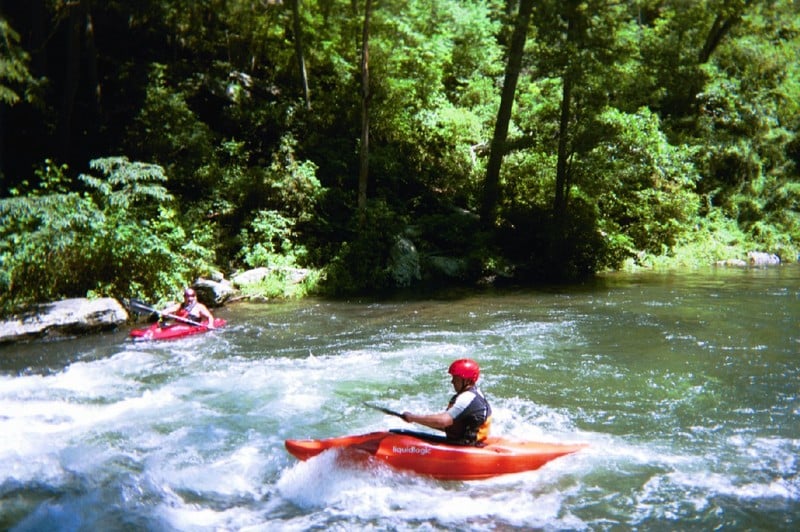
Ed Evangelidi testifies: No question that the short whitewater stretch is also the prettiest part of the run. However, on a hot summer day, it is hard to beat the rest of the run \[running down to Big Falls, Blue Mont or Monkton Rds.\]. It takes less water to negotiate the shallow spots here and it is in a pretty state park from Falls Road to Big Falls Road. Then comes a stretch through an active quarry with man made Class 2 rapids and finally a very long stretch of fairly easy water but with bikers whizzing by on a nearby bike path and floating tuber congestion in season. The confluence of the creek and Little Falls has a great swimming hole on river left where the cold Gunpowder water mixes with the warmer tributary.
Rapids in this Run (12)
Difficulty
Class I-III
Length
2.1 mi
Gradient
18 ft/mi
max 40
Rapids
12
Access Points
Difficulty Classes
I Easy
II Novice
III Intermediate
IV Advanced
V Expert/Extreme
VI Unrunnable
Current Conditions
5-Day Forecast
Whitewater data from
American Whitewater
American Whitewater